Map of Gilbert, Arizona
Our map of Gilbert, Arizona, shows a fast-growing suburb southeast of Phoenix. You’ll find highways, roads, parks and more.
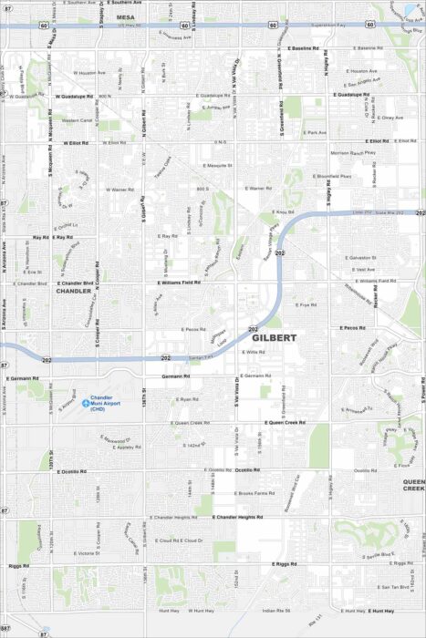
Our map of Gilbert, Arizona, shows a fast-growing suburb southeast of Phoenix. You’ll find highways, roads, parks and more.
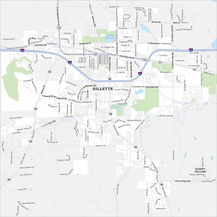
Gillette lies in northeast Wyoming surrounded by wide plains. It’s a hub for coal and energy because of nearby mining operations.
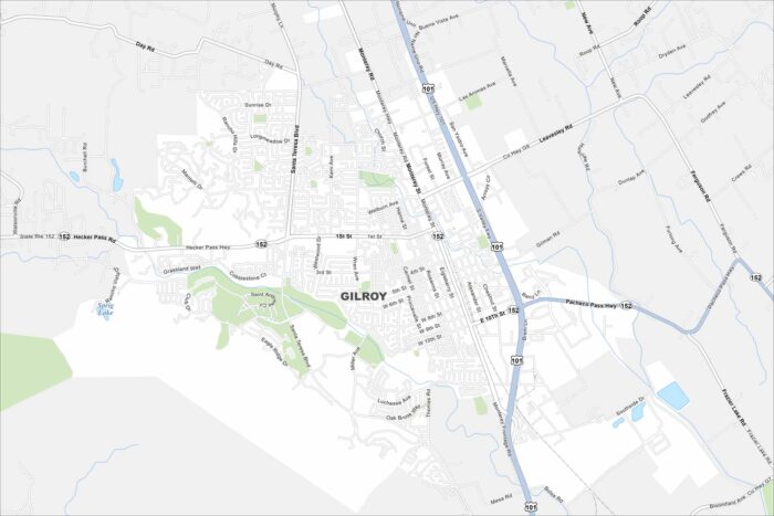
Explore our map of Gilroy, California. The city is called the “Garlic Capital of the World” because of its famous crop.
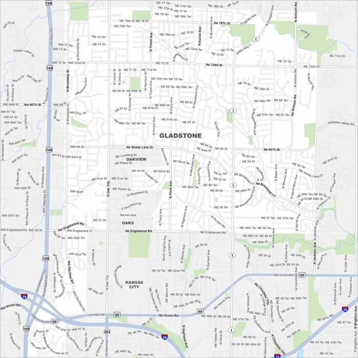
Gladstone, Missouri is a small city in the Kansas City metro. Our map shows its highways, roads, streams and local parks.
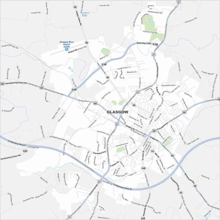
Glasgow, Kentucky, sits among hills and farmland. It’s located in the southern part of the state and is close to Mammoth Cave National Park.
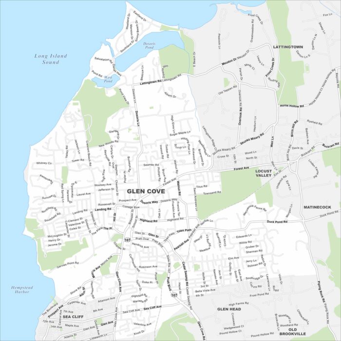
Our map of Glen Cove, New York, highlights a waterfront city on Long Island’s North Shore. Harbors and inlets define much of the landscape.
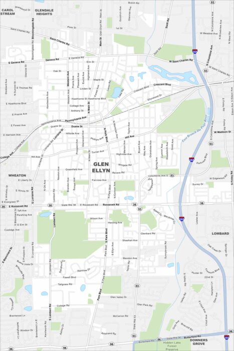
Glen Ellyn is west of Chicago. It feels suburban but still connects easily to the city by rail. Parks and forest preserves edge the map.
Check out our map of Glendale just northwest of Phoenix. Wide roads and freeways cut through desert neighborhoods.
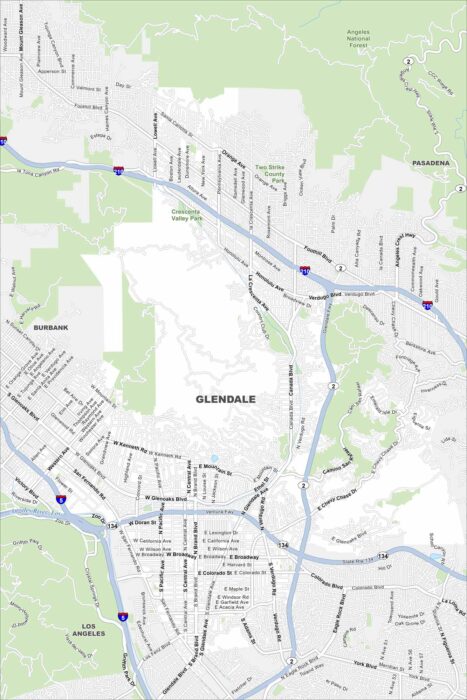
Glendale is part of the Los Angeles metro. Our map shows this busy area that sits right at the crossroads of several major freeways.
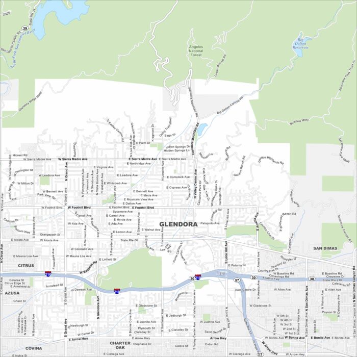
Check out our map of Glendora, California. This city spreads toward the San Gabriel Mountains. It’s called the “Pride of the Foothills”.
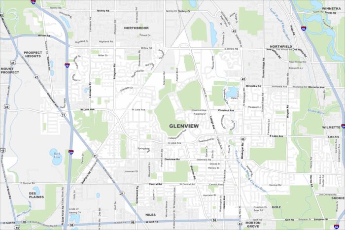
Glenview is just outside Chicago, Illinois. You’ll notice highways, roads, rivers, lakes and green spaces that stretch across the map.
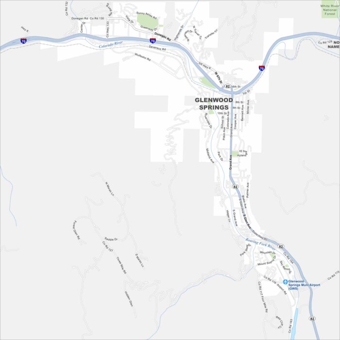
Our map of Glenwood Springs shows streets winding along the Colorado River. The city stands out because of its natural hot springs.
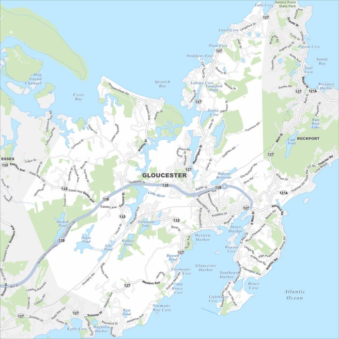
Gloucester sits on Cape Ann in Massachusetts, with a shoreline full of coves and beaches. It’s a working port but also a tourist draw.
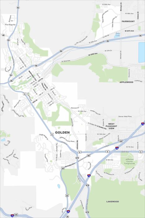
Golden is near the foothills west of Denver. Trails and open spaces stretch into the mountains. It’s known as the “Gateway to the Rockies”.
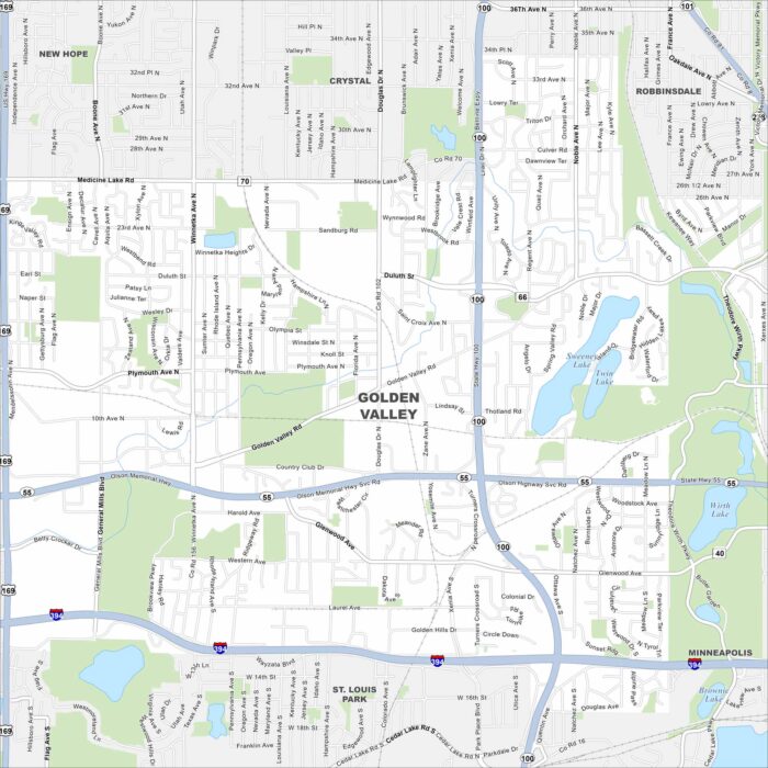
Take a look at our map of Golden Valley, Minnesota. Here’s where ponds and parks break up neighborhoods and highways.