Map of Elmira, New York
Elmira is located along the Chemung River in southern New York. The city connects to Route 14 and 17. It’s often known as the “Queen City”.
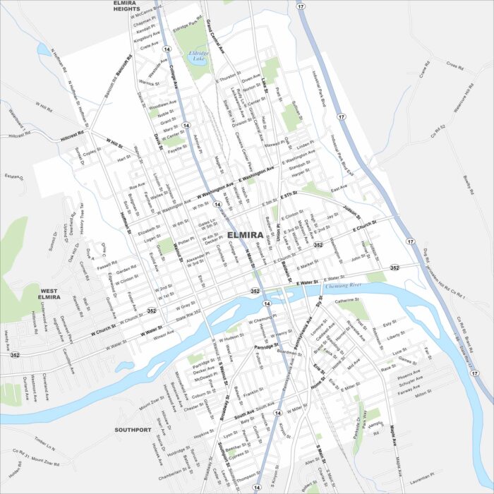
Elmira is located along the Chemung River in southern New York. The city connects to Route 14 and 17. It’s often known as the “Queen City”.
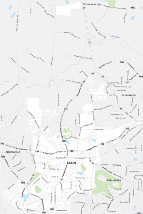
See Elon on our map with S Williamson Ave as the main route here. The town has a small, walkable street network.
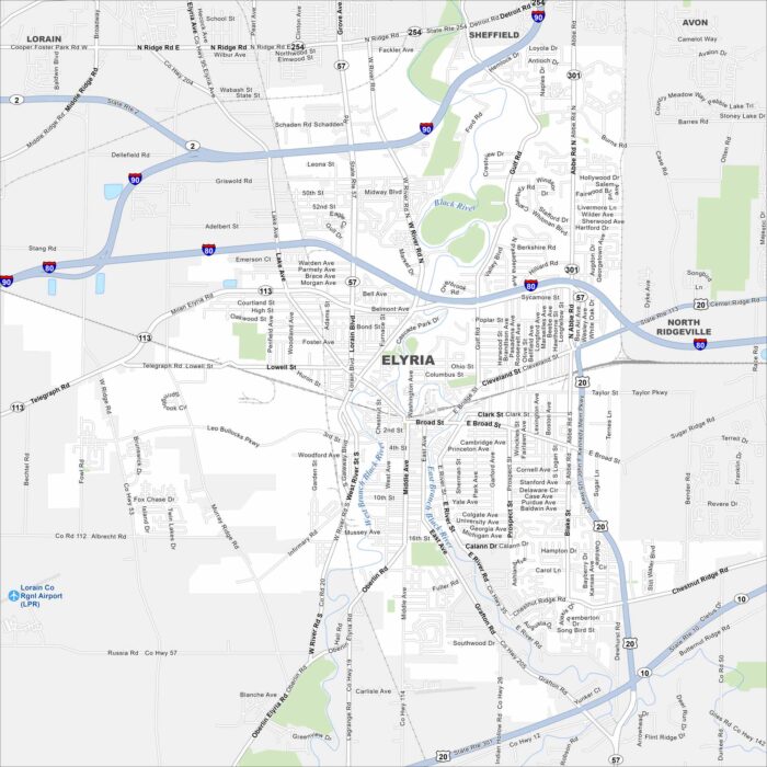
Our map of Elyria shows I-80 and I-90 running just north of the city. The Black River cuts through its center in two branches (west and east).
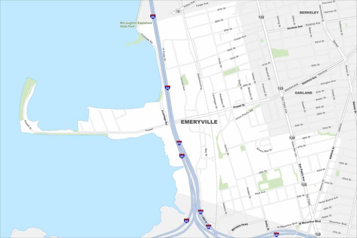
Emeryville is located between Oakland and Berkeley along I-80. The city borders the San Francisco Bay with views of the Bay Bridge.
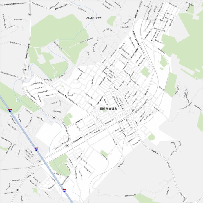
Look at Emmaus on our map just south of Allentown. Main roads like Chestnut Street and Cedar Crest Boulevard shape the borough.
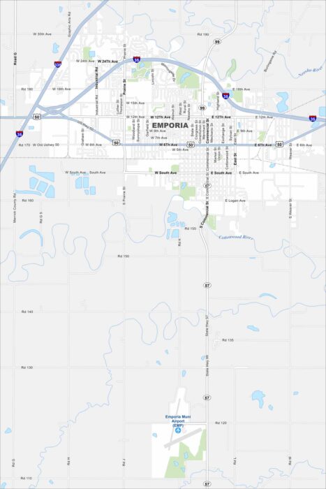
Emporia sits between Topeka and Wichita on the Kansas prairie. Both U.S. 50 and I-35 cross right by the city.
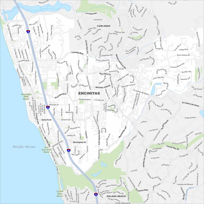
Our map of Encinitas puts it on the Pacific shoreline north of San Diego. Beaches line the coastline, while parks fill the rest.
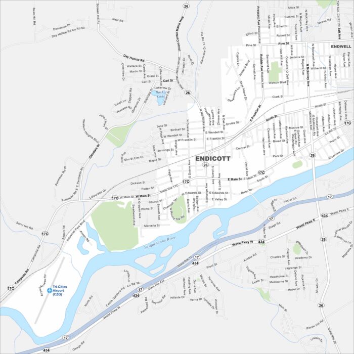
Endicott, New York lies west of Binghamton along the Susquehanna River. Streets spread out on both sides of the water.
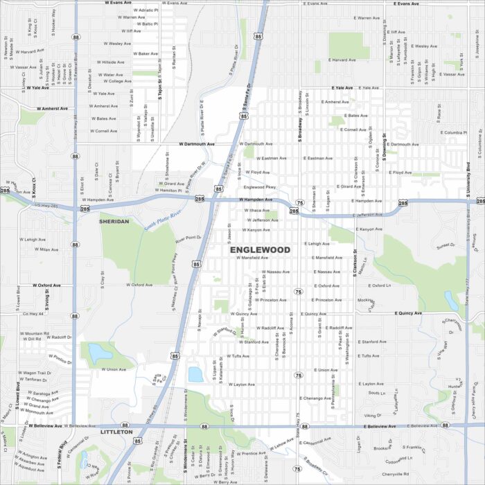
Englewood borders Denver to the south. U.S. 285 cuts across the city toward the foothills. Its views of the Rocky Mountains are a standout.
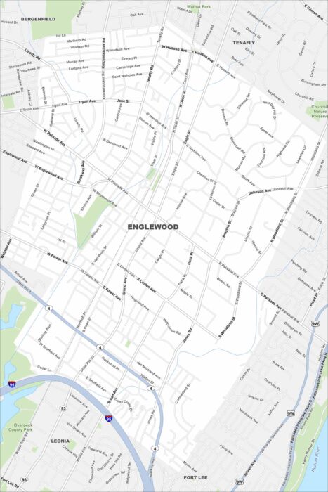
Our map of Englewood shows it just west of the Hudson River. It’s nestled against the Palisades cliffs with steep terrain at the east side.
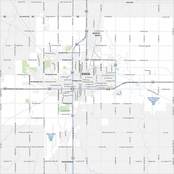
Enid spreads out in north-central Oklahoma’s flat plains. U.S. 60, 64, and 81 meet here. The wide grid of roads reflects its prairie setting.
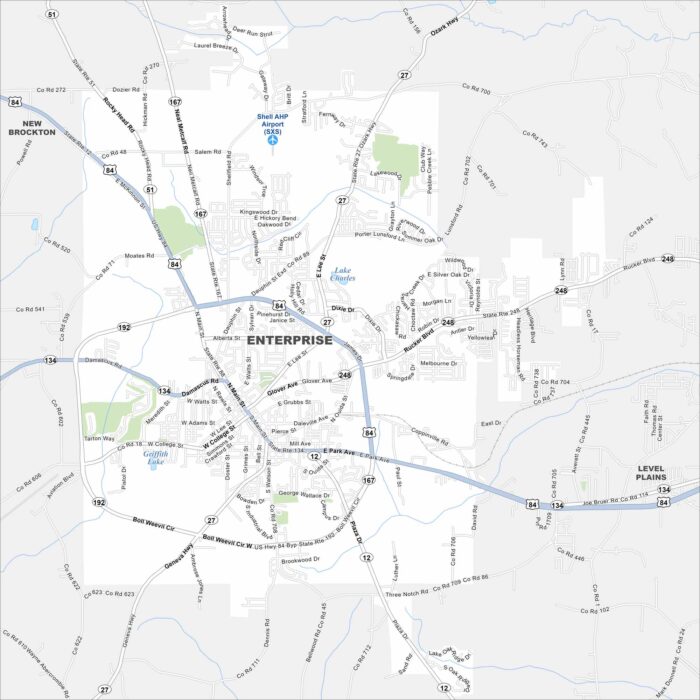
Enterprise sits in the southeastern corner of Alabama. Highways 84 and 167 cross in the heart of the city. Farmland dominates the exterior.
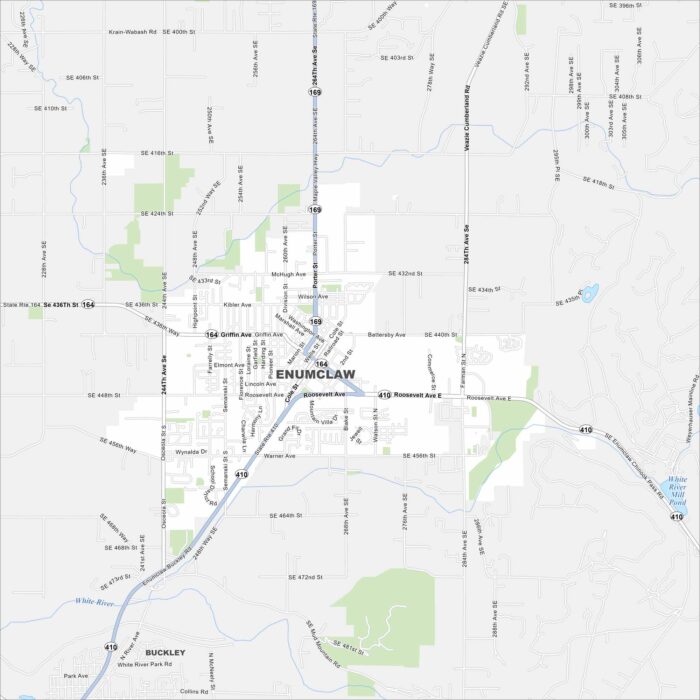
Enumclaw rests on a plateau near Mount Rainier. Farmland surrounds the area in every direction. That mountain backdrop dominates the view.
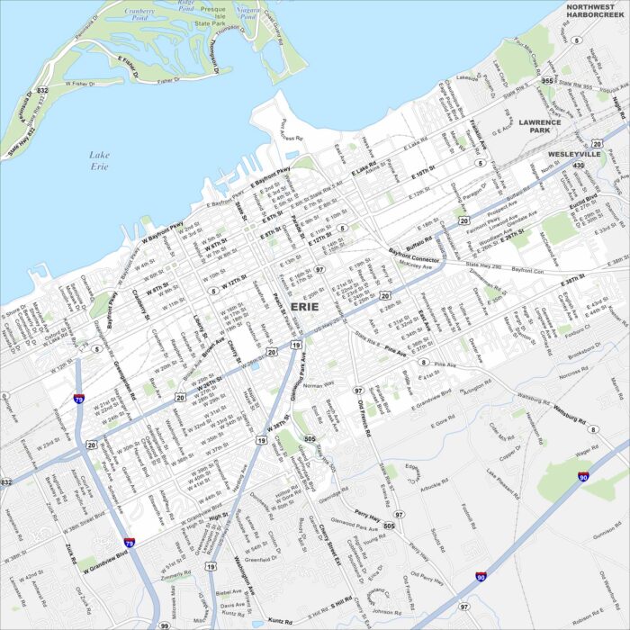
Erie lies on the southern shore of Lake Erie. Its downtown runs right up to Presque Isle Bay. The peninsula sheltering the bay is a landmark.
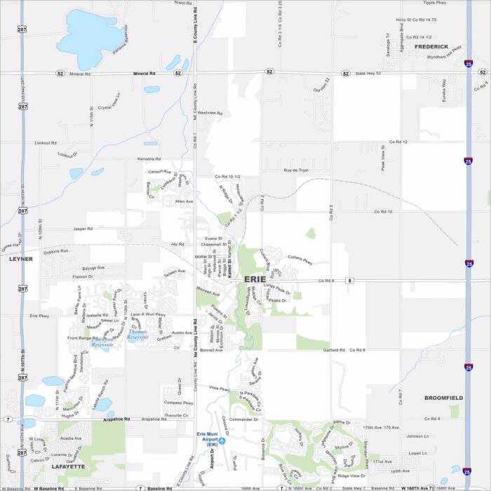
Our map of Erie shows it between Denver and Boulder. The Front Range mountains frame the horizon. But open fields still surround its growth.