Map of Duluth, Minnesota
Duluth sits on the western tip of Lake Superior. Our map of the city shows the harbor, lift bridge, and hillside streets.
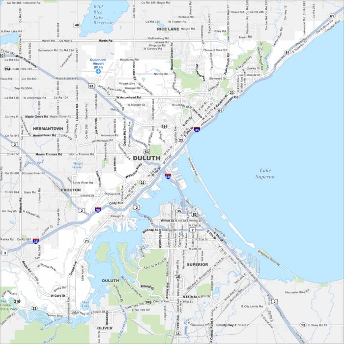
Duluth sits on the western tip of Lake Superior. Our map of the city shows the harbor, lift bridge, and hillside streets.
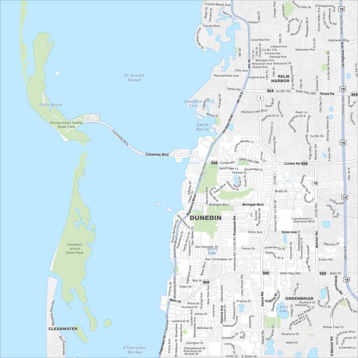
Explore our map of Dunedin along Florida’s Gulf Coast. You’ll spot sandy beaches, offshore islands, and green coastal parks.
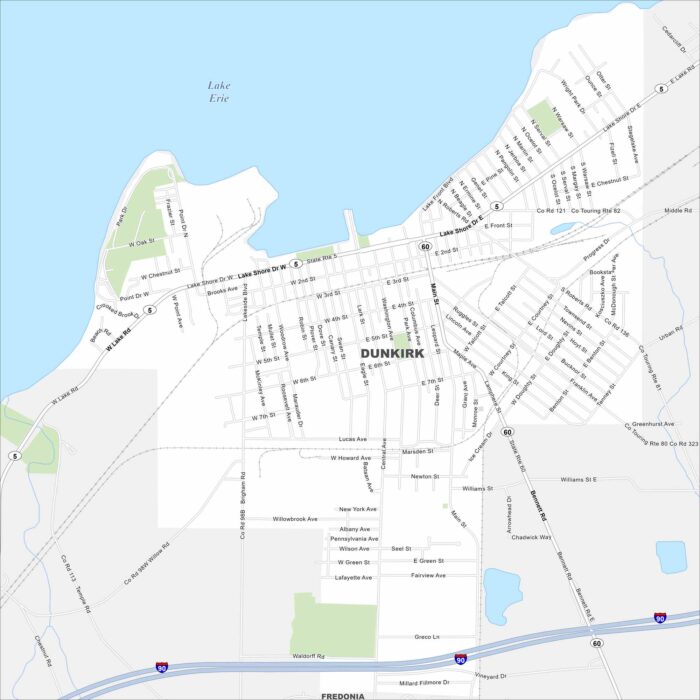
Dunkirk lies on the shores of Lake Erie in western New York. Our map shows Lake Shore Drive and Lake Front Blvd that stretches on waterfront.
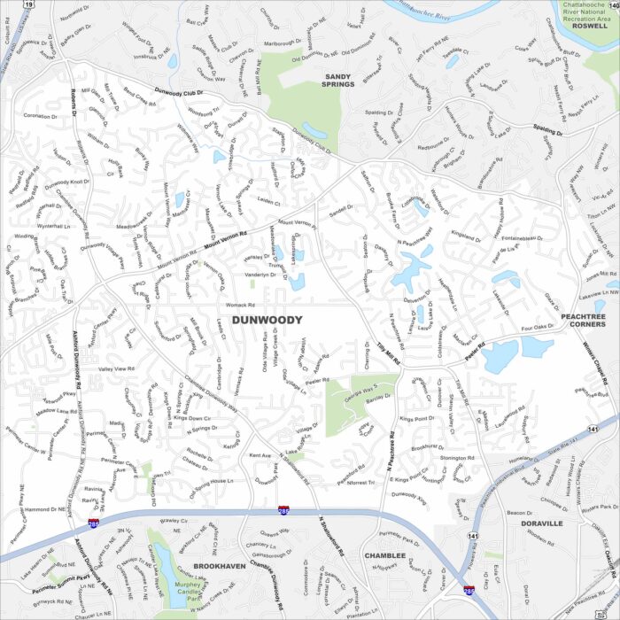
Dunwoody is just north of Atlanta. On the map you’ll notice major highways cutting across neighborhoods and wooded greenbelts.
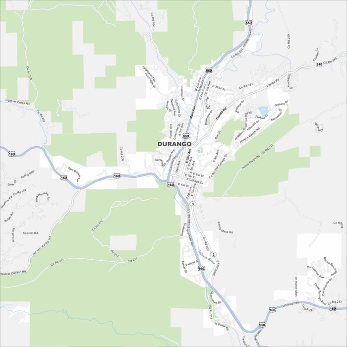
Our map of Durango highlights the Animas River winding along US-160. Mountains surround it on nearly all sides.
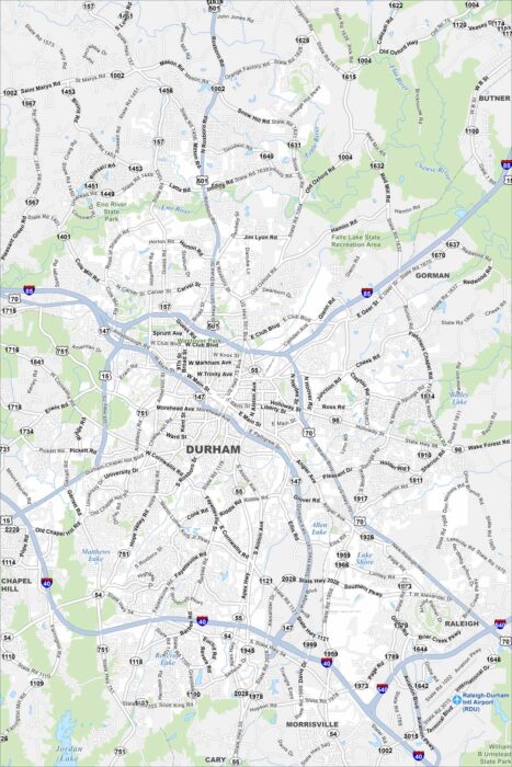
Check out our map of Durham in the state’s Piedmont region. Rolling terrain, creeks, and a growing downtown stand out.
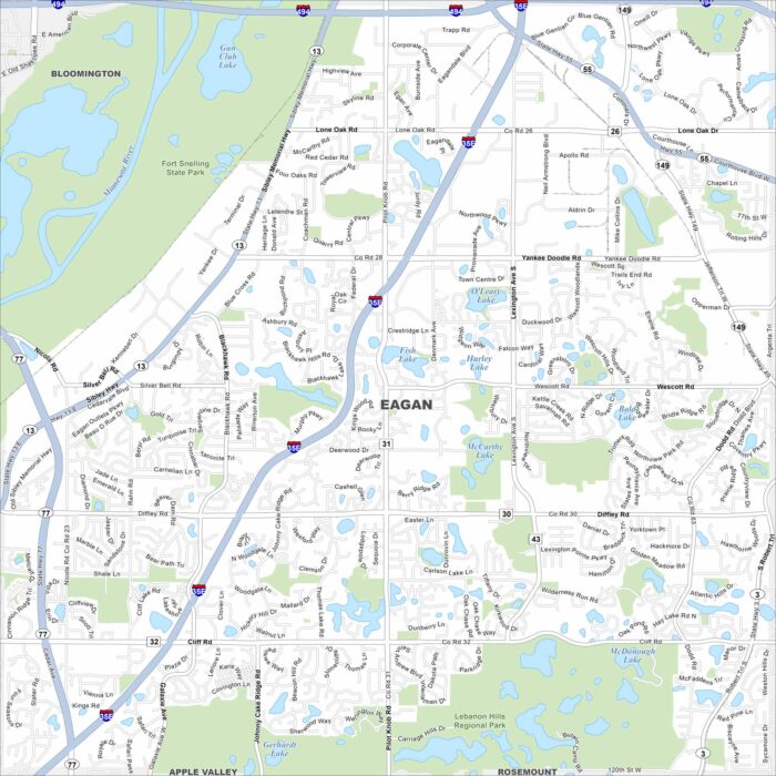
Eagan stretches along the Minnesota River, just south of St. Paul. This map shows its lakes, parks and major freeways.
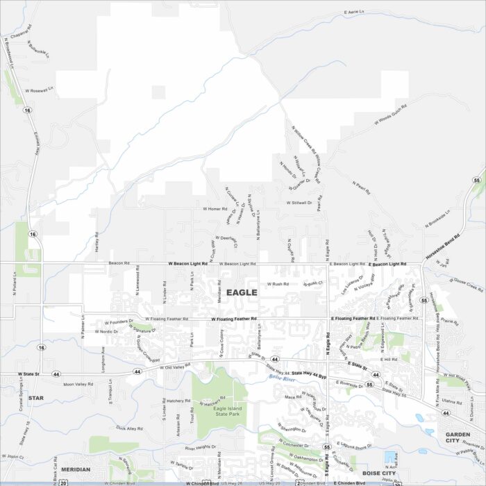
Eagle is just west of Boise along the Boise River. This area has winding neighborhoods, greenbelt trails, and farmland beyond.
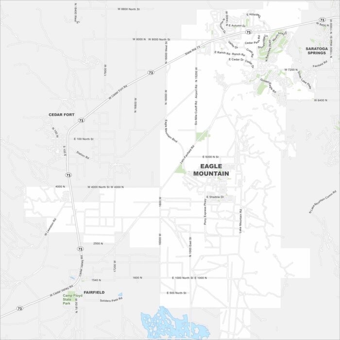
Explore Eagle Mountain on the edge of Utah County. This region has open desert, foothills, and fast-growing housing communities.
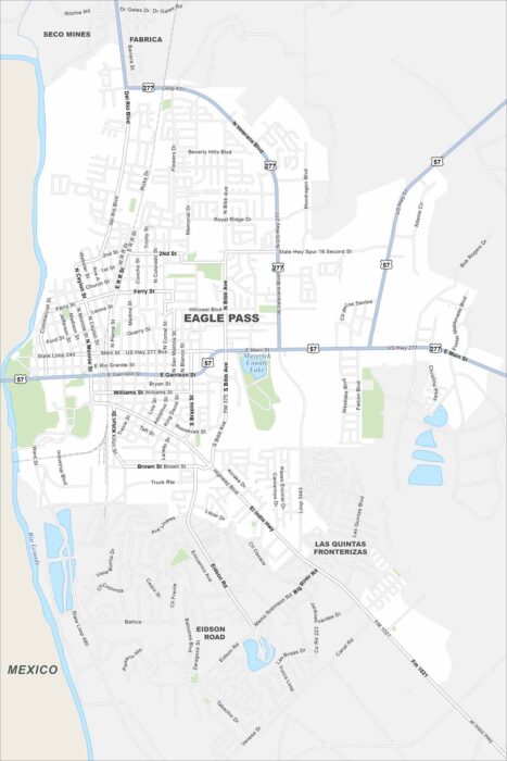
Eagle Pass sits right on the Rio Grande, across from Mexico. The river forms its southern boundary on the map.
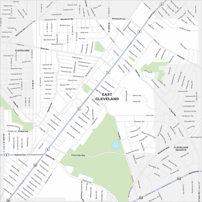
East Cleveland sits close to Lake Erie. On the map, you’ll see it bordered by Cleveland’s east side and major roadways.
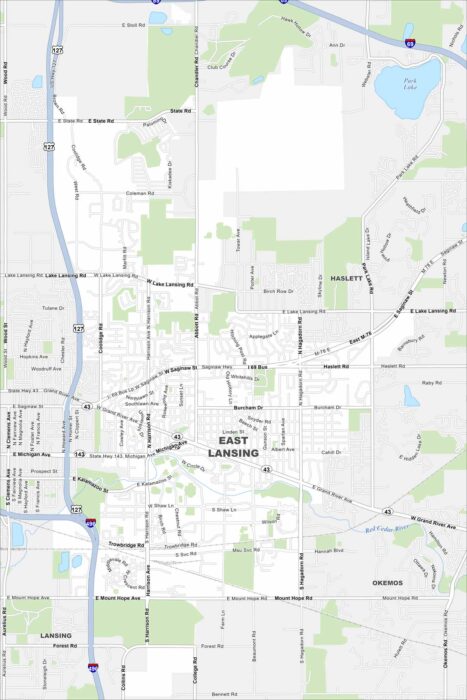
Our map of East Lansing shows the Red Cedar River running through the city. Green spaces and parks stretch along its banks.
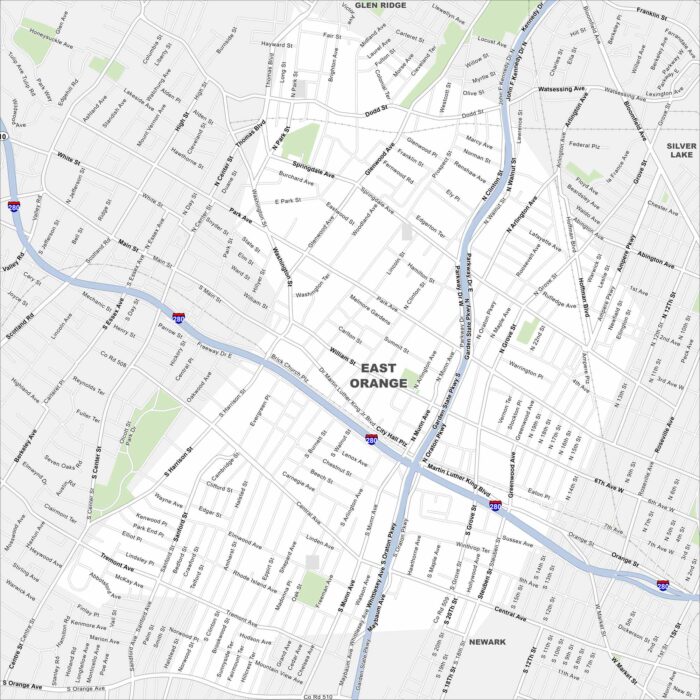
Explore East Orange in northern New Jersey, just west of Newark. The grid of streets links quickly into the Garden State Parkway.
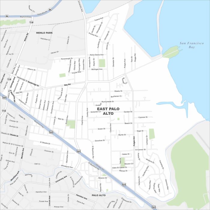
East Palo Alto is on the edge of the San Francisco Bay. This map highlights wetlands and open shoreline areas nearby.
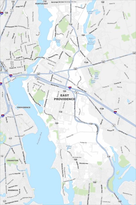
Our map of East Providence shows the Providence River cutting along the west side. Bridges connect it directly to Providence.