Mammoth Cave National Park Map
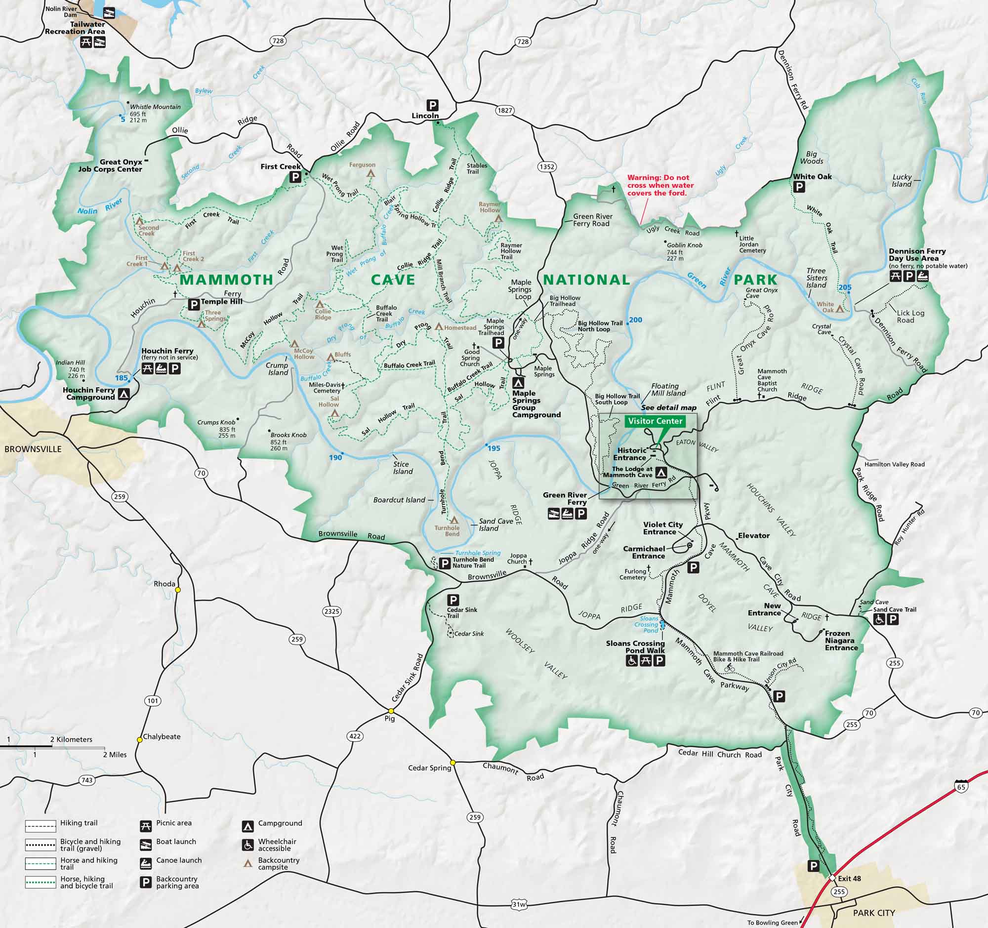
Our map of Mammoth Cave National Park shows trails, campsites, roads, and rivers. Located in central Kentucky, this park has the planet’s longest known cave system.
Map Information
On the Map
Interstates/Highways: I-65 Major Roads: State Rte 70, State Rte 255, State Rte 728, State Rte 1827, State Rte 1352, Brownsville Rd, Joppa Ridge Rd, Mammoth Cave Parkway, Green River Ferry Rd, Houchins Ferry Rd, Ollie Rd, Flint Ridge Rd Rivers/Creeks: Green River, Nolin River, Buffalo Creek, Wet Prong, First Creek Cities/Towns: Brownsville, Park City, Cave City, Cedar Spring, Pig, Chalybeate, Ollie, Lincoln Campgrounds/Park Sites: Mammoth Cave Hotel, Maple Springs Group Campground, Houchin Ferry Campground Other Landmarks: Historic Entrance, Violet City Entrance, Carmichael Entrance, New Entrance, Frozen Niagara Entrance, Cedar Sink, Sloans Crossing Pond, Turnhole Bend, Good Spring ChurchNational Park Maps
Find maps of green spaces and national parks near you.


