Map of Livonia, Michigan
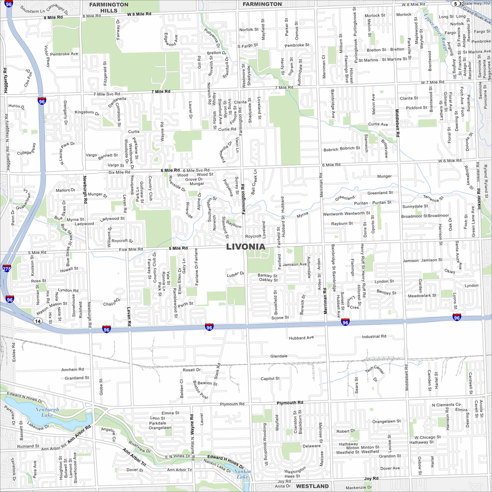
Our map of Livonia places it west of Detroit. Interstate 96 runs through the city from east to west. Neighborhoods and commercial areas fill its broad grid.
Map Information
On the Map
Interstates/Highways: I-96, I-275, State Rte 5, State Rte 14, State Rte 102 Major Roads: 8 Mile Rd, 7 Mile Rd, 6 Mile Rd, 5 Mile Rd, Plymouth Rd, Ann Arbor Rd, Middlebelt Rd, Merriman Rd, Farmington Rd, Newburgh Rd, Haggerty Rd, Levan Rd, Inkster Rd, Stark Rd, Wayne Rd, Joy Rd, Industrial Rd, Schoolcraft Rd, Hubbard Ave, Amrhein Rd Airports: Lakes and Reservoirs: Newburgh Lake, Nankin Lake Major Rivers: Upper River Rouge Parks and Preserves: Nearby Communities: Farmington Hills, Farmington, WestlandMichigan State Maps
Get to know Michigan with our detailed maps


City Maps of Michigan
Check out our maps of Detroit and other cities in Michigan


