Map of Lauderhill, Florida
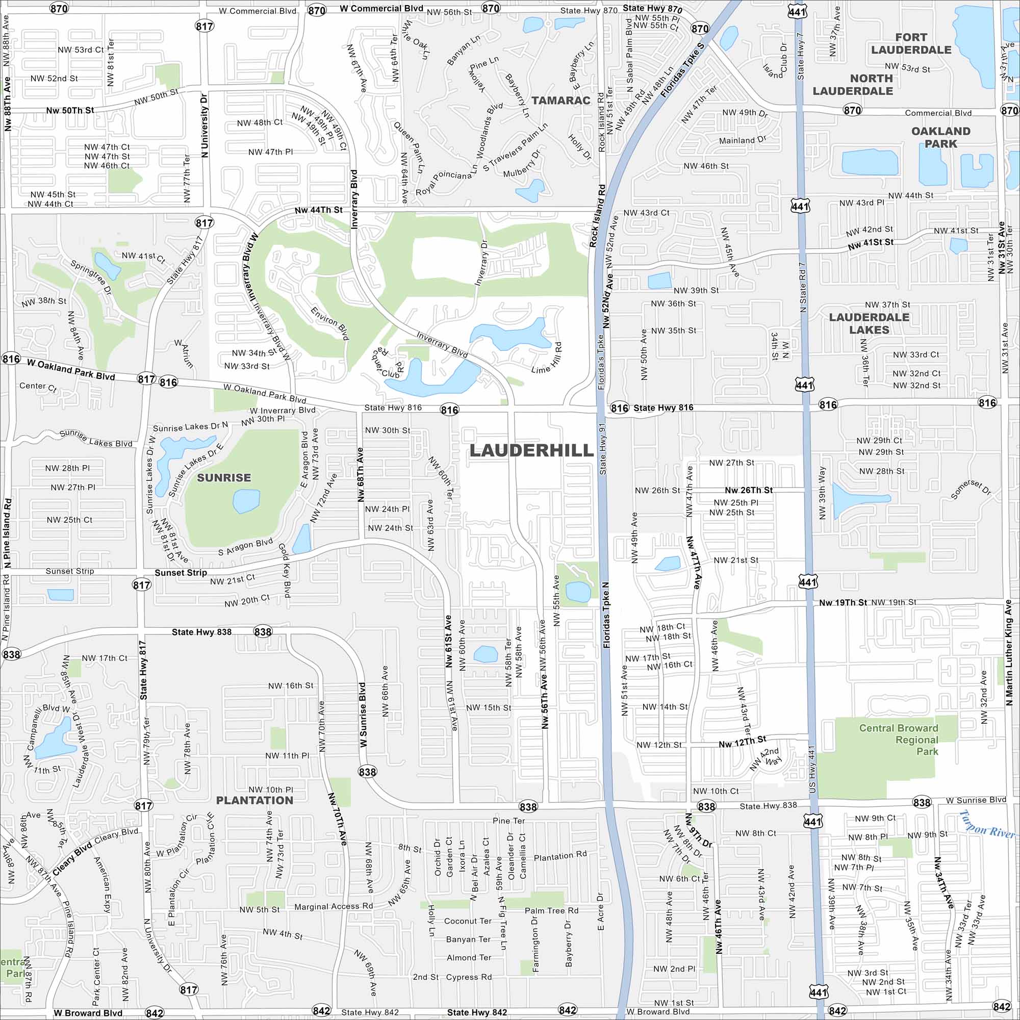
Check out Lauderhill in central Broward County. This map shows dense neighborhoods laid out in a grid. But parks and canals break up the pattern.
Florida State Maps
Discover Florida through our state maps


Map Information
On the Map
Interstates/Highways: Florida’s Tpke Major Roads: University Blvd, State Hwy 817, Oakland Park Blvd, State Hwy 816, Sunrise Blvd, State Hwy 838, State Hwy 870, Commercial Blvd, State Hwy 842, Broward Blvd, US Hwy 441, State Rd 7, Inverrary Blvd, Rock Island Rd, NW 44th St, NW 31st Ave, NW 19th St, Sunset Strip, NW 56th Ave Major Rivers: Tarpon River Parks and Preserves: Central Broward Regional Park Nearby Communities: Tamarac, Sunrise, Plantation, Fort Lauderdale, North Lauderdale, Lauderdale Lakes, Oakland Park, Margate, North LauderdaleFlorida City Maps
Chart your course through Miami and Florida’s cities


