Map of Lansing, Michigan
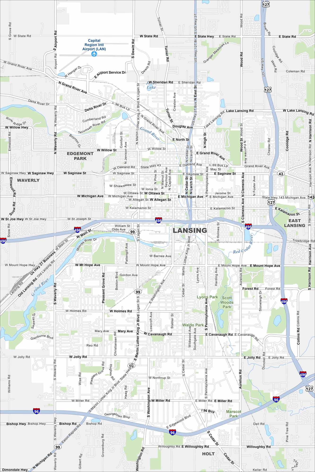
Our map of Lansing shows the Grand River winding through the central region. The State Capitol dominates downtown. Highways wrap around the city in every direction.
Map Information
On the Map
Interstates/Highways: I-96, I-496, I-127, US Hwy 27, US Hwy 127, State Rte 43, State Rte 99 Major Roads: Saginaw St, Michigan Ave, Grand River Ave, Oakland Ave, Martin Luther King Jr Blvd, Cedar St, Larch St, Pennsylvania Ave, Waverly Rd, Airport Rd, State Rd, Lake Lansing Rd, Mt Hope Ave, Holmes Rd, Jolly Rd, Miller Rd, Willoughby Rd, Edgewood Blvd, Pine Tree Rd, Aurelius Rd Airports: Capital Region Intl Airport (LAN) Lakes and Reservoirs: Lake Lansing, Sheridan Lake Major Rivers: Grand River, Red Cedar River, Sycamore Creek Parks and Preserves: Lyons Park, Scott Woods Park Nearby Communities: Waverly, Edgemont Park, East Lansing, HoltMichigan State Maps
Get to know Michigan with our detailed maps


City Maps of Michigan
Check out our maps of Detroit and other cities in Michigan


