Map of Lake Wales, Florida
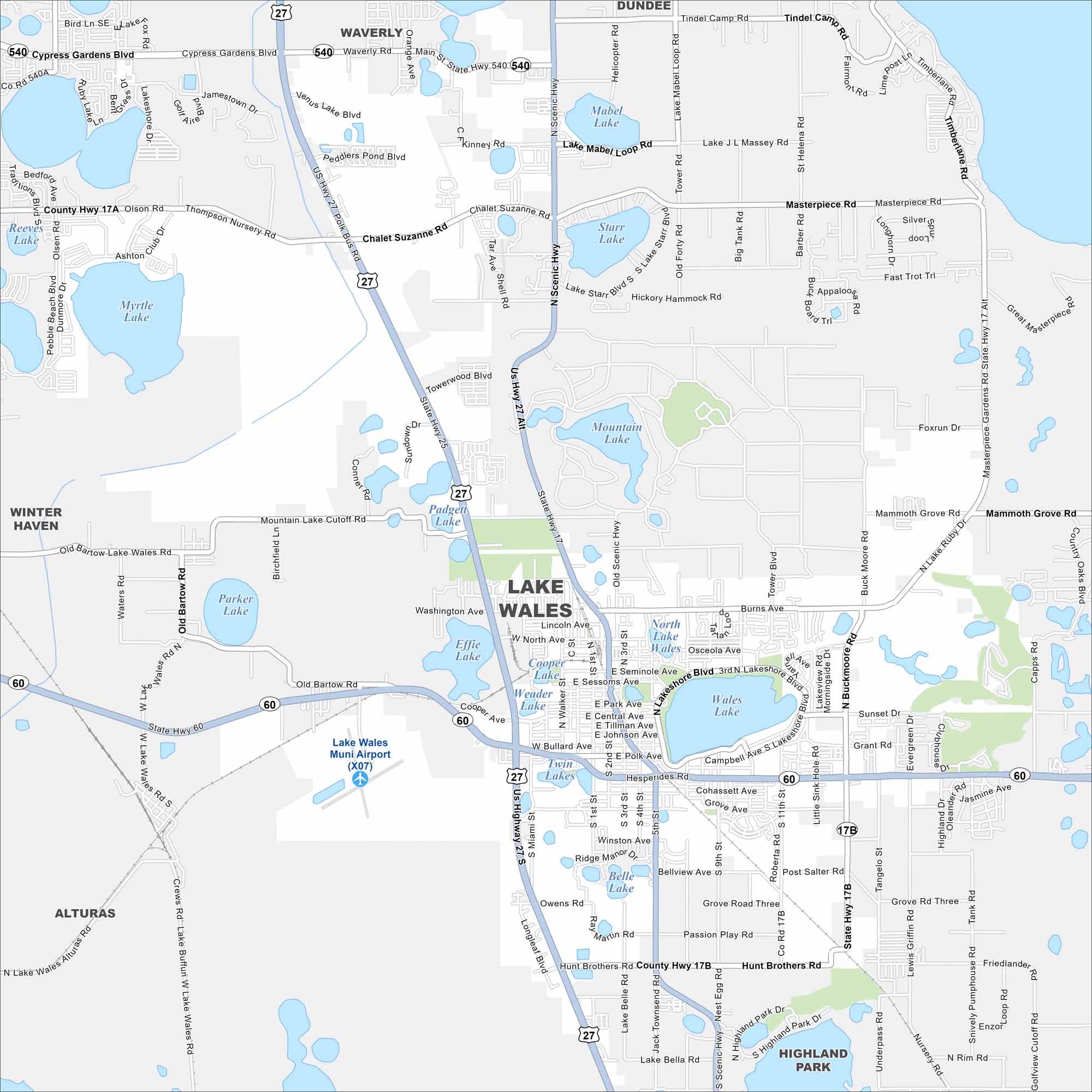
Find Lake Wales sitting among central Florida’s chain of lakes. This map highlights US Highway 27 that runs north-south through the city. Citrus groves spread across the outskirts.
Florida State Maps
Discover Florida through our state maps


Map Information
On the Map
Interstates/Highways: US Hwy 27, US Hwy 17, State Hwy 60 Major Roads: Hesperides Rd, Scenic Hwy, Burns Ave, Central Ave, E Central Ave, Washington Ave, North Ave, W North Ave, Sessoms Ave, E Sessoms Ave, Park Ave, E Park Ave, Bullard Ave, W Bullard Ave, Tower Blvd, Post Ln, Thompson Nursery Rd Airports: Lake Wales Muni Airport (X07) Lakes and Reservoirs: Lake Wales, Wales Lake, Mountain Lake, Starr Lake, Lake Starr, Mabel Lake, Lake Mabel, Twin Lakes, Belle Lake, Weader Lake, Effie Lake, Parker Lake, Myrtle Lake, Reeves Lake Nearby Communities: Winter Haven, Alturas, Highland Park, Waverly, DundeeFlorida City Maps
Chart your course through Miami and Florida’s cities


