Map of Lake Mary, Florida
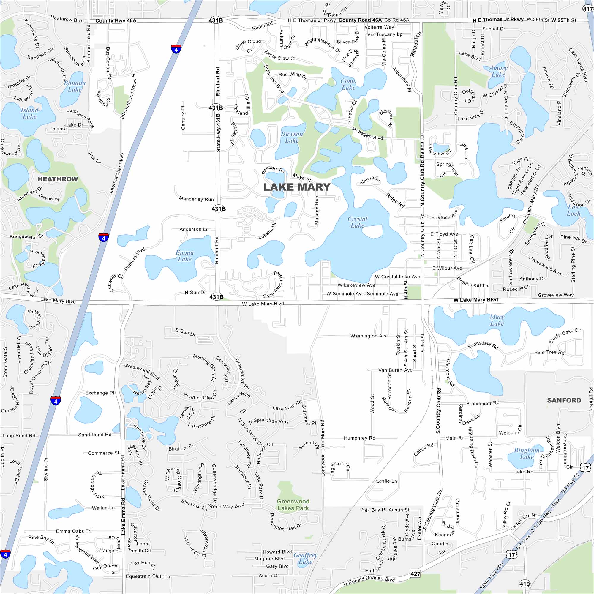
Lake Mary’s map reveals clusters of lakes scattered everywhere. Residential neighborhoods fill a lot of the spaces between. Interstate 4 runs just to the west into Lake Mary Boulevard.
Florida State Maps
Discover Florida through our state maps


Map Information
On the Map
Interstates/Highways: I-4, US Hwy 17, US Hwy 92 Major Roads: Lake Mary Blvd, W Lake Mary Blvd, E Lake Mary Blvd, Rhinehart Rd, Country Club Rd, N Country Club Rd, S Country Club Rd, Longwood Lake Mary Rd, Ronald Reagan Blvd, N Ronald Reagan Blvd, Lake Emma Rd, International Pkwy, HE Thomas Jr Pkwy, 25th St, W 25th St, Airport Blvd, Main St, Sun Dr, Primera Blvd, Emma Oaks Trl Airports: Lakes and Reservoirs: Crystal Lake, Lake Mary, Mary Lake, Emma Lake, Island Lake, Banana Lake, Bradcliffe Lake, Loch Loch, Amory Lake, Dawson Lake, Como Lake, Mohegan Blvd, Geoffrey Lake, Acorn Dr, Heron Bay, Bingham Lake Parks and Preserves: Greenwood Lakes Park Nearby Communities: Heathrow, SanfordFlorida City Maps
Chart your course through Miami and Florida’s cities


