Map of Lake Havasu City, Arizona
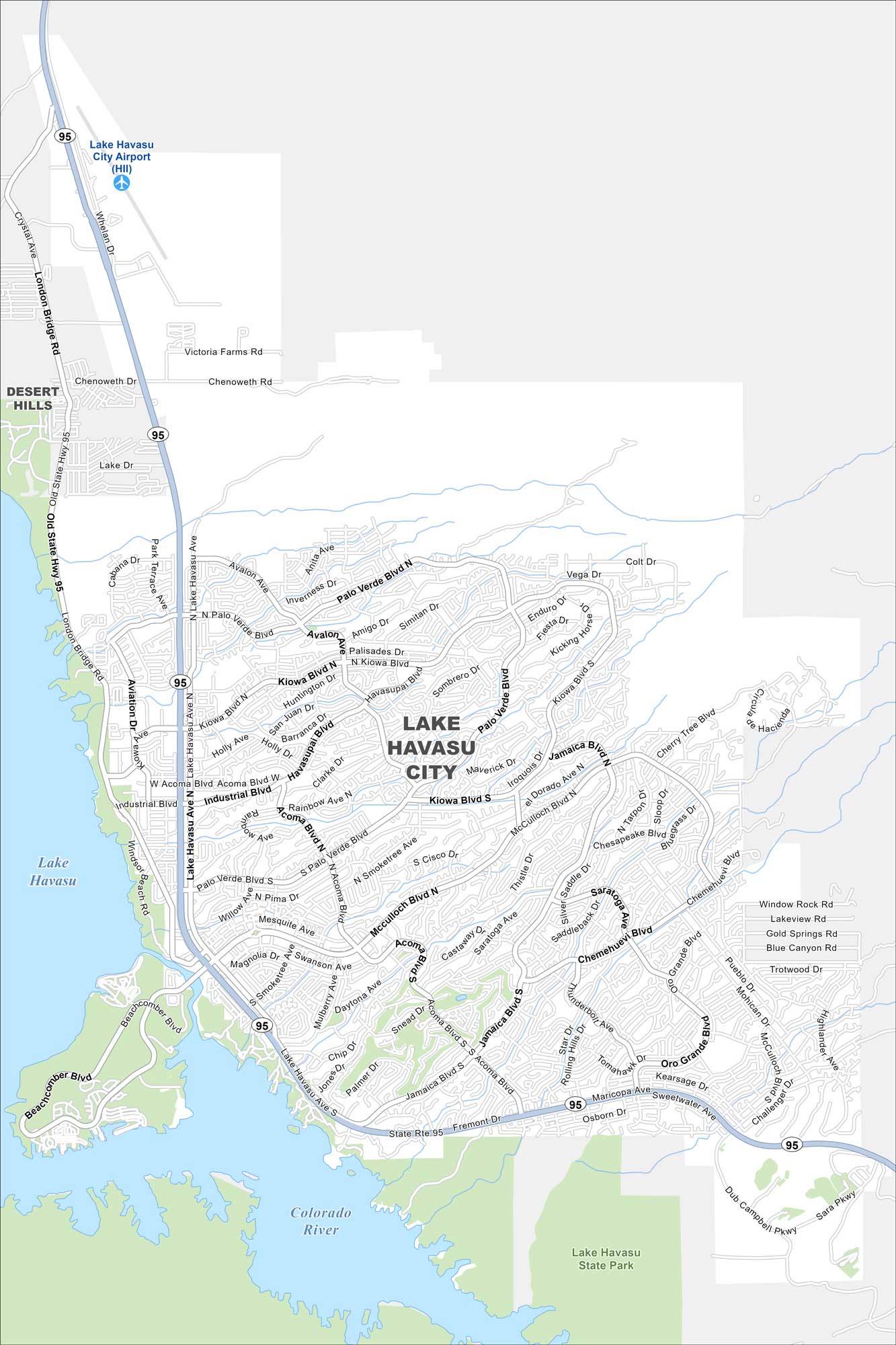
Lake Havasu spreads blue across the map on the western side of our map. The London Bridge marks the city’s centerpiece. Desert terrain surrounds the shoreline.
Arizona State Maps
Check out our Arizona state maps we’ve put together


Map Information
On the Map
Interstates/Highways: State Route 95 Major Roads: McCulloch Blvd, London Bridge Rd, Mesquite Ave, Acoma Blvd, Jamaica Blvd, Palo Verde Blvd, Swanson Ave, Kiowa Blvd, Daytona Ave, Oro Grande Blvd, Cherry Tree Blvd, Lake Havasu Ave, Industrial Blvd, Smoketree Ave, Chenoweth Dr, Kiowa Ave, Maracaibo Ln, Acoma Blvd, McCulloch Blvd Airports: Lake Havasu City Airport (HII) Lakes and Reservoirs: Lake Havasu Rivers and Creeks: Colorado River Parks/Preserves/Forests: Lake Havasu State Park Nearby Communities: Desert HillsArizona City Maps
Here’s our full batch of Arizona city maps


