Map of Kissimmee, Florida
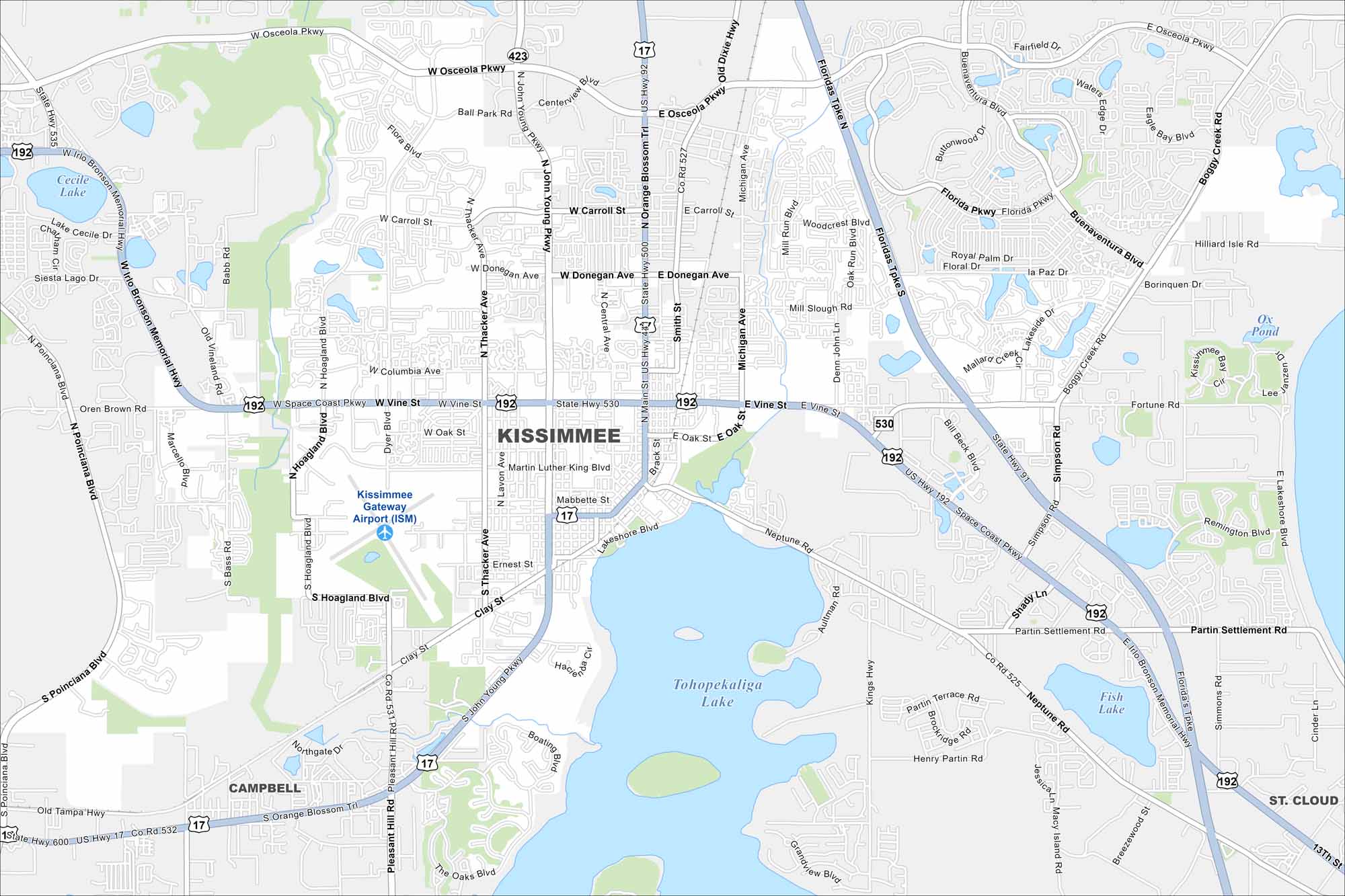
Kissimmee lies just south of Orlando. Our map shows lakes across the landscape and roads leading toward Disney parks. The city spreads along the shore of Lake Tohopekaliga.
Florida State Maps
Discover Florida through our state maps


Map Information
On the Map
Interstates/Highways: Florida’s Tpke, US Hwy 192, US Hwy 17, US Hwy 92 Major Roads: Vine St, W Vine St, E Vine St, Main St, N Main St, John Young Pkwy, N John Young Pkwy, S John Young Pkwy, Osceola Pkwy, W Osceola Pkwy, E Osceola Pkwy, Orange Blossom Trl, Neptune Rd, Carroll St, W Carroll St, E Carroll St, Donegan Ave, W Donegan Ave, E Donegan Ave, Thacker Ave Airports: Kissimmee Gateway Airport (ISM) Lakes and Reservoirs: Tohopekaliga Lake, Fish Lake, Ox Pond, Cecile Lake, Lake Cecile, Mill Slough Nearby Communities: Campbell, St. CloudFlorida City Maps
Chart your course through Miami and Florida’s cities


