Map of Kinston, North Carolina
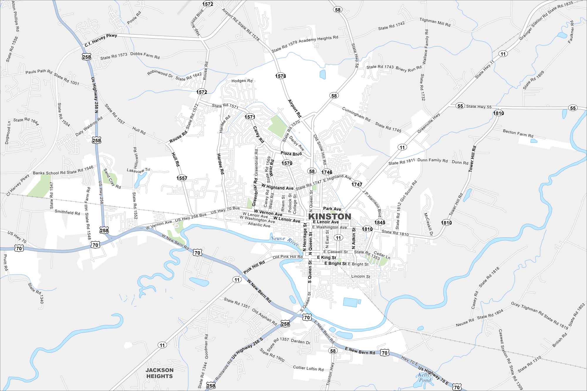
Kinston is set on the Neuse River. This map shows its downtown surrounded by farmland. Highways branch out toward Greenville and New Bern.
Map Information
On the Map
Interstates/Highways: US Hwy 70, US Hwy 258, State Rte 11, State Rte 58, State Rte 55 Major Roads: Vernon Ave, Queen St, King St, New Bern Rd, Airport Rd, Caswell St, Heritage St, Adkin St, Rouse Rd, Hull Rd, Hardee Rd, Greenbriar Rd, Carey Rd, Tower Hill Rd, Old Snow Hill Rd, Greenville Hwy, Academy Heights Rd, Cunningham Rd, Richlands Rd, British Rd Major Rivers: Neuse River Nearby Communities: Jackson HeightsNorth Carolina State Maps
Get to know the mountains and coastlines of North Carolina.


City Maps of North Carolina
Journey through North Carolina with our city maps


