Map of Kannapolis, North Carolina
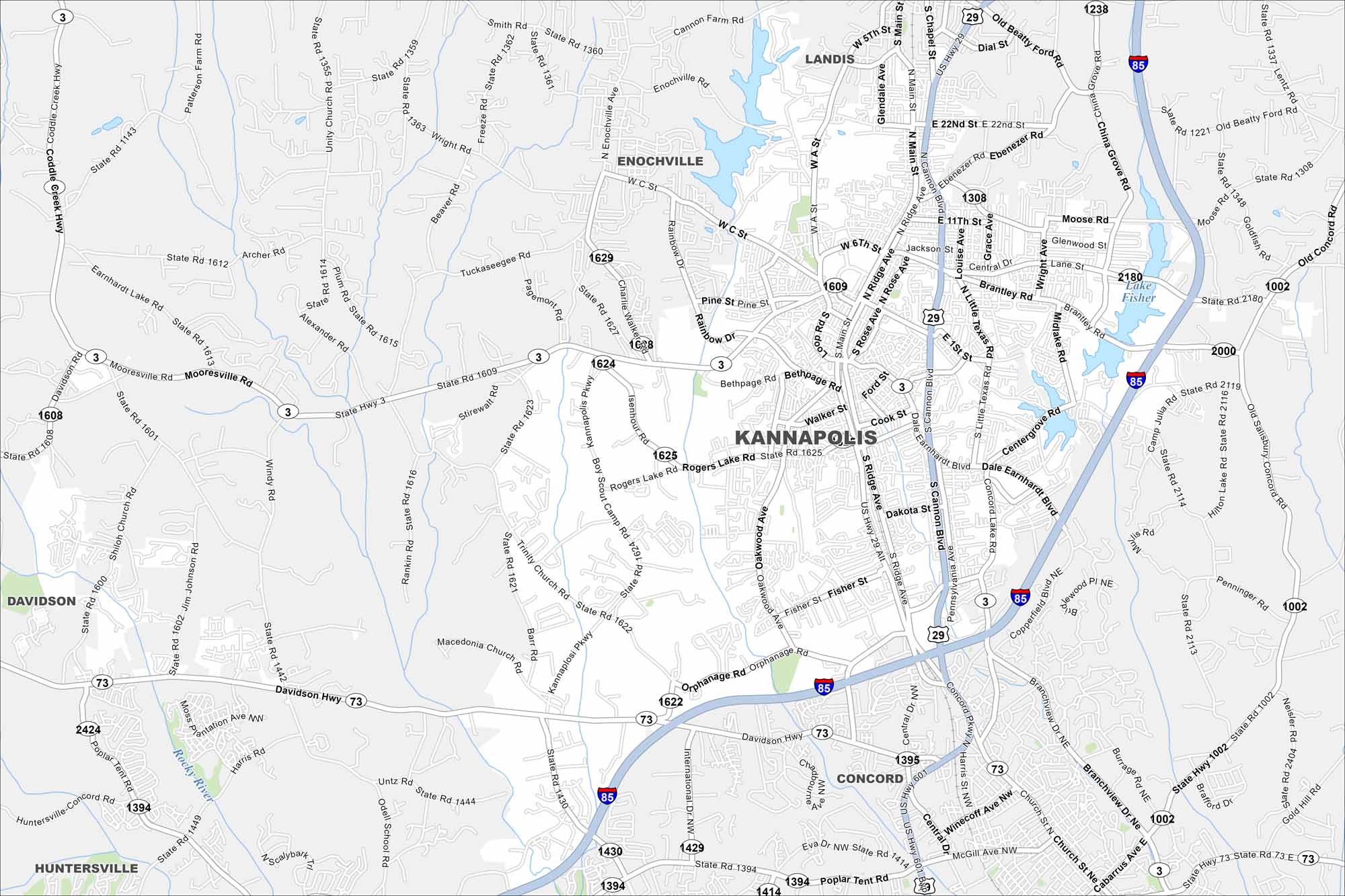
Kannapolis lies north of Charlotte. The map shows a redeveloped downtown with its lakes in northeast. Residential areas spread outward into rolling Piedmont hills.
Map Information
On the Map
Interstates/Highways: I-85, US Hwy 29, State Rte 3, State Rte 73 Major Roads: Main St, Kannapolis Pkwy, Cannon Blvd, Ridge Ave, Dale Earnhardt Blvd, Rogers Lake Rd, Mooresville Rd, Davidson Hwy, Concord Lake Rd, Centergrove Rd, Lane St, Trinity Church Rd, Orphanage Rd, Branchview Dr, Winecoff Ave, Poplar Tent Rd, Old Salisbury Concord Rd, Wright Rd, Moose Rd, Central Dr Lakes and Reservoirs: Lake Fisher, Kannapolis Lake, Buffalo Reservoir Major Rivers: Rocky River Nearby Communities: Landis, Enochville, Concord, Davidson, HuntersvilleNorth Carolina State Maps
Get to know the mountains and coastlines of North Carolina.


City Maps of North Carolina
Journey through North Carolina with our city maps


