Map of Jacksonville, North Carolina
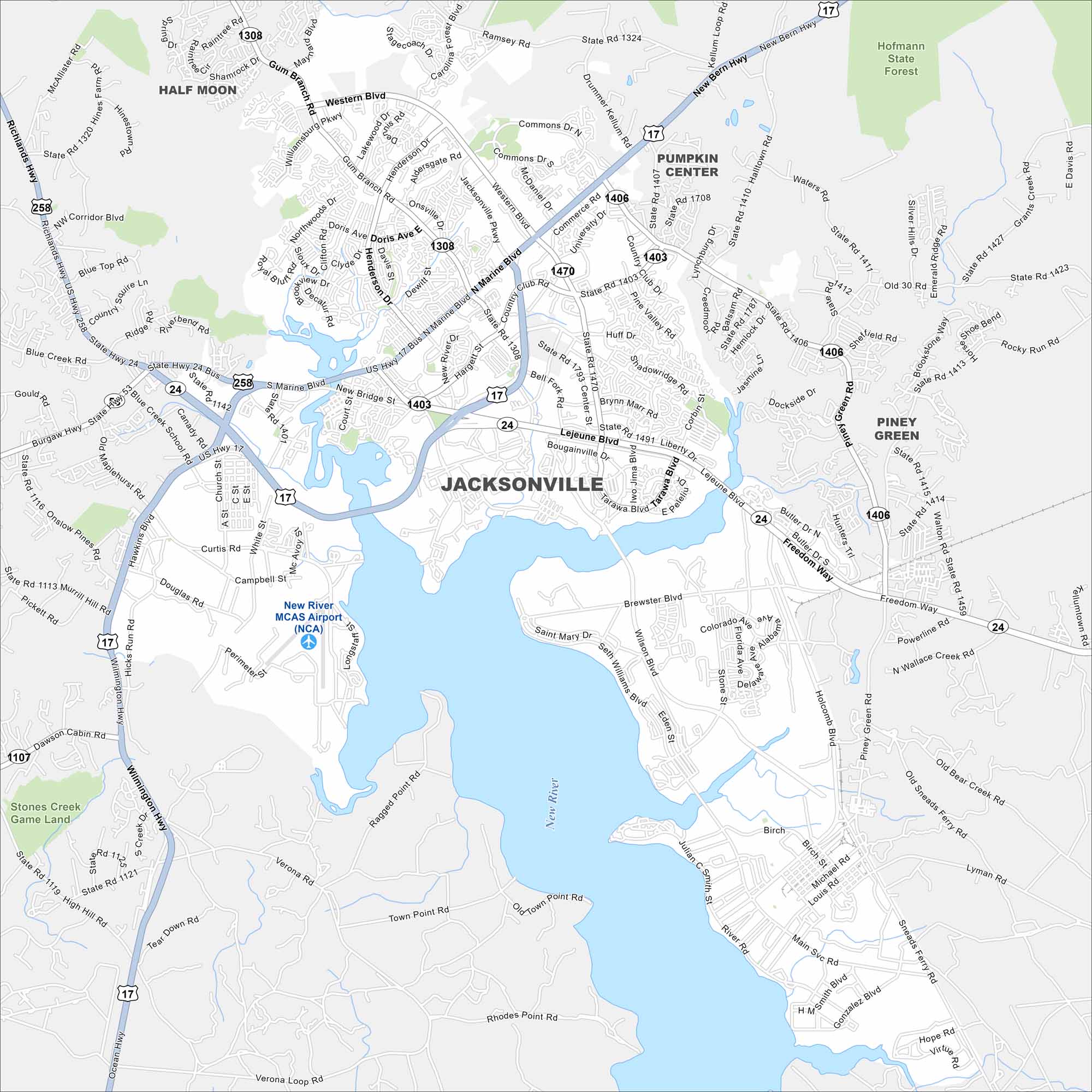
Our map shows Jacksonville with the New River cutting across. It’s close to Camp Lejeune. Otherwise, neighborhoods dominate the area.
Map Information
On the Map
Interstates/Highways: US Hwy 17, US Hwy 17 Bus, State Rte 24, State Rte 53 Major Roads: Western Blvd, Marine Blvd, Gum Branch Rd, Onslow Dr, Henderson Dr, Bell Fork Rd, Piney Green Rd, Lejeune Blvd, Wilmington Hwy, Blue Creek Rd, Burgaw Hwy, Freedom Way, McAvoy St, White St, South Dr, Country Club Rd, Commons Dr, Onslow Pines Rd, High Hill Rd Airports: New River MCAS Airport (NCA) Major Rivers: New River Parks and Preserves: Hofmann State Forest, Stones Creek Game Land Nearby Communities: Half Moon, Pumpkin Center, Piney Green, Half Moon, VeronaNorth Carolina State Maps
Get to know the mountains and coastlines of North Carolina.


City Maps of North Carolina
Journey through North Carolina with our city maps


