Map of Jacksonville, Florida
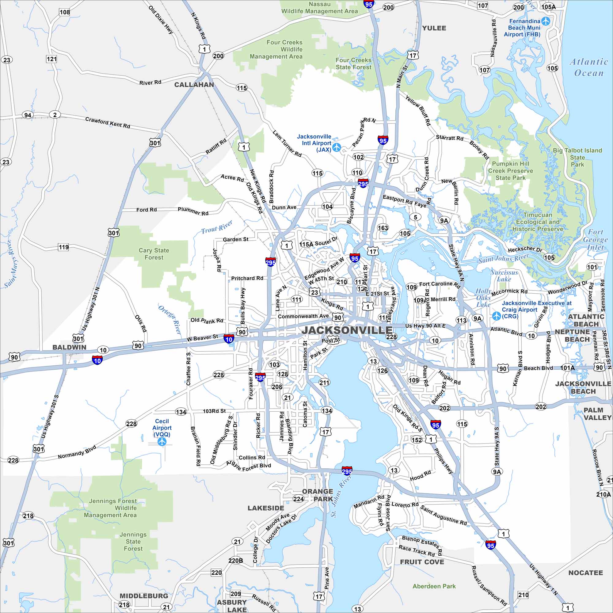
Jacksonville spreads along the St. Johns River. Check out the state parks and highways looping around the city. Beaches and suburbs extend to the east.
Florida State Maps
Discover Florida through our state maps


Map Information
On the Map
Interstates/Highways: I-10, I-95, I-295, US Hwy 1, US Hwy 17, US Hwy 23, US Hwy 90, US Hwy 301, State Rte 9A, State Rte 10, State Rte 13, State Rte 21, State Rte 104, State Rte 115, State Rte 134, State Rte 152, State Rte 200, State Rte 202, State Rte 228 Major Roads: Main St, Beach Blvd, Atlantic Blvd, New Kings Rd, Lem Turner Rd, San Jose Blvd, Roosevelt Blvd, Blanding Blvd, Cassat Ave, Edgewood Ave, University Blvd, Heckscher Dr, Merrill Rd, 103rd St, Normandy Blvd, Chaffee Rd, Beaver St, Commonwealth Ave, Philips Hwy, Kernan Blvd Airports: Jacksonville Intl Airport (JAX), Jacksonville Executive at Craig Airport (CRG), Cecil Airport (VQQ), Fernandina Beach Muni Airport (FHB) Lakes and Reservoirs: Atlantic Ocean, Narcissus Lake, Holly Oaks Lake Major Rivers: St. Johns River, Nassau River, Trout River, Ortega River Parks and Preserves: Timucuan Ecological and Historic Preserve, Jennings Forest State Forest, Cary State Forest, Pumpkin Hill Creek Preserve State Park, Big Talbot Island State Park, Four Creeks State Forest, Jennings Forest Wildlife Management Area, Nassau Wildlife Management Area, Four Creeks Wildlife Management Area, Aberdeen Park Nearby Communities: Orange Park, Lakeside, Fruit Cove, Nocatee, Asbury Lake, Middleburg, Baldwin, Callahan, Yulee, Fernandina Beach, Atlantic Beach, Neptune Beach, Jacksonville Beach, Palm Valley Neighborhoods: Downtown JacksonvilleFlorida City Maps
Chart your course through Miami and Florida’s cities


