Map of Ithaca, New York
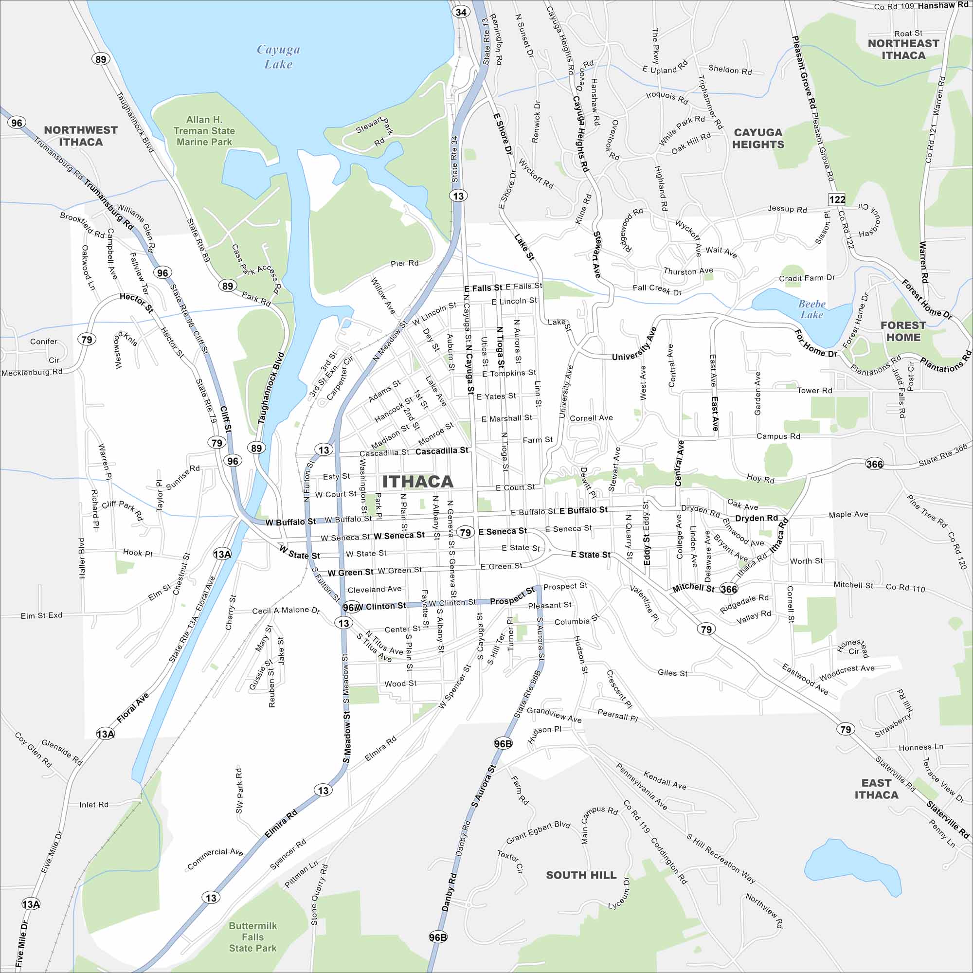
Check out our map of Ithaca on the southern tip of Cayuga Lake. Gorges and waterfalls cut through the city. Cornell University is also here across the hills.
Map Information
On the Map
Interstates/Highways: State Rte 13, State Rte 34, State Rte 89, State Rte 96, State Rte 79, State Rte 366, State Rte 13A, State Rte 96B Major Roads: Meadow St, Fulton St, Cayuga St, Aurora St, Stewart Ave, University Ave, College Ave, East Ave, Mitchell St, State St, Seneca St, Buffalo St, Court St, Elmira Rd, Taughannock Blvd, Central Ave, Garden Ave, Campus Rd, Dryden Rd, Wyckoff Rd Lakes and Reservoirs: Cayuga Lake, Beebe Lake Parks and Preserves: Allan H. Treman State Marine Park, Buttermilk Falls State Park Nearby Communities: Northwest Ithaca, Ithaca, Cayuga Heights, Northeast Ithaca, Forest Home, East Ithaca, South HillNew York State Maps
Find state maps of the Empire State.


City Maps of New York
Here are the city maps that define New York


