Map of Hollywood, Florida
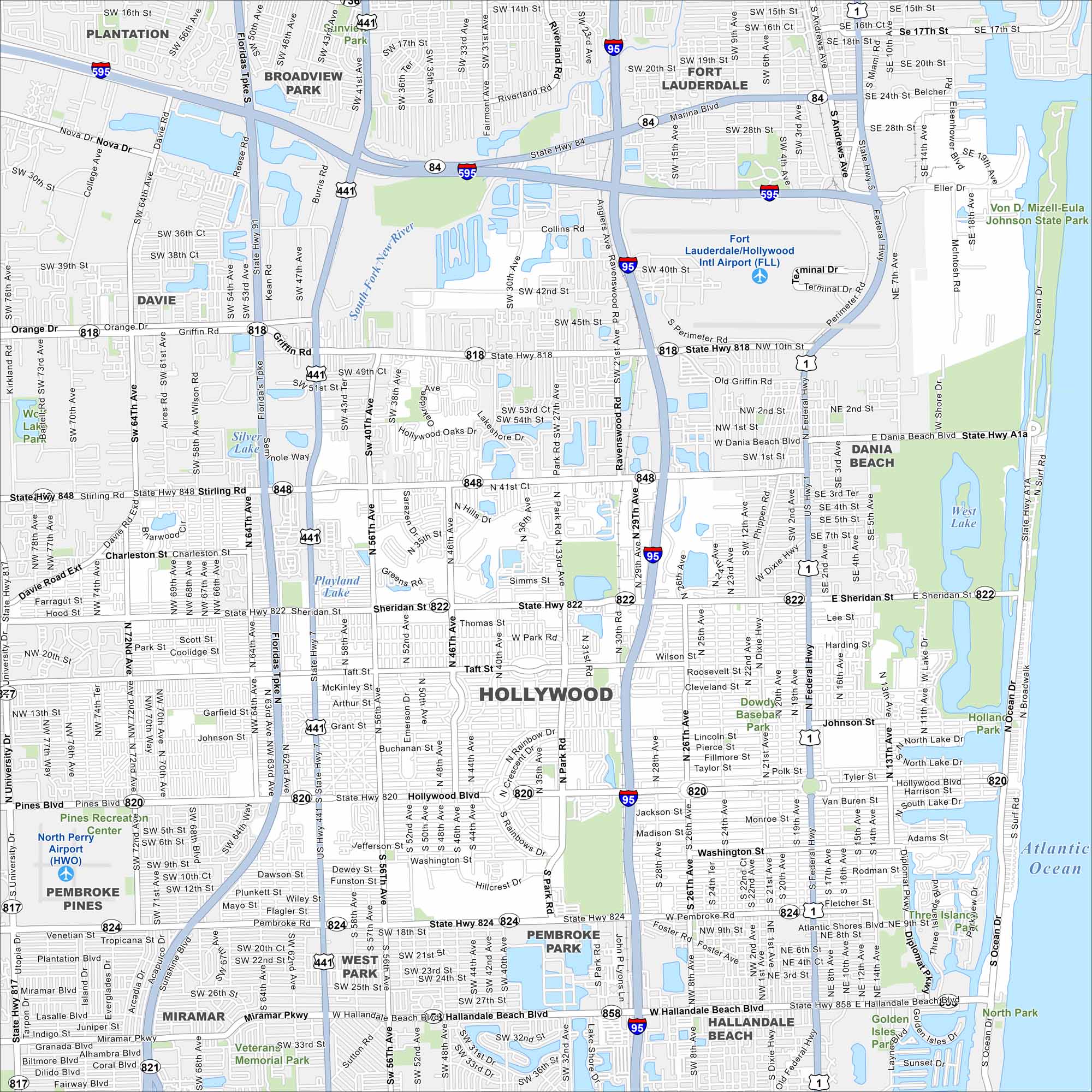
Not to be confused with Hollywood, California… Hollywood, Florida is set between Miami and Fort Lauderdale. Our map highlights its beachfront boardwalk. Inland, neighborhoods stretch along canals and lakes.
Florida State Maps
Discover Florida through our state maps


Map Information
On the Map
Interstates/Highways: I-95, I-595, US Hwy 1, US Hwy 441, State Rte 84, State Rte 817, State Rte 818, State Rte 820, State Rte 822, State Rte 824, State Rte 848, State Rte 858, State Rte A1a, Federal Hwy Major Roads: Pines Blvd, Hollywood Blvd, Sheridan St, Stirling Rd, Griffin Rd, Hallandale Beach Blvd, Pembroke Rd, Miramar Pkwy, University Dr, Douglas Rd, Flamingo Rd, Johnson St, Taft St, Davie Rd Ext, State Hwy 7, University Dr, NW 27th Ave, NE 2nd St, Washington St Airports: Fort Lauderdale/Hollywood Intl Airport (FLL), North Perry Airport (HWO) Lakes and Reservoirs: Atlantic Ocean, West Lake, Silver Lake, Playland Lake Major Rivers: South Fork New River Parks and Preserves: Von D. Mizell-Eula Johnson State Park, Holland Park, Dowdy Baseball Park, Veterans Memorial Park Nearby Communities: Dania Beach, Hallandale Beach, Pembroke Park, West Park, Pembroke Pines, Miramar, Davie, Broadview Park, Plantation, Fort LauderdaleFlorida City Maps
Chart your course through Miami and Florida’s cities


