Map of High Point, North Carolina
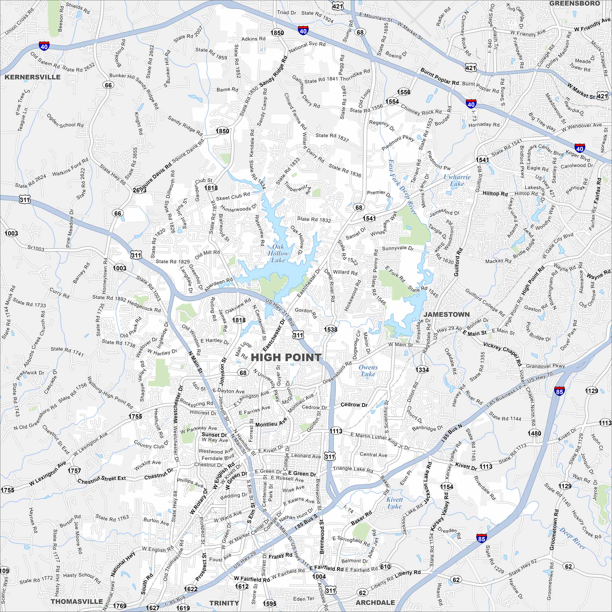
High Point is in central North Carolina between Greensboro and Winston-Salem. This map highlights highways and rivers crossing the city. You’ll also find lakes, green spaces and other notables places of interest.
Map Information
On the Map
Interstates/Highways: I-85, I-74, US Hwy 311, US Hwy 29, US Hwy 70, State Rte 68, State Rte 66, State Rte 62 Major Roads: Main St, Eastchester Dr, Westchester Dr, Skeet Club Rd, High Point Rd, Kivett Dr, University Pkwy, Lexington Ave, Johnson St, Centennial St, Green St, Ward Ave, Fairfield Rd, Baker Rd, Deep River Rd, Barrow Rd, Penny Rd, Wendover Ave, Market St, Friendly Ave Lakes and Reservoirs: Oak Hollow Lake, High Point City Lake, Owens Lake, Kivett Lake, Uwharrie Lake, Tangle Lake Major Rivers: East Fork Deep River, Deep River, West Fork Deep River Nearby Communities: Kernersville, Jamestown, Archdale, Trinity, Thomasville, GreensboroNorth Carolina State Maps
Get to know the mountains and coastlines of North Carolina.


City Maps of North Carolina
Journey through North Carolina with our city maps


