Map of Hialeah Gardens, Florida
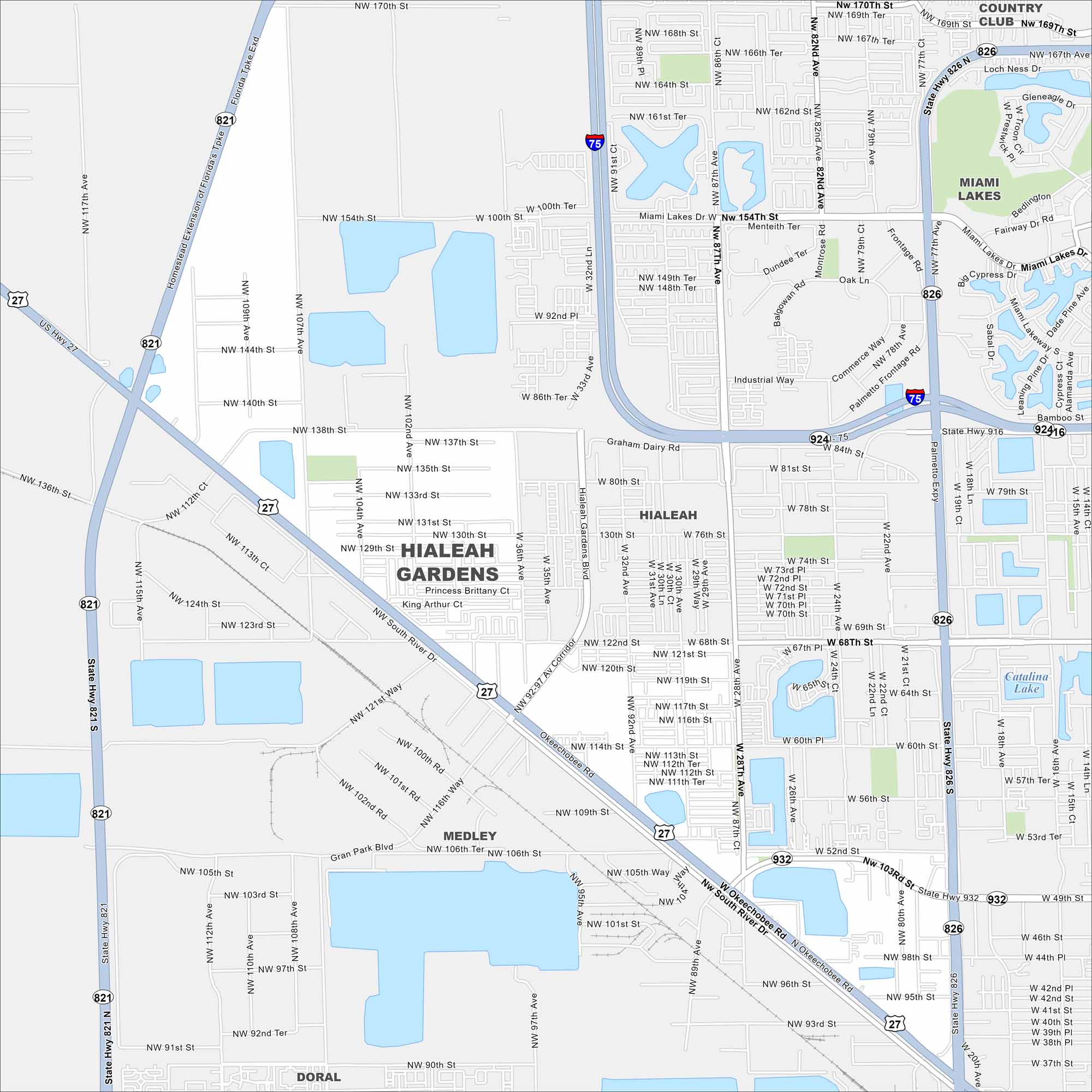
Our map of Hialeah Gardens highlights its position along the Palmetto Expressway (State Road 826). It borders Hialeah to the east. Canals and residential blocks are spread throughout.
Florida State Maps
Discover Florida through our state maps


Map Information
On the Map
Interstates/Highways: I-75, US Hwy 27, State Rte 821, State Rte 826, State Rte 924, State Rte 932, Palmetto Expy Major Roads: Okeechobee Rd, Hialeah Gardens Blvd, Graham Dairy Rd, Frontage Rd, Commerce Way, W 103rd St, W 84th St, W 68th St, NW 138th St, NW 107th Ave, NW 87th Ave, NW 170th St, NW 154th St, NW 122nd St, NW 106th, NW 97th Ave, NW 102nd Ave, NW 92nd Ave, NW 77th Ave Lakes and Reservoirs: Catalina Lake Nearby Communities: Hialeah, Medley, Miami Lakes, Doral, Country ClubFlorida City Maps
Chart your course through Miami and Florida’s cities


