Guadalupe Mountains National Park Map
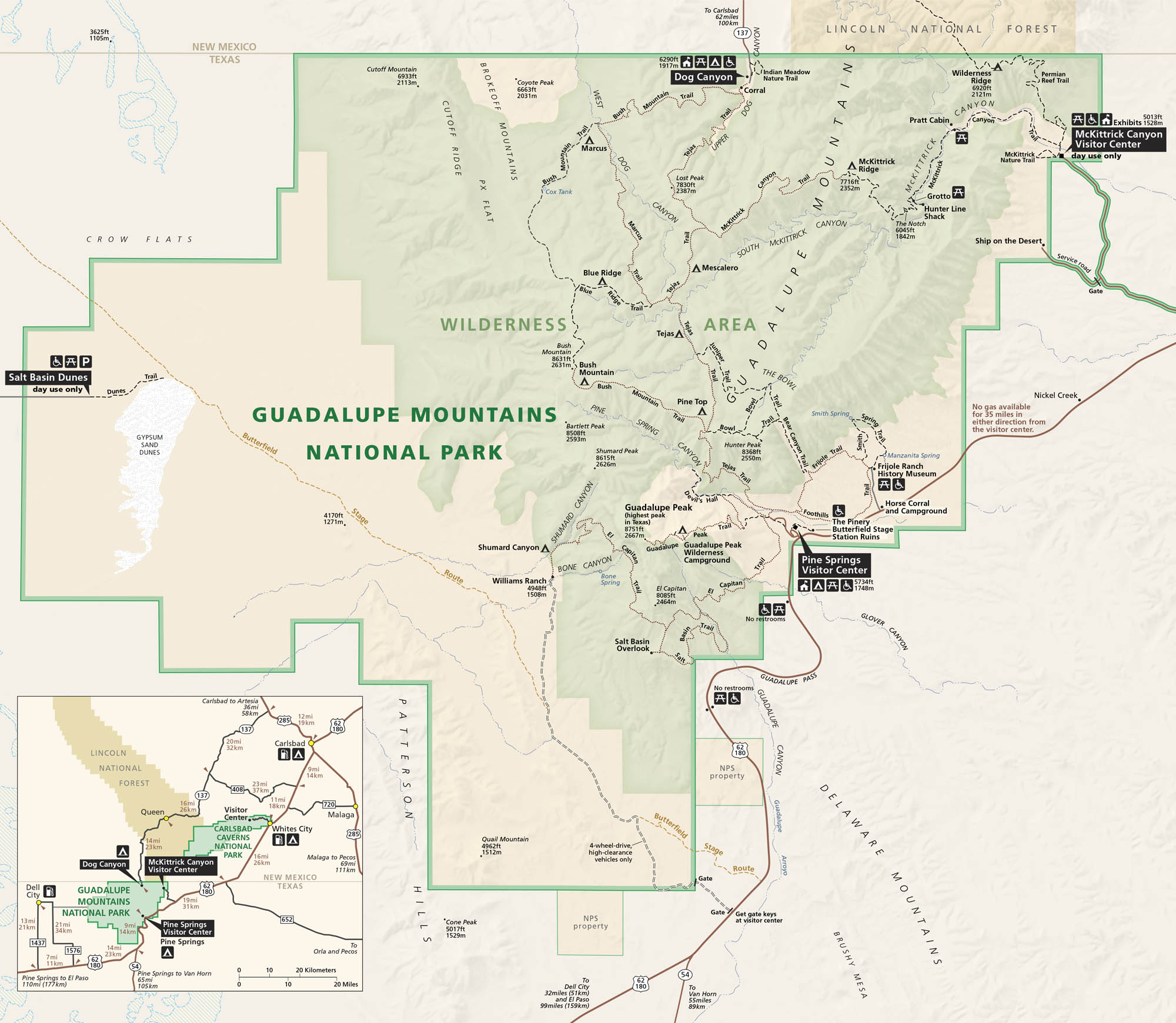
Guadalupe Mountains National Park stands tall on the border of Texas and New Mexico. Our park map shows roads, trails, campgrounds, and the terrain. This national park mixes canyons, cliffs, and the highest point in Texas.
Map Information
National Park Maps
Find maps of green spaces and national parks near you.


