Map of Green Cove Springs, Florida
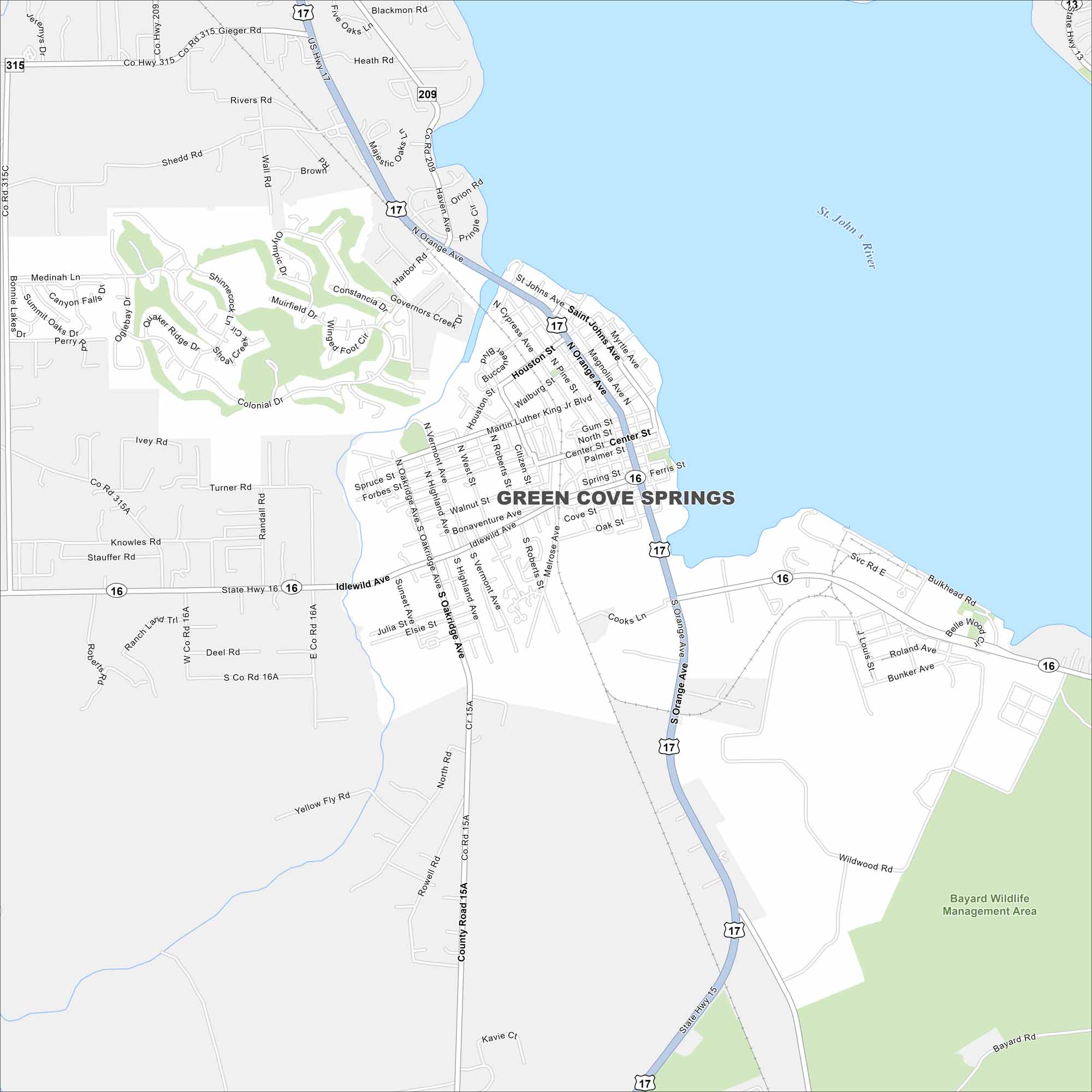
Green Cove Springs is along the St. Johns River in northeast Florida. On the map, you’ll see the river shaping the city’s edge. Highways connect it toward Jacksonville.
Florida State Maps
Discover Florida through our state maps


Map Information
On the Map
Interstates/Highways: US Hwy 17, State Hwy 16, State Hwy 15, State Hwy 13, State Hwy 315 Major Roads: Orange Ave, Ferris St, Idlewild Ave, St Johns Ave, Governors Creek, Martin Luther King Jr Blvd, Houston St, Walburg St, Oakridge Ave, Highland Ave, West St, Vermont Ave, Roberts St, Melrose Ave, Oak St, Cove St, Bulkhead Rd, Roland Ave, Bunker Ave, Julia St Major Rivers: Saint John’s River Parks and Preserves: Bayard Wildlife Management AreaFlorida City Maps
Chart your course through Miami and Florida’s cities


