Map of Grand Haven, Michigan
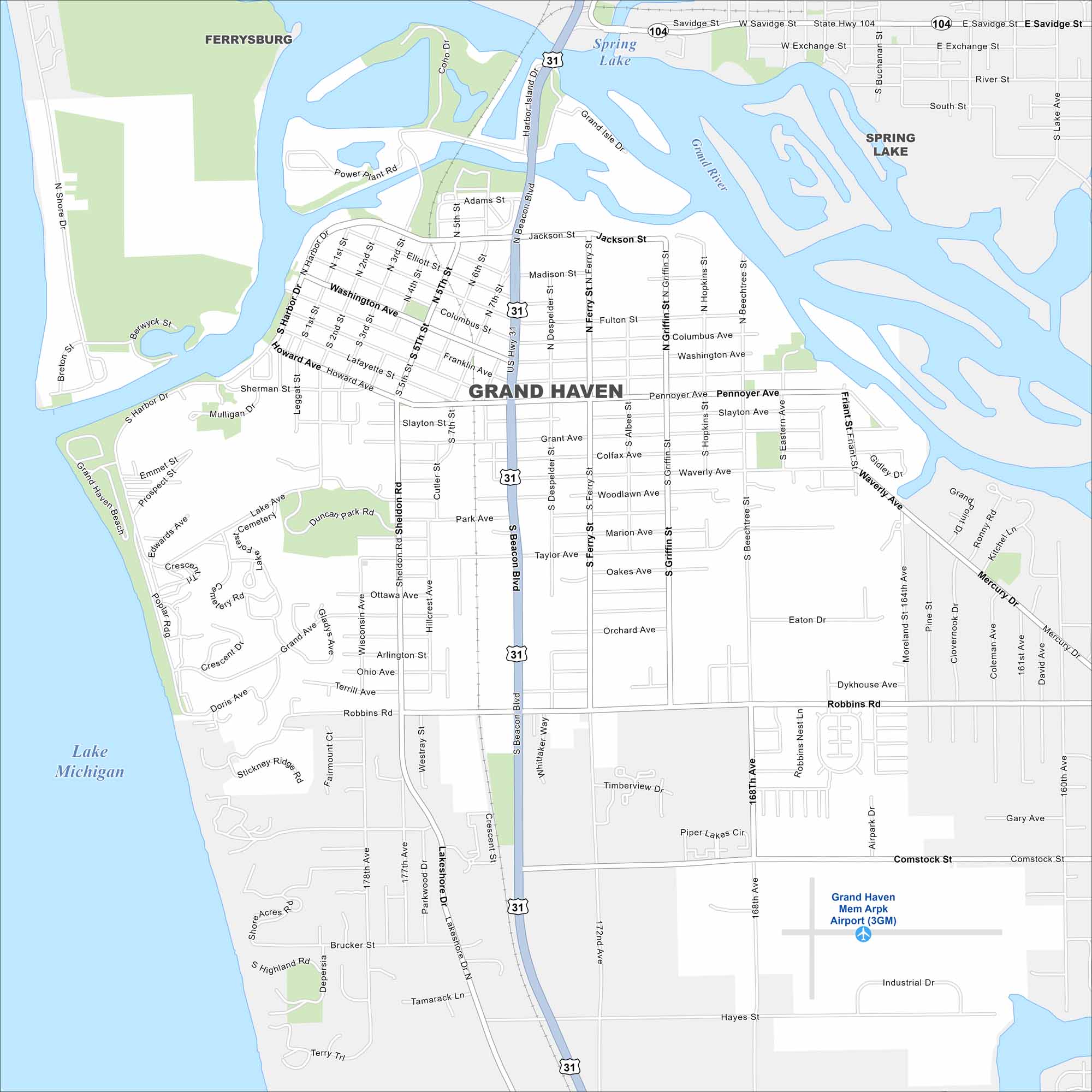
Check out our map of Grand Haven on Lake Michigan’s eastern shore. You’ll see the Grand River flowing into the lake, along with marina areas. It’s a popular spot for beaches and a well-known lighthouse.
Map Information
On the Map
Interstates/Highways: US Hwy 31, State Rte 104 Major Roads: Beacon Blvd, Washington Ave, Jackson St, Pennoyer Ave, Robbins Rd, Harbor Dr, Lakeshore Dr, Ferry St, Despelder St, Griffin St, Beechtree St, 168th Ave, 172nd Ave, Hayes St, Comstock St, Mercury Dr, Waverly Ave, Madison St, Fulton St, Grant Ave Airports: Grand Haven Mem Arpk Airport (3GM) Lakes and Reservoirs: Lake Michigan Major Rivers: Grand River Nearby Communities: Ferrysburg, Spring LakeMichigan State Maps
Get to know Michigan with our detailed maps


City Maps of Michigan
Check out our maps of Detroit and other cities in Michigan


