Grand Canyon National Park Map
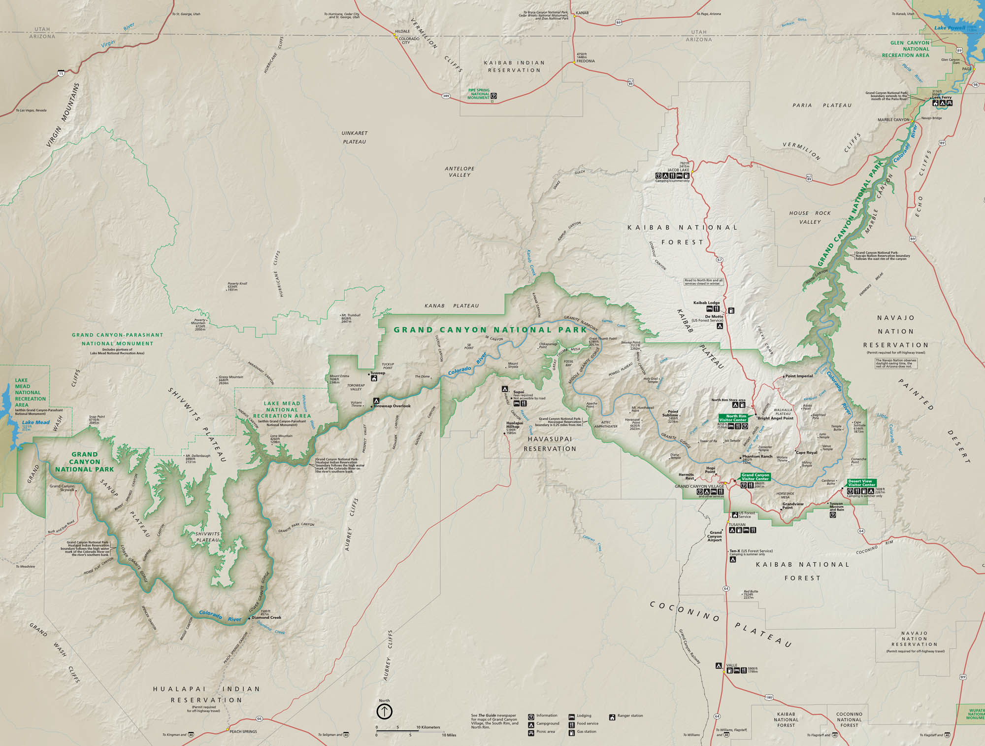
Grand Canyon National Park might seem a bit overwhelming because of its sheer scale. But hopefully our park map can simplify it. Spread across northern Arizona, Grand Canyon’s layered rock plunge into one of the deepest gorges on Earth. See its roads, trails, and overlooks with our map.
Map Information
On the Map
Parks: Grand Canyon National Park, Grand Canyon-Parashant National Monument, Lake Mead National Recreation Area, Glen Canyon National Recreation Area Visitor Centers: Grand Canyon Visitor Center, North Rim Visitor Center, Desert View Visitor Center, Verkamp’s Visitor Center Major Roads: US Hwy 180, US Hwy 64, State Rte 64, State Rte 67, Desert View Dr, Hermit Rd Rivers/Lakes: Colorado River, Lake Mead, Lake Powell, Kanab Creek, Diamond Creek, Havasu Creek, Little Colorado River Cities and Towns: Grand Canyon Village, Tusayan, Supai, Page, Marble Canyon, Meadview, Peach Springs Park Sites: Mather Campground, Desert View Campground, North Rim Campground, Phantom Ranch, Bright Angel Point, Cape Royal, Point Imperial, Toroweap Overlook, Hermits Rest, Yavapai Point, Desert View Watchtower Other Landmarks: Havasupai Reservation, Navajo Nation Reservation, Kaibab Indian Reservation, Hualapai Indian Reservation, Kaibab National ForestNational Park Maps
Find maps of green spaces and national parks near you.


