Map of Goodyear, Arizona
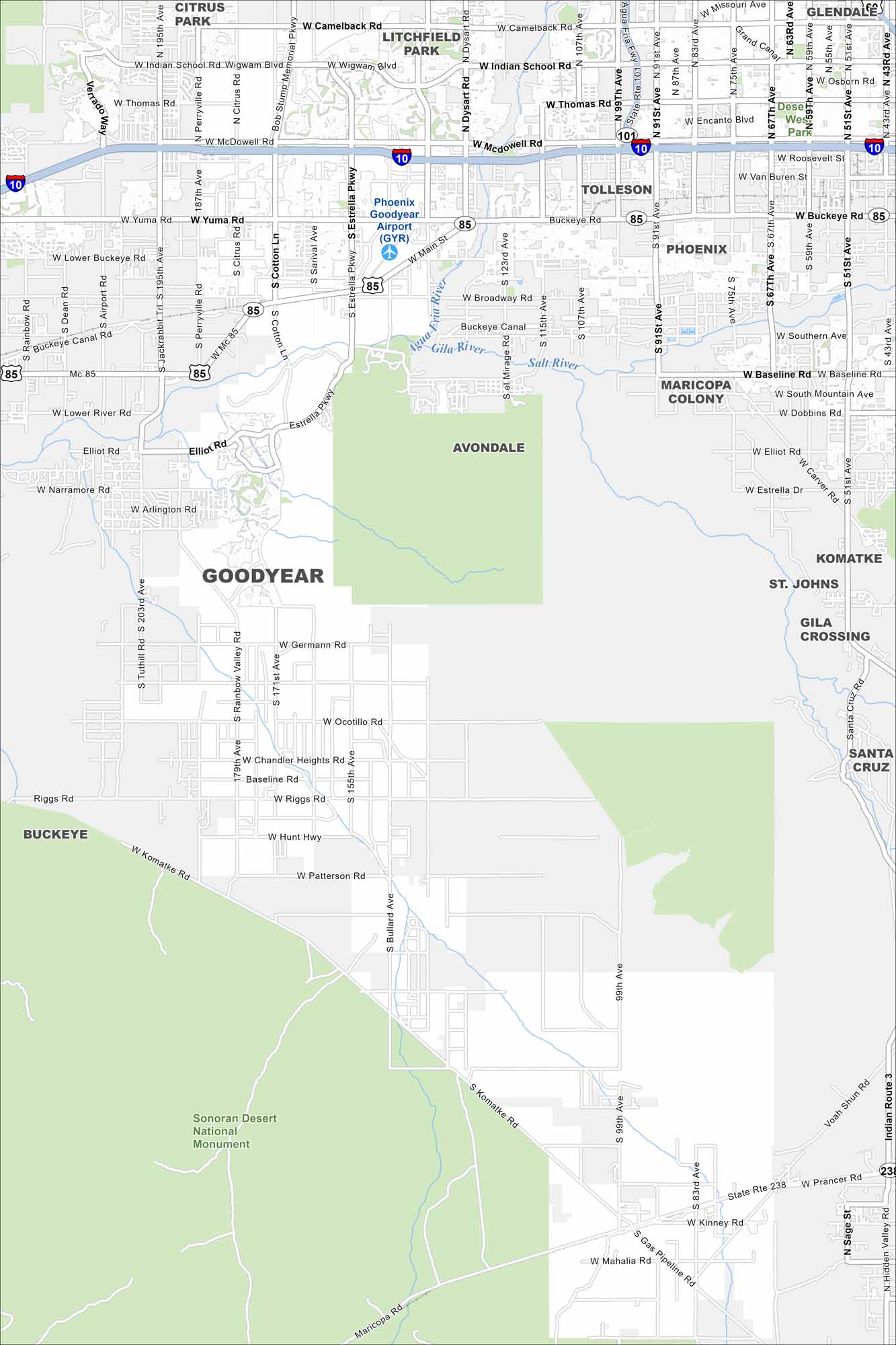
Our map of Goodyear, Arizona is a tale of two sides. The top half is growing fast because of its spot near Phoenix. But the bottom half is mostly occupied by the Sonoran Desert National Monument.
Arizona State Maps
Check out our Arizona state maps we’ve put together


Map Information
On the Map
Interstates/Highways: I-10, SR-85, MC-85, Loop 303 (Bob Stump Memorial Pkwy), SR-238 Major Roads: Indian School Rd, Thomas Rd, McDowell Rd, Van Buren St, Yuma Rd, Lower Buckeye Rd, Broadway Rd, Southern Ave, Baseline Rd, Dobbins Rd, Elliot Rd, Estrella Pkwy, Litchfield Rd, Bullard Ave, Sarival Ave, Cotton Ln, Jackrabbit Trl, Perryville Rd, Citrus Rd, Rainbow Valley Rd Airports: Phoenix Goodyear Airport (GYR) Rivers and Creeks: Gila River, Agua Fria River, Salt River Parks/Preserves/Forests: Sonoran Desert National Monument Nearby Communities: Avondale, Litchfield Park, Tolleson, Buckeye, Komatke, St. Johns, Gila Crossing, Santa CruzArizona City Maps
Here’s our full batch of Arizona city maps


