Map of Glendale, Arizona
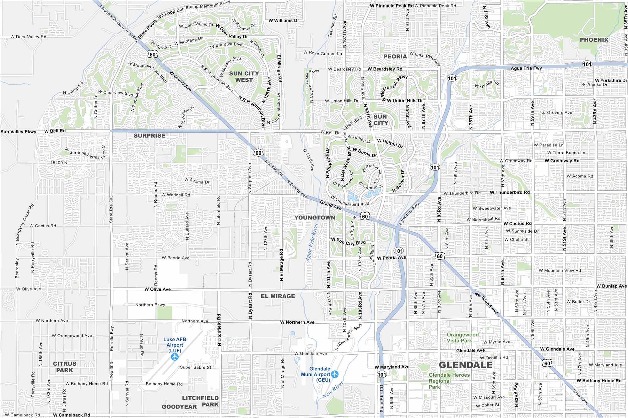
Check out our map of Glendale just northwest of Phoenix. Wide roads and freeways cut through desert neighborhoods. Green spaces and canals stand out on the flat landscape.
Arizona State Maps
Check out our Arizona state maps we’ve put together


Map Information
On the Map
Interstates/Highways: US Hwy 60 (Grand Ave), State Rte 101 (Agua Fria Fwy) Major Roads: Bell Rd, Greenway Rd, Thunderbird Rd, Cactus Rd, Peoria Ave, Olive Ave, Northern Ave, Glendale Ave, Bethany Home Rd, Camelback Rd, 43rd Ave, 51st Ave, 59th Ave, 67th Ave, 75th Ave, 83rd Ave, 91st Ave, 99th Ave, 107th Ave, Litchfield Rd Airports: Luke AFB Airport (LUF), Glendale Muni Airport (GEU) Rivers and Creeks: New River Parks/Preserves/Forests: Glendale Heroes Regional Park, Orangewood Vista Park Nearby Communities: Phoenix, Peoria, Sun City, Youngtown, El Mirage, Litchfield ParkArizona City Maps
Here’s our full batch of Arizona city maps


