Map of Glen Cove, New York
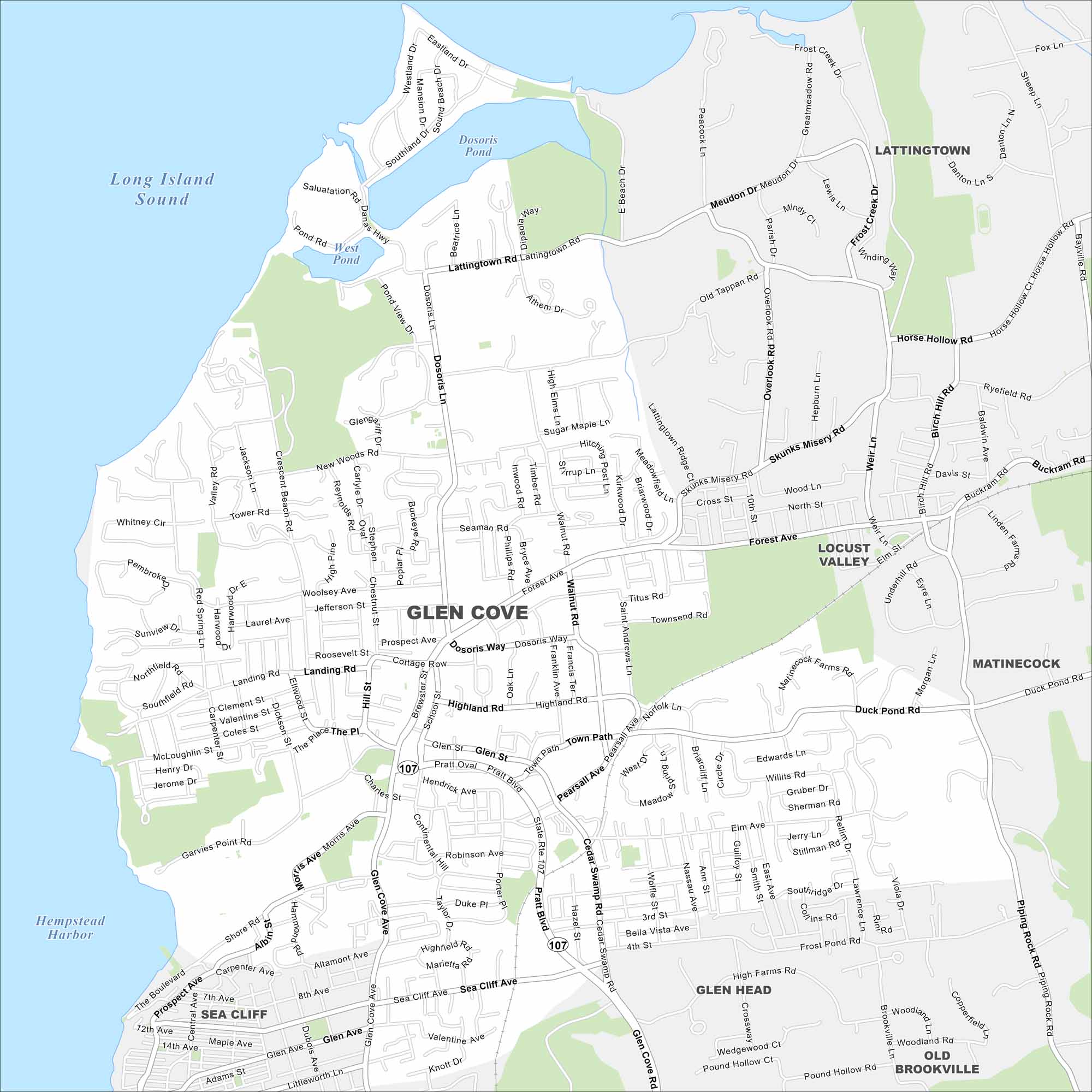
Our map of Glen Cove, New York, highlights a waterfront city on Long Island’s North Shore. Harbors and inlets define much of the landscape.
Map Information
On the Map
Interstates/Highways: State Rte 107 Major Roads: Pratt Blvd, Cedar Swamp Rd, Glen Cove Ave, Forest Ave, Landing Rd, Brewster St, School St, Highland Rd, Dosoris Way, Walnut Rd, Duck Pond Rd, Lattingtown Rd, Meudon Dr, Old Tappan Rd, Skunks Misery Rd, Horse Hollow Rd, Buckram Rd, Piping Rock Rd, Glen Cove Rd, Sea Cliff Ave Lakes and Reservoirs: Long Island Sound, Hempstead Harbor, Dosoris Pond, West Pond, Duck Pond Nearby Communities: Lattingtown, Locust Valley, Matinecock, Old Brookville, Glen Head, Sea CliffNew York State Maps
Find state maps of the Empire State.


City Maps of New York
Here are the city maps that define New York


