Map of Gastonia, North Carolina
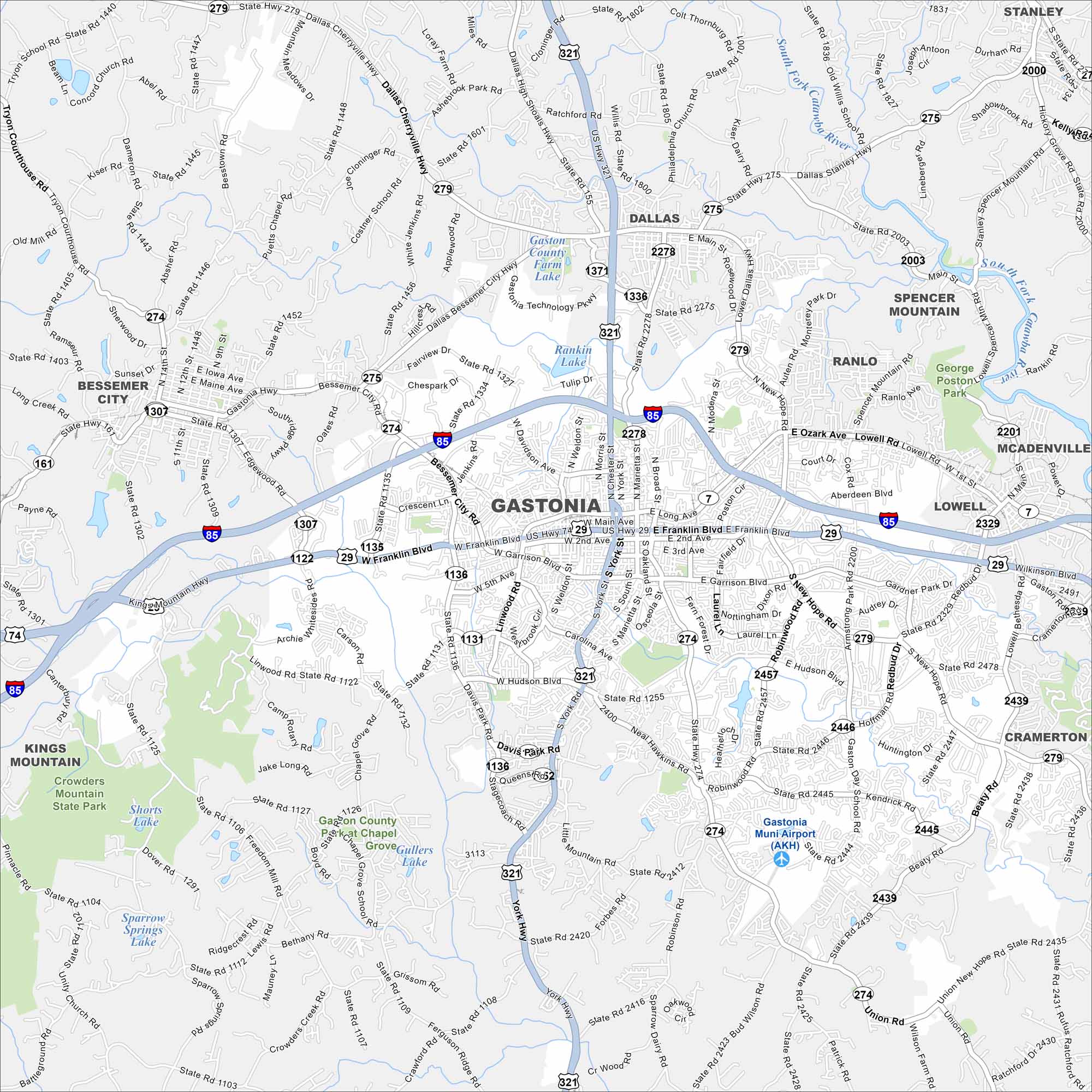
Our map of Gastonia lays out the city streets, highways, and local parks. The roads tie into the larger Charlotte area. But Gastonia still stands on its own at the edge of the Piedmont region.
Map Information
On the Map
Interstates/Highways: I-85, US Hwy 321, US Hwy 29, US Hwy 74, State Rte 279, State Rte 274, State Rte 275, State Rte 161 Major Roads: Main Ave, Franklin Blvd, Garrison Blvd, Hudson Blvd, New Hope Rd, Gaston Day School Rd, Union Rd, Hoffman Rd, Redbud Dr, Cox Rd, Ozark Ave, Lowell Rd, Main St, Church St, Marietta St, York St, Broad St, Chester St, Oakland St, Southridge Pkwy Airports: Gastonia Muni Airport (AKH) Lakes and Reservoirs: Gaston County Farm Lake, Rankin Lake, Shorts Lake, Sparrow Springs Lake, Grove Gullers Lake Major Rivers: South Fork Catawba River Parks and Preserves: Crowders Mountain State Park, George Poston Park Nearby Communities: Dallas, Spencer Mountain, Ranlo, Lowell, McAdenville, Cramerton, Belmont, Kings Mountain, Bessemer CityNorth Carolina State Maps
Get to know the mountains and coastlines of North Carolina.


City Maps of North Carolina
Journey through North Carolina with our city maps


