Map of Fort Walton Beach, Florida
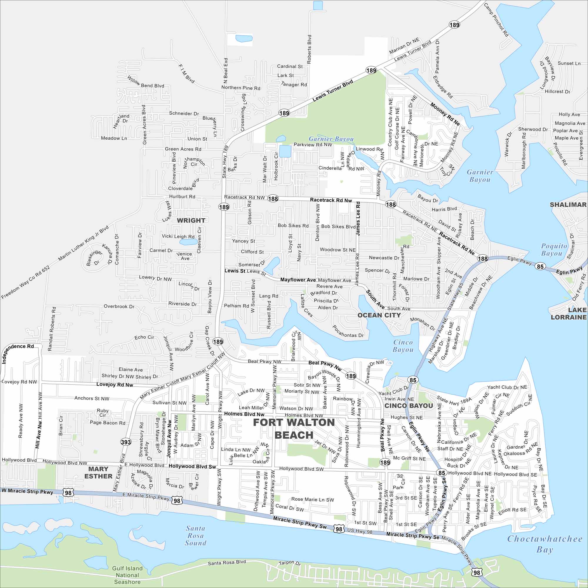
Our map of Fort Walton Beach shows it between Choctawhatchee Bay and the Gulf Coast. White-sand beaches line the southern edge. U.S. 98 runs straight through the heart of town.
Florida State Maps
Discover Florida through our state maps


Map Information
On the Map
Interstates/Highways: US Hwy 98, State Hwy 189, State Hwy 188, State Hwy 85, State Hwy 393, State Hwy 189A, Miracle Strip Pkwy, Beal Pkwy, Eglin Pkwy Major Roads: Mary Esther Cutoff, Lewis Turner Blvd, Racetrack Rd, Hollywood Blvd, Mooney Rd, Lovejoy Rd, Hurlburt Rd, Green Acres Blvd, Pryor Rd, Brooks St, Jet Dr, Holmes Blvd, Robinwood Dr, Yacht Club Dr, Hughes St, Beal Pkwy Nw, Beal Pkwy Lakes and Reservoirs: Choctawhatchee Bay, Santa Rosa Sound, Garnier Bayou, Cinco Bayou, Poquito Bayou Parks and Preserves: Gulf Island National Seashore Nearby Communities: Wright, Ocean City, Cinco Bayou, Mary Esther, Shalimar, Lake LorraineFlorida City Maps
Chart your course through Miami and Florida’s cities


