Map of Fort Myers, Florida
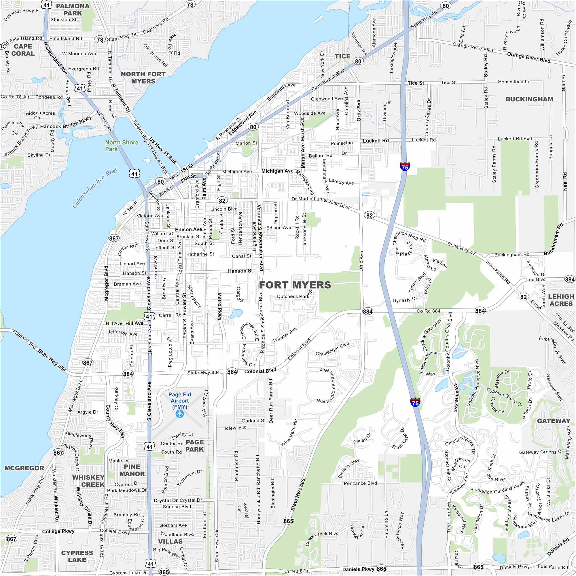
Fort Myers sits on the Caloosahatchee River near the Gulf Coast. Our map displays highways, roads, lakes, waterways and parks. U.S. 41 and I-75 both cut through the region.
Florida State Maps
Discover Florida through our state maps


Map Information
On the Map
Interstates/Highways: I-75, US Hwy 41, US Hwy 41 Bus, State Hwy 80, State Hwy 82, State Hwy 78, State Hwy 867, State Hwy 884, State Hwy 865, State Hwy 869 Major Roads: Cleveland Ave, Colonial Blvd, Daniels Pkwy, Mcgregor Blvd, Fowler St, Ortiz Ave, Metro Pkwy, Winkler Ave, Veronica S Shoemaker Blvd, Edison Ave, Martin Luther King Blvd, Palm Beach Blvd, Luckett Rd, Evans Ave, Carrell Rd, Hanson St, Pine Island Rd, College Pkwy, Six Mile Cypress Pkwy, Treeline Ave Airports: Page Fld Airport (FMY) Major Rivers: Caloosahatchee River Parks and Preserves: North Shore Park Nearby Communities: Cape Coral, North Fort Myers, Palmona Park, Tice, Buckingham, Lehigh Acres, Gateway, Mcgregor, Whiskey Creek, Pine Manor, Page Park, Villas, Cypress LakeFlorida City Maps
Chart your course through Miami and Florida’s cities


