Map of Fort Lauderdale, Florida
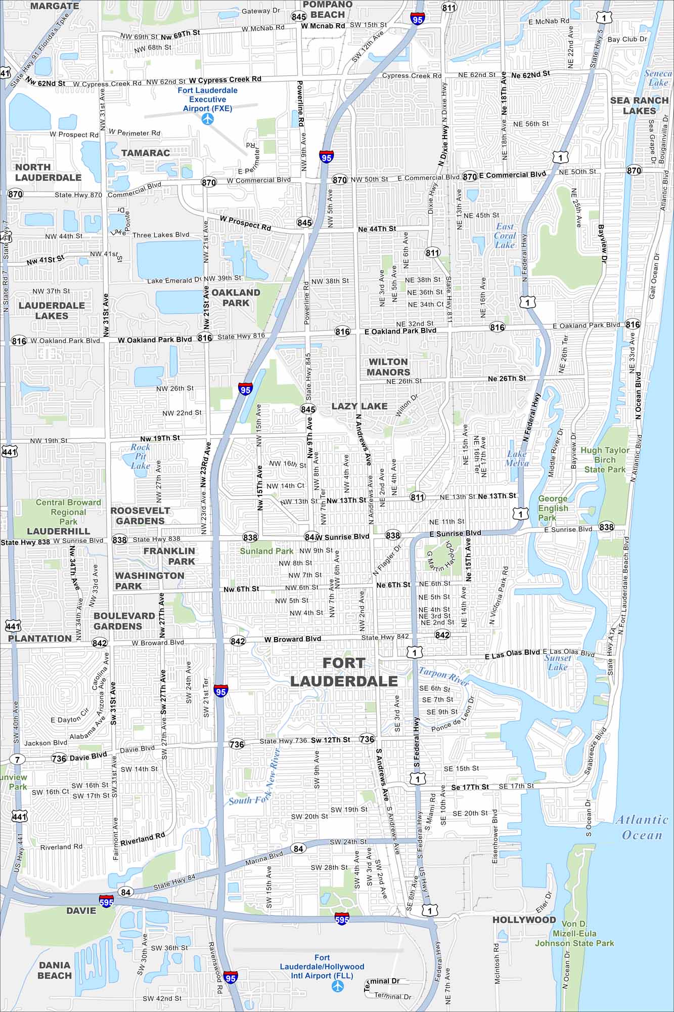
Fort Lauderdale sits on the Atlantic coast with canals running everywhere. It’s often called the “Venice of America” for that very reason. Our map shows the New River and streets winding right through the city.
Florida State Maps
Discover Florida through our state maps


Map Information
On the Map
Interstates/Highways: I-95, I-595, US Hwy 1, US Hwy 441, State Hwy 870, State Hwy 845, State Hwy 811, State Hwy 816, State Hwy 838, State Hwy 842, State Hwy 736, State Hwy 84, State Hwy A1A Major Roads: Commercial Blvd, Sunrise Blvd, Oakland Park Blvd, Broward Blvd, Federal Hwy, Dixie Hwy, Powerline Rd, Andrews Ave, Davie Blvd, University Dr, State Rd 7, Cypress Creek Rd, McNab Rd, Prospect Rd, 31st Ave, 27th Ave, 15th Ave, 4th Ave, 3rd Ave, Ocean Blvd Airports: Fort Lauderdale/Hollywood Intl Airport (FLL), Fort Lauderdale Executive Airport (FXE) Lakes and Reservoirs: Atlantic Ocean, Lake Melva, East Coral Lake, Rock Pit Lake, Sunset Lake, Seneca Lake Major Rivers: South Fork New River Parks and Preserves: Hugh Taylor Birch State Park, George English Park, Central Broward Regional Park, Von D. Mizell-Eula Johnson State Park Nearby Communities: Pompano Beach, Margate, Tamarac, North Lauderdale, Lauderdale Lakes, Oakland Park, Wilton Manors, Lazy Lake, Roosevelt Gardens, Franklin Park, Washington Park, Boulevard Gardens, Plantation, Davie, Dania Beach, Hollywood, Sea Ranch LakesFlorida City Maps
Chart your course through Miami and Florida’s cities


