Map of Flint, Michigan
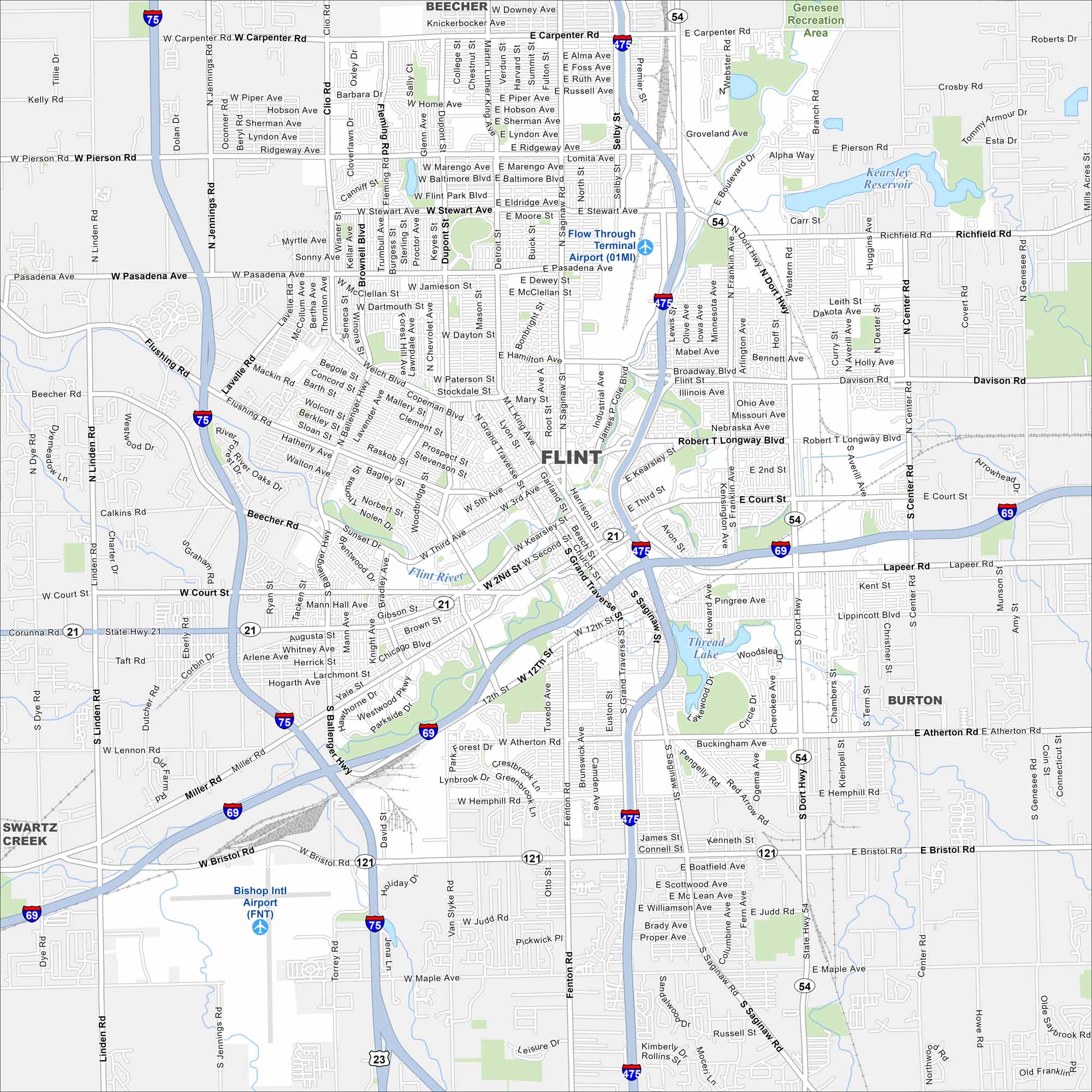
Flint sits along the Flint River in eastern Michigan. Its streets stretch out from the downtown core into wide neighborhoods. On our map, the river curves are the feature that catches your eye first.
Map Information
On the Map
Interstates/Highways: I-75, I-475, I-69, State Rte 54, State Rte 21, State Rte 121 Major Roads: Saginaw St, Dort Hwy, Miller Rd, Corunna Rd, Court St, Pasadena Ave, Carpenter Rd, Pierson Rd, Stewart Ave, Robert T Longway Blvd, Lapeer Rd, Atherton Rd, Hemphill Rd, Bristol Rd, Maple Rd, Ballenger Hwy, Fenton Rd, Clio Rd, Jennings Rd, Linden Rd Airports: Bishop Intl Airport (FNT) Lakes and Reservoirs: Kearsley Reservoir, Thread Lake Major Rivers: Flint River Parks and Preserves: Genesee Recreation Area Nearby Communities: Beecher, Burton, Swartz CreekMichigan State Maps
Get to know Michigan with our detailed maps


City Maps of Michigan
Check out our maps of Detroit and other cities in Michigan


