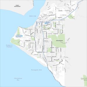
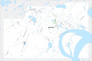
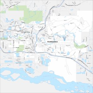
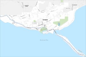
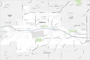
Map of Fairbanks, Alaska

Fairbanks sits along the Chena River in interior Alaska. But the Tanana River flows just below it. Our map shows it surrounded by vast forest and open land. Its northern location makes it a true gateway to the Arctic.
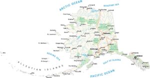
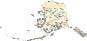
Alaska State Maps
Take a look at our Alaska state maps


Map Information
On the Map
Interstates/Highways: Steese Hwy, Old Steese Hwy, Richardson Hwy, Old Richardson Hwy, Johansen Expy Major Roads: College Rd, Airport Way, Phillips Field Rd, Illinois St, Cushman St, University Ave, Geist Rd, Farmers Loop Rd, Davis Rd, 30th Ave, New Richardson Hwy, Peger Rd, Mitchell Expy, Lathrop St, College Rd W, Chena Hot Springs Rd, Badger Rd, Nordale Rd, Gaffney Rd, Airport Way W Airports: Fairbanks Intl Airport (FAI), Ladd AAF Airport (FBK) Rivers and Creeks: Chena River, Tanana River Parks/Preserves/Forests: Chena River State Recreation SiteAlaska City Maps
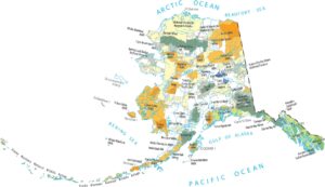
Browse our collection of Alaska city maps