Everglades National Park Map
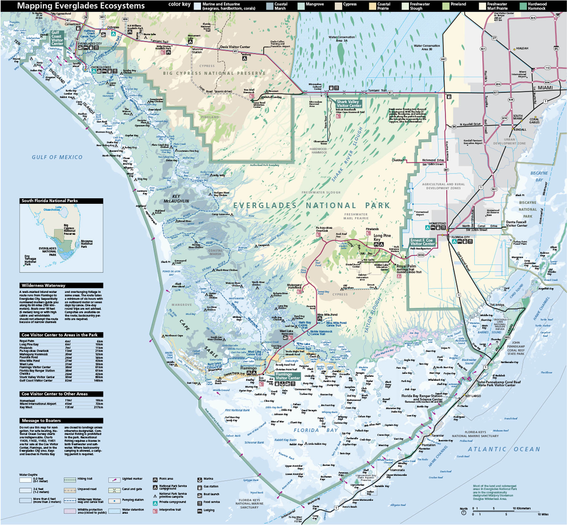
In southern Florida, you can find Everglades National Park with its coastal environment. Our park map shows roads, picnic areas and its ecosystems.
Map Information
On the Map
Parks: Everglades National Park, Big Cypress National Preserve, Biscayne National Park, John Pennekamp Coral Reef State Park Visitor Centers: Ernest F. Coe Visitor Center, Flamingo Visitor Center, Shark Valley Visitor Center, Gulf Coast Visitor Center, Oasis Visitor Center, Dante Fascell Visitor Center Interstates/Highways: I-75, I-95 Major Roads: US Hwy 41, US Hwy 1, State Rte 9336, State Rte 997, Tamiami Trail, Main Park Rd, Card Sound Rd, Ingraham Hwy Bays/Waterways: Florida Bay, Atlantic Ocean, Shark River Slough, Taylor Slough, Whitewater Bay, Oyster Bay, Ponce de Leon Bay, Tarpon Bay, Coot Bay, West Lake, Seven Mile Canoe Trail, Wilderness Waterway Cities/Towns: Miami, Homestead, Florida City, Everglades City, Chokoloskee, Key Largo, Islamorada, Tavernier, Ochopee Park Sites: Flamingo, Long Pine Key, Pine Island, Chekika, Mahogany Hammock, Pa-hay-okee Overlook, Royal Palm, Gumbo Limbo Trail, Anhinga Trail, West Lake Other Landmarks: Miccosukee Indian Reservation, Miami International Airport, Turkey Point Power Plant, Nike Missile SiteNational Park Maps
Find maps of green spaces and national parks near you.


