Map of Estero, Florida
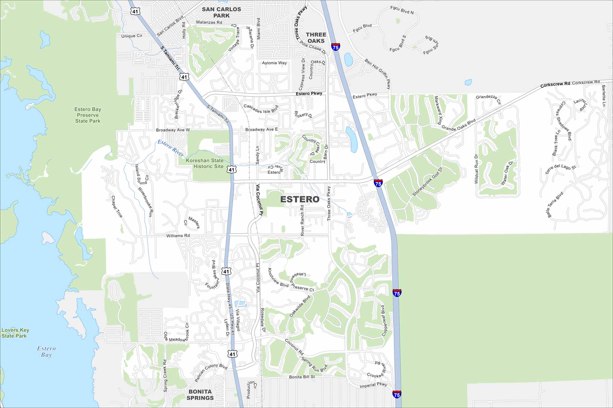
Check out our map of Estero along Florida’s Gulf Coast. The Estero River flows through toward Estero Bay. Wetlands and preserves cover much of the area.
Florida State Maps
Discover Florida through our state maps


Map Information
On the Map
Interstates/Highways: I-75, US Hwy 41 Major Roads: Tamiami Trl, Corkscrew Rd, Estero Pkwy, Ben Hill Griffin Pkwy, Three Oaks Pkwy, Coconut Rd, Via Coconut Pt, Broadway Ave, Williams Rd, Sandy Ln, River Ranch Rd, Stoneybrook Golf Dr, Wildcat Run Dr, Grandezza Cir, Torre Del Lago St, Bella Terra Blvd, Cypress View Dr, Pelican Colony Blvd, Bonita Bill St, Imperial Pkwy Lakes and Reservoirs: Estero Bay Major Rivers: Estero River Parks and Preserves: Estero Bay Preserve State Park, Koreshan State Historic Site, Lovers Key State Park Nearby Communities: San Carlos Park, Three Oaks, Bonita SpringsFlorida City Maps
Chart your course through Miami and Florida’s cities


