Map of Elmira, New York
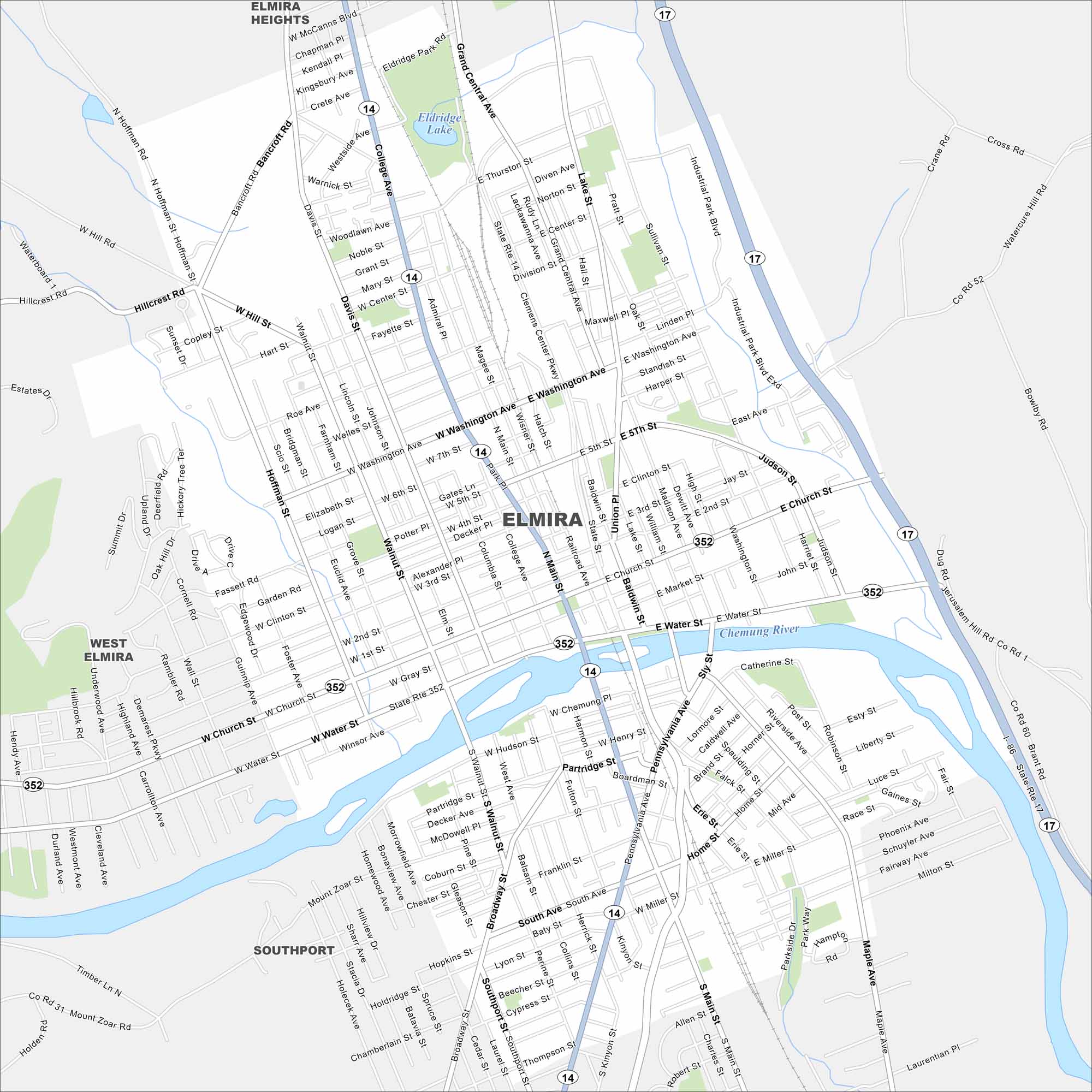
Elmira is located along the Chemung River in southern New York. The city connects to Route 14 and 17. It’s often known as the “Queen City” of the Southern Tier.
Map Information
On the Map
Interstates/Highways: I-86, State Rte 17, State Rte 14, State Rte 352 Major Roads: Church St, Water St, Washington Ave, Clemens Center Pkwy, Main St, Broadway, Pennsylvania Ave, Madison Ave, Lake St, Grand Central Ave, College Ave, Hoffman St, Walnut St, Sullivan St, Market St, Second St, Miller St, South Ave, Hudson St, Partridge St Lakes and Reservoirs: Eldridge Lake Major Rivers: Chemung River Nearby Communities: Elmira Heights, West Elmira, SouthportNew York State Maps
Find state maps of the Empire State.


City Maps of New York
Here are the city maps that define New York


