Map of Durham, North Carolina
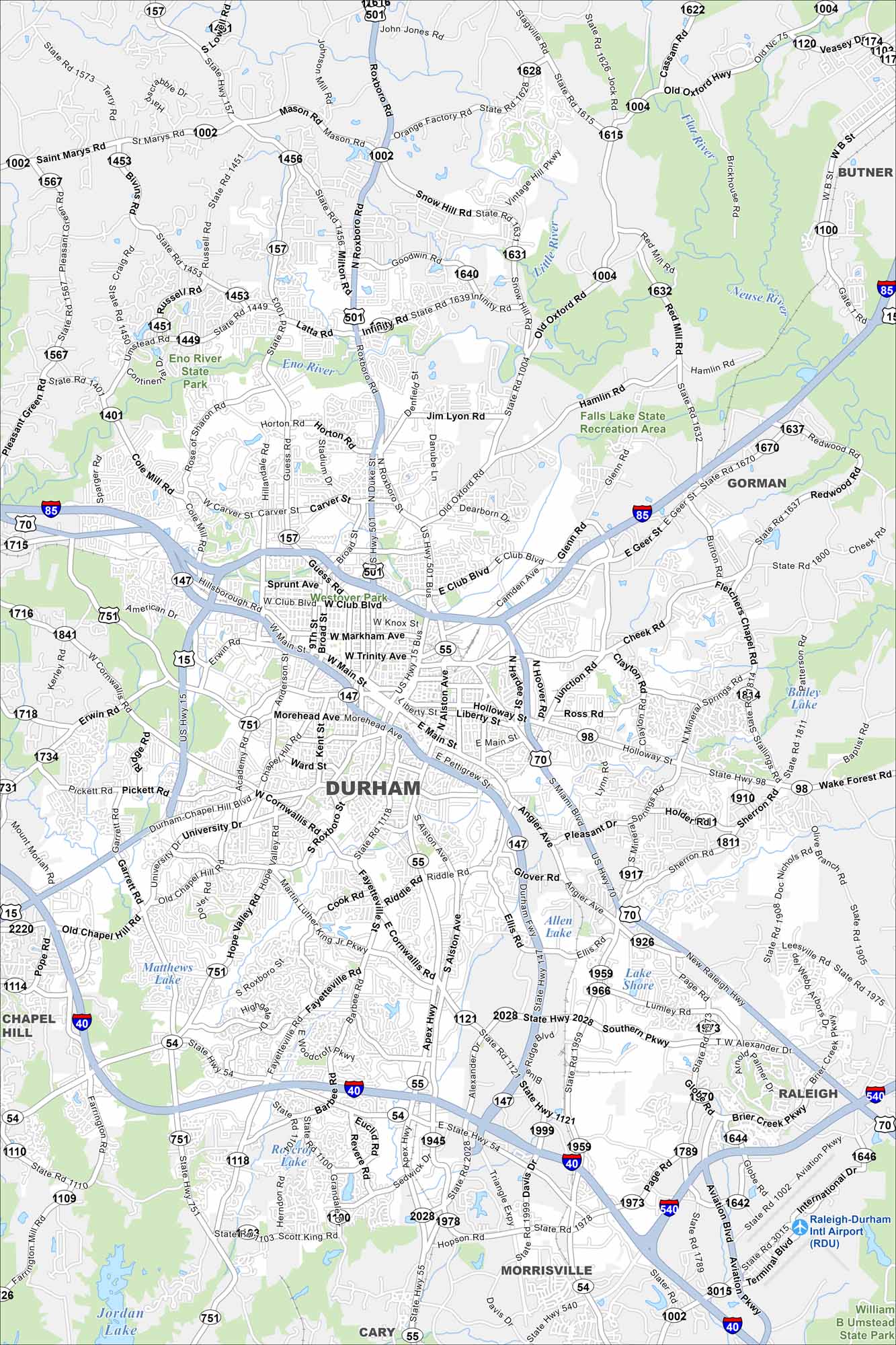
Check out our map of Durham in the state’s Piedmont region. Rolling terrain, creeks, and a growing downtown stand out. The city is often called the “Bull City” because of its tobacco history.
Map Information
On the Map
Interstates/Highways: I-85, I-40, I-540, US Hwy 15, US Hwy 501, US Hwy 70, State Rte 147, State Rte 55, State Rte 54, State Rte 751, State Rte 157, State Rte 98 Major Roads: Main St, Roxboro St, Duke St, Gregson St, Mangum St, Fayetteville St, Alston Ave, Cornwallis Rd, University Dr, Chapel Hill Blvd, Erwin Rd, Hillandale Rd, Broad St, Guess Rd, Academy Rd, Hope Valley Rd, Anderson St, Swift Ave, Club Blvd, Miami Blvd Airports: Raleigh-Durham Intl Airport Lakes and Reservoirs: Falls Lake, Jordan Lake, Lake Shore, Rosetta Lake, Brierly Lake, Allen Lake Major Rivers: Eno River, Flat River, Little River, Neuse River Parks and Preserves: Eno River State Park, Falls Lake State Recreation Area, William B Umstead State Park Nearby Communities: Raleigh, Cary, Morrisville, Chapel Hill, Butner, GormanNorth Carolina State Maps
Get to know the mountains and coastlines of North Carolina.


City Maps of North Carolina
Journey through North Carolina with our city maps


