Map of Destin, Florida
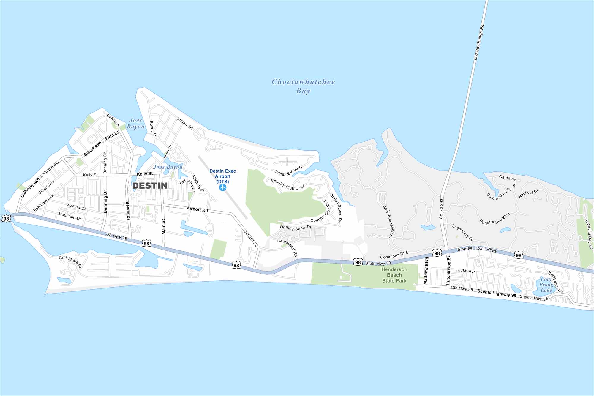
Check out our map of Destin on Florida’s Emerald Coast. It has plenty of white-sand beaches along the Choctawhatchee Bay. It’s often called the “World’s Luckiest Fishing Village” because of its offshore waters.
Florida State Maps
Discover Florida through our state maps


Map Information
On the Map
Interstates/Highways: US Hwy 98, State Rte 30, Emerald Coast Pkwy, Scenic Hwy 98 Major Roads: Main St, Airport Rd, Matthew Blvd, Hutchinson St, Calhoun Ave, Kelly St, Sibert Ave, Benning Dr, Mountain Dr, Beach Dr, Stahlman Ave, Azalea Dr, Gulf Shore Dr, Indian Bayou N, Country Club Dr, Commons Dr E, Regatta Bay Blvd, Legendary Dr Airports: Destin Exec Airport (DTS) Lakes and Reservoirs: Choctawhatchee Bay, Joes Bayou, Four Prong Lake Nearby Communities: Henderson Beach State ParkFlorida City Maps
Chart your course through Miami and Florida’s cities


