Map of Daytona Beach, Florida
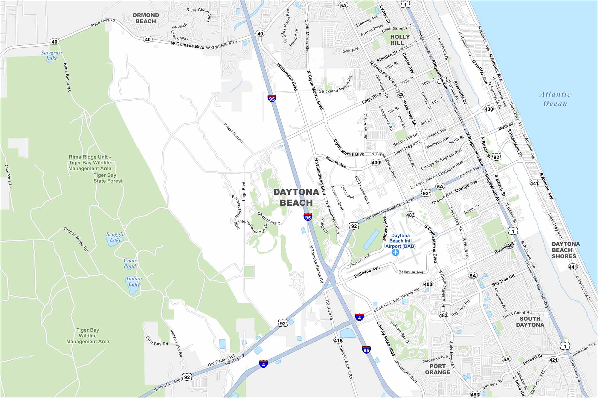
Daytona Beach stretches along the Atlantic, with roads running parallel to its famous beaches. Famous for its speedway and sandy shoreline, our map makes its beaches and river crossings easy to see.
Florida State Maps
Discover Florida through our state maps


Map Information
On the Map
Interstates/Highways: I-95, I-4, US Hwy 92, US Hwy 1, US Hwy 441, State Hwy 400, State Hwy 40, State Hwy 5A, State Hwy 483, State Hwy A1A Major Roads: International Speedway Blvd, Atlantic Ave, Ridgewood Ave, Beach St, Nova Rd, Clyde Morris Blvd, Williamson Blvd, Mason Ave, Beville Rd, Main St, Volusia Ave, Dr Mary McLeod Bethune Blvd, George W Engram Blvd, LPGA Blvd, Granada Blvd, Tomoka Farms Rd, Bellevue Ave, Madeline Ave, Herbert St Airports: Daytona Beach Intl Airport (DAB) Lakes and Reservoirs: Atlantic Ocean, Scoggin Lake, Coon Pond, Indian Lake, Tiger Bay, Sawgrass Lake Parks and Preserves: Tiger Bay Wildlife Management Area, Tiger Bay State Forest Nearby Communities: Ormond Beach, Holly Hill, Daytona Beach Shores, South Daytona, Port OrangeFlorida City Maps
Chart your course through Miami and Florida’s cities


