Map of Dania Beach, Florida
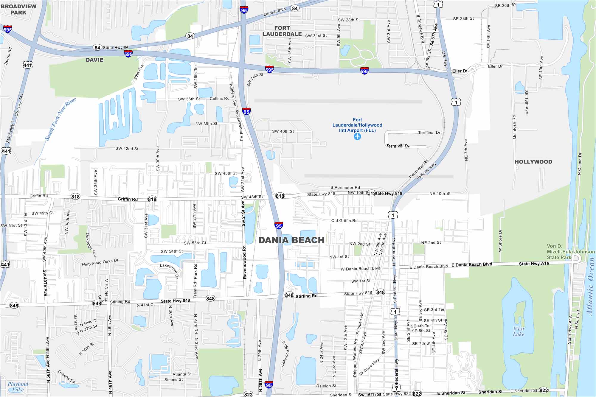
Dania Beach hugs the Intracoastal Waterway and the Atlantic coast. Its streets lead from beachside resorts inland toward residential neighborhoods.
Florida State Maps
Discover Florida through our state maps


Map Information
On the Map
Interstates/Highways: I-95, I-595, US Hwy 1, State Hwy A1A, State Hwy 818, State Hwy 848, State Hwy 84, State Hwy 822, Federal Hwy Major Roads: Dania Beach Blvd, Stirling Rd, Griffin Rd, Sheridan St, Taylor St, Phippen Waiters Rd, Dixie Hwy, Gulfstream Way, Bryan Rd, Ravenswood Rd, Anglers Ave, Perimeter Rd, Terminal Dr Airports: Fort Lauderdale/Hollywood Intl Airport (FLL) Lakes and Reservoirs: West Lake, Atlantic Ocean Major Rivers: South Fork New River Parks and Preserves: Von D. Mizell-Eula Johnson State Park Nearby Communities: Fort Lauderdale, Hollywood, Davie, Broadview ParkFlorida City Maps
Chart your course through Miami and Florida’s cities


