Cuyahoga Valley National Park Map
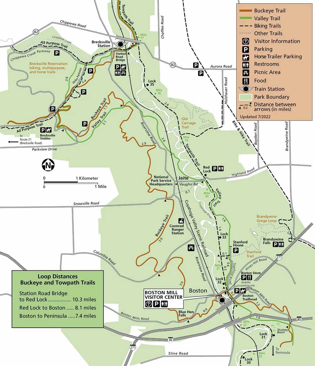
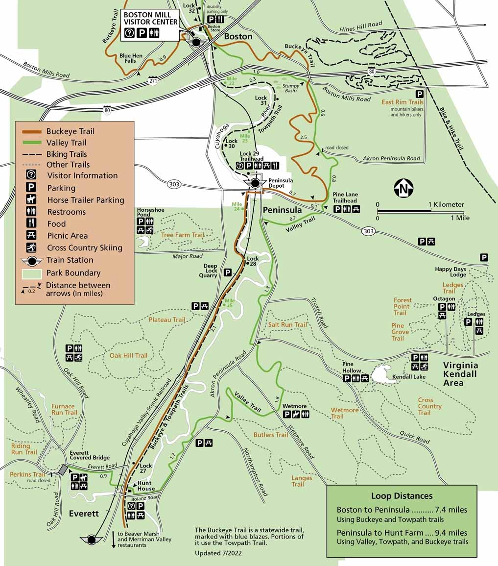
Our map of Cuyahoga Valley National Park sets the scene clearly. It’s split into two maps with Station Road to Boston and Boston to Everett. Both maps highlight roads, trails and visitor areas.
Map Information
On the Map
Parks: Cuyahoga Valley National Park, Brecksville Reservation Visitor Centers: Boston Mill Visitor Center Interstates/Highways: I-80, I-271 Major Roads: Riverview Rd, Valley Pkwy, Brecksville Rd, Snowville Rd, Columbia Rd, Boston Mills Rd, Hines Hill Rd, Highland Rd, Aurora Rd, Holzhauer Rd, Brandywine Rd, Boyden Rd, Chaffee Rd Rivers/Creeks: Cuyahoga River, Chippewa Creek, Brandywine Creek, Blue Hen Falls Cities/Towns: Boston, Peninsula, Jaite, Brecksville Campgrounds/Park Sites: Brandywine Falls, Stanford House, Boston Store, Blue Hen Falls, Station Road Bridge, Red Lock, Canal Exploration Center Others: Ohio & Erie Canal Towpath Trail, Buckeye Trail, Valley Trail, Cuyahoga Valley Scenic RailroadNational Park Maps
Find maps of green spaces and national parks near you.


