Map of Cutler Bay, Florida
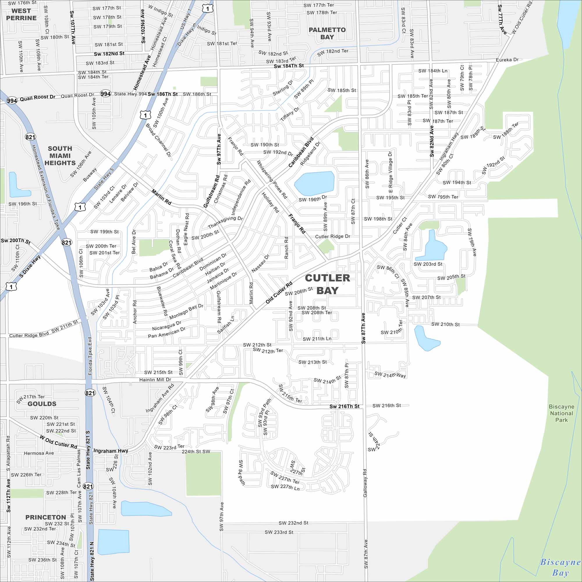
Our map of Cutler Bay outlines its streets, highways, and coastal waterways. South of Miami, the town sits close to Biscayne Bay. Mangrove wetlands shape much of the shoreline.
Florida State Maps
Discover Florida through our state maps


Map Information
On the Map
Interstates/Highways: US Hwy 1, State Hwy 821, Florida Tpke Exd Major Roads: Cutler Ridge Blvd, Old Cutler Rd, Franjo Rd, Quail Roost Dr, Marlin Rd, Caribbean Blvd, Gulfstream Rd, Ingraham Hwy, Allapattah Rd, Galloway Rd, Eureka Dr, Hainlin Mill Dr, Bel Aire Dr, Silver Palm Dr, Baid Dr, Montego Bay Dr, Nicaragua Dr, Pan American Dr Lakes and Reservoirs: Biscayne Bay Parks and Preserves: Biscayne National Park Nearby Communities: Palmetto Bay, Goulds, Princeton, South Miami Heights, West PerrineFlorida City Maps
Chart your course through Miami and Florida’s cities


