Crater Lake National Park Map
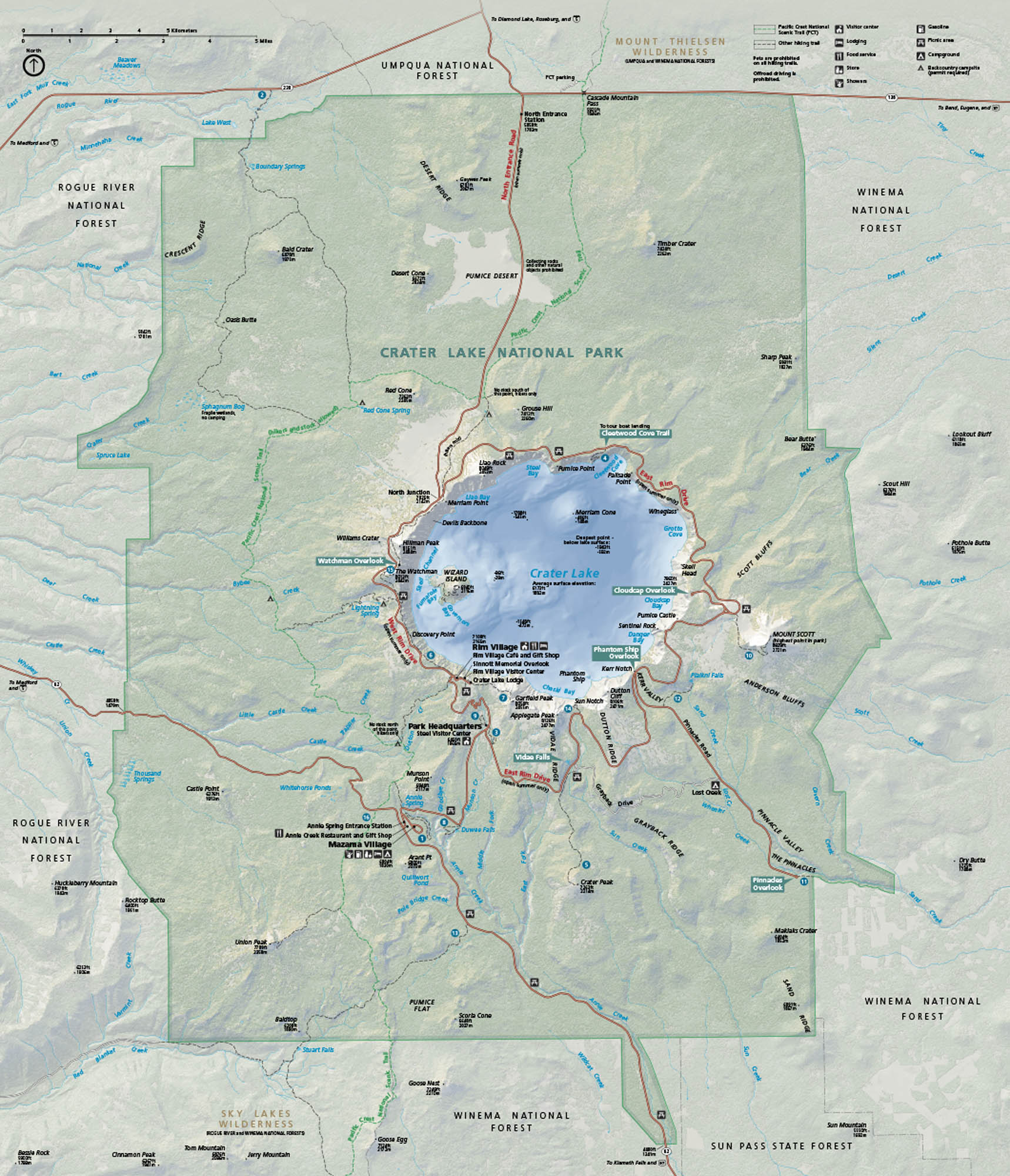
Stare straight into a caldera filled with the bluest water you’ll ever see. Crater Lake sits in southern Oregon, shaped by the volcano that collapsed long ago. Our map lays out rim roads, overlooks, trails, and all the main access points around the lake.
Map Information
On the Map
Parks: Crater Lake National Park, Umpqua National Forest, Rogue River National Forest, Winema National Forest, Sky Lakes Wilderness, Sun Pass State Forest Visitor Centers: Rim Village Visitor Center, Steel Visitor Center Interstates/Highways: US Hwy 97 Major Roads: Rim Dr, Volcanic Legacy Scenic Byway, State Rte 62, State Rte 138, State Rte 230, State Rte 232, North Entrance Rd, West Rim Dr, East Rim Dr, Pinnacles Rd Rivers/Lakes: Crater Lake, Diamond Lake, Rogue River, Boundary Springs, Sphagnum Bog, Bear Creek, Annie Creek, Sand Creek Cities/Towns: Mazama Village, Union Creek, Fort Klamath Campgrounds/Park Specific sites: Mazama Campground, Lost Creek Campground, Rim Village, Wizard Island, Phantom Ship, The Watchman, Mount Scott, Pinnacles Overlook, Vidae Falls, Cleetwood Cove Others: Pumice Desert, Mount Mazama, Llao Rock, Cloudcap, Sun Notch, Kerr NotchNational Park Maps
Find maps of green spaces and national parks near you.


