Map of Coconut Creek, Florida
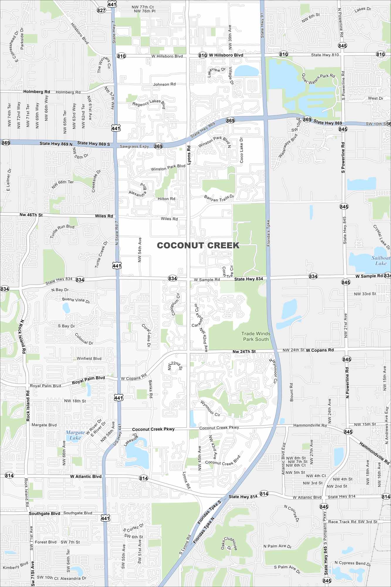
See our map of Coconut Creek with its roads, lakes, and canals. It’s positioned north of Fort Lauderdale and called the “Butterfly Capital of the World”. Wetlands and waterways border the city.
Florida State Maps
Discover Florida through our state maps


Map Information
On the Map
Interstates/Highways: US Hwy 441, State Rte 7, State Rte 810, State Rte 814, State Rte 834, State Rte 845, State Rte 869, Florida’s Tpke, Sawgrass Expy Major Roads: W Hillsboro Blvd, W Sample Rd, W Copans Rd, Coconut Creek Pkwy, W Atlantic Blvd, Lyons Rd, N Powerline Rd, S Powerline Rd, NW 74th Ter, Holmberg Rd, Johnson Rd, Winston Park Blvd, Wiles Rd, NW 46th St, NW 24th St, Banks Rd, Margate Blvd, Southgate Blvd Airports: Margate Lake, Sailboat Lake Lakes and Reservoirs: Tradewinds Park SouthFlorida City Maps
Chart your course through Miami and Florida’s cities


