Map of Cocoa Beach, Florida
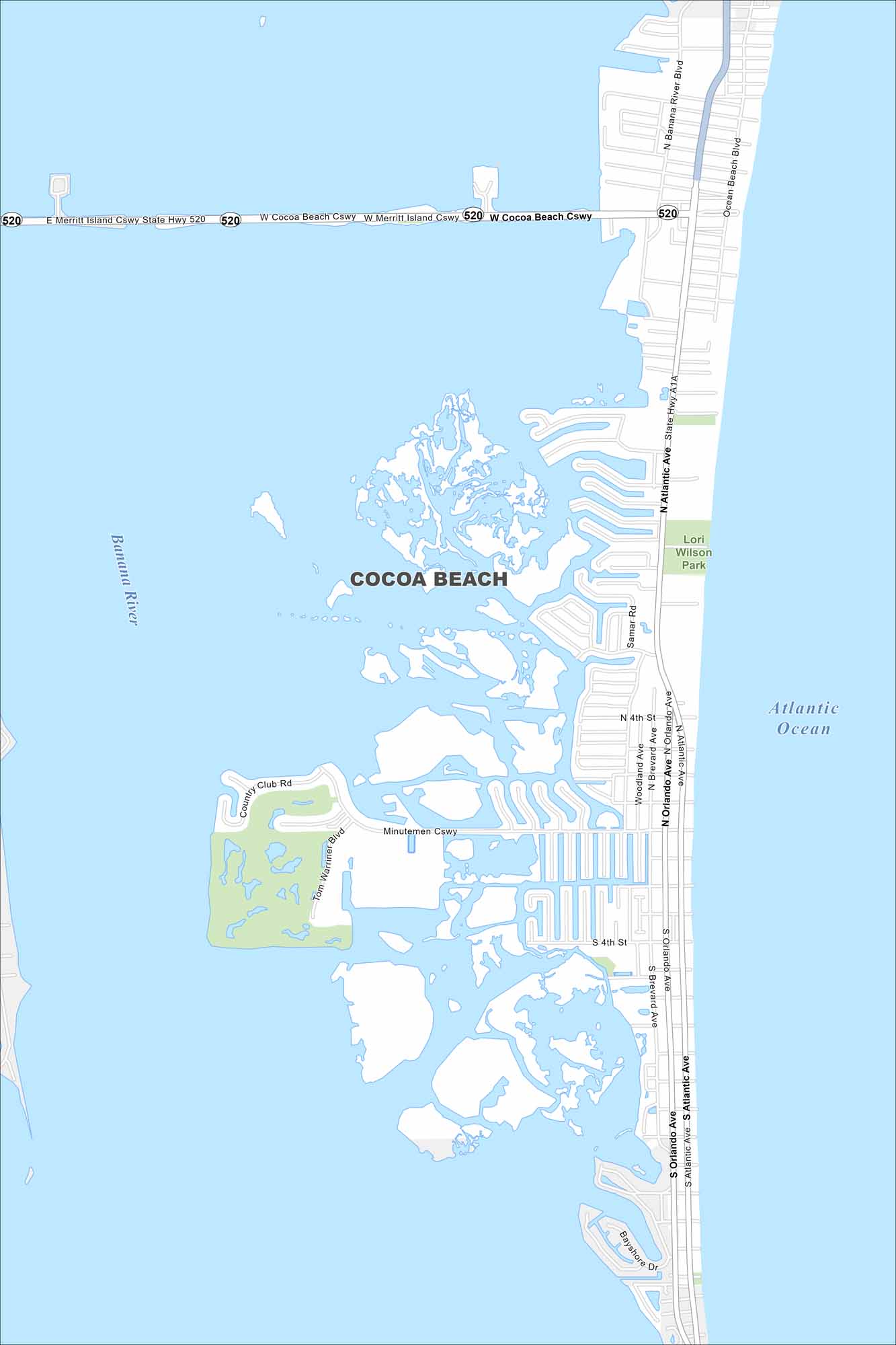
We’ve mapped out Cocoa Beach, which sits on a barrier island along Florida’s Space Coast. The Atlantic shoreline stretches the length of the city. Our map shows its streets, coastal roads, and beachfront.
Florida State Maps
Discover Florida through our state maps


Map Information
On the Map
Interstates/Highways: State Rte 520, State Rte A1A Major Roads: N Atlantic Ave, S Atlantic Ave, N Orlando Ave, S Orlando Ave, Minutemen Cswy, Merritt Island Cswy, Cocoa Beach Cswy, Banana River Blvd, Ocean Beach Blvd, Tom Warriner Blvd, Country Club Rd, Woodland Ave, Brevard Ave, Samar Rd, Bayshore Dr Lakes and Reservoirs: Atlantic Ocean Major Rivers: Banana River Parks and Preserves: Lori Wilson ParkFlorida City Maps
Chart your course through Miami and Florida’s cities


