Map of Clermont, Florida
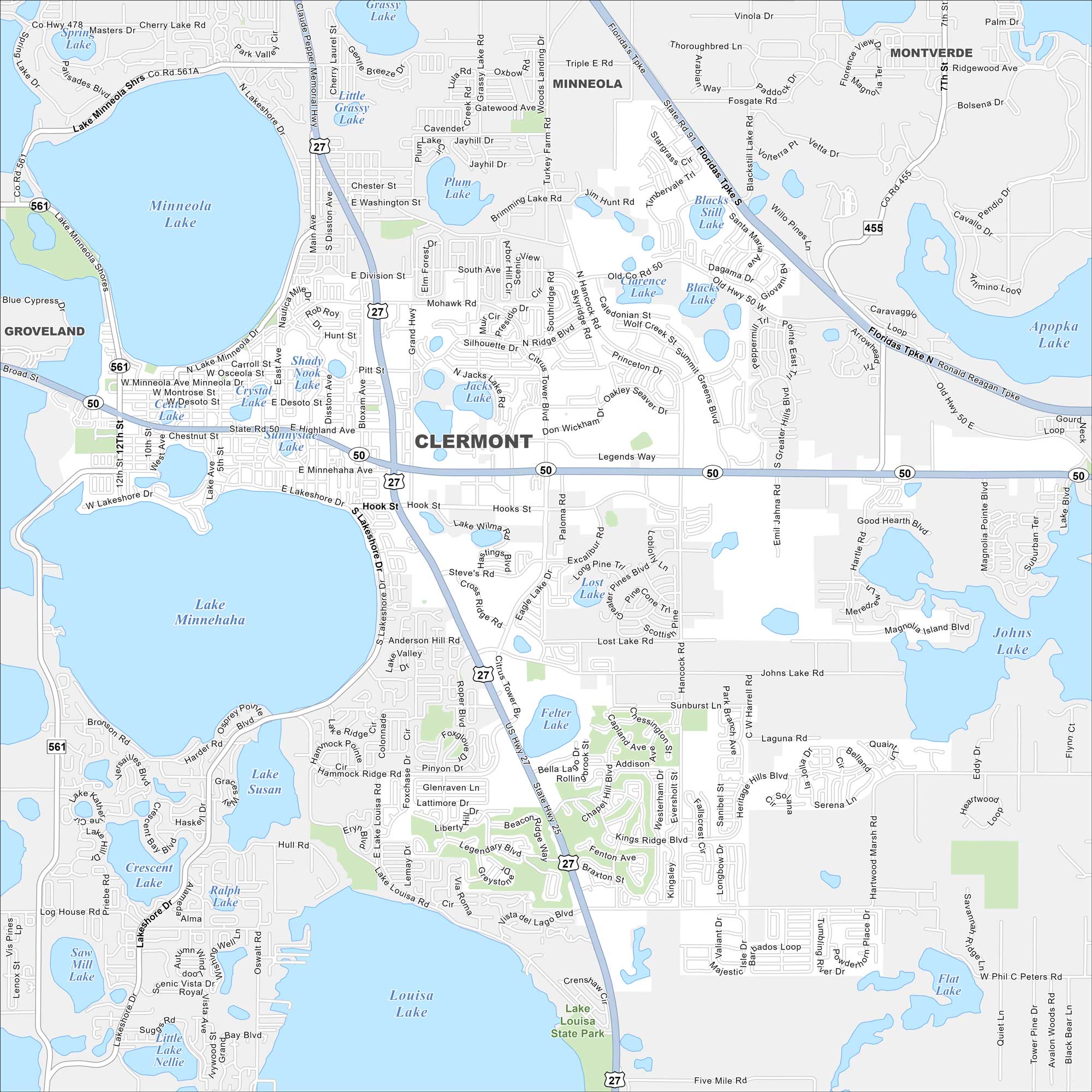
Clermont is mapped with its roads, highways, and nearby lakes. West of Orlando, the city is known for its rolling hills. Lake Minneola shapes the heart of town.
Florida State Maps
Discover Florida through our state maps


Map Information
On the Map
Interstates/Highways: US Hwy 27, State Rte 50, State Rte 455, State Rte 561, Florida’s Tpke Major Roads: Hancock Rd, Citrus Tower Blvd, Lakeshore Dr, Hook St, Minnehaha Ave, Division St, Washington St, Chester St, Hartwood Marsh Rd, Fosgate Rd, Ridgewood Ave, Sullivan Rd, Magnolia Pointe Blvd, Emil Jahn Rd, Greater Hills Blvd, Lake Louisa Rd, Monte Vista Rd, Cherry Lake Rd, Hull Rd Lakes and Reservoirs: Lake Minnehaha, Lake Minneola, Lake Louisa, Lake Susan, Plum Lake, Jacks Lake, Crescent Lake, Saw Mill Lake, Flat Lake, Grassy Lake, Little Grassy Lake, Blue Cypress Lake, Crystal Lake, Sunnyside Lake, Clarence Lake, Blacks Still Lake, Apopka Lake, Cherry Lake, Spring Lake Parks and Preserves: Lake Louisa State Park Nearby Communities: Minneola, Montverde, GrovelandFlorida City Maps
Chart your course through Miami and Florida’s cities


