Map of Clayton, North Carolina
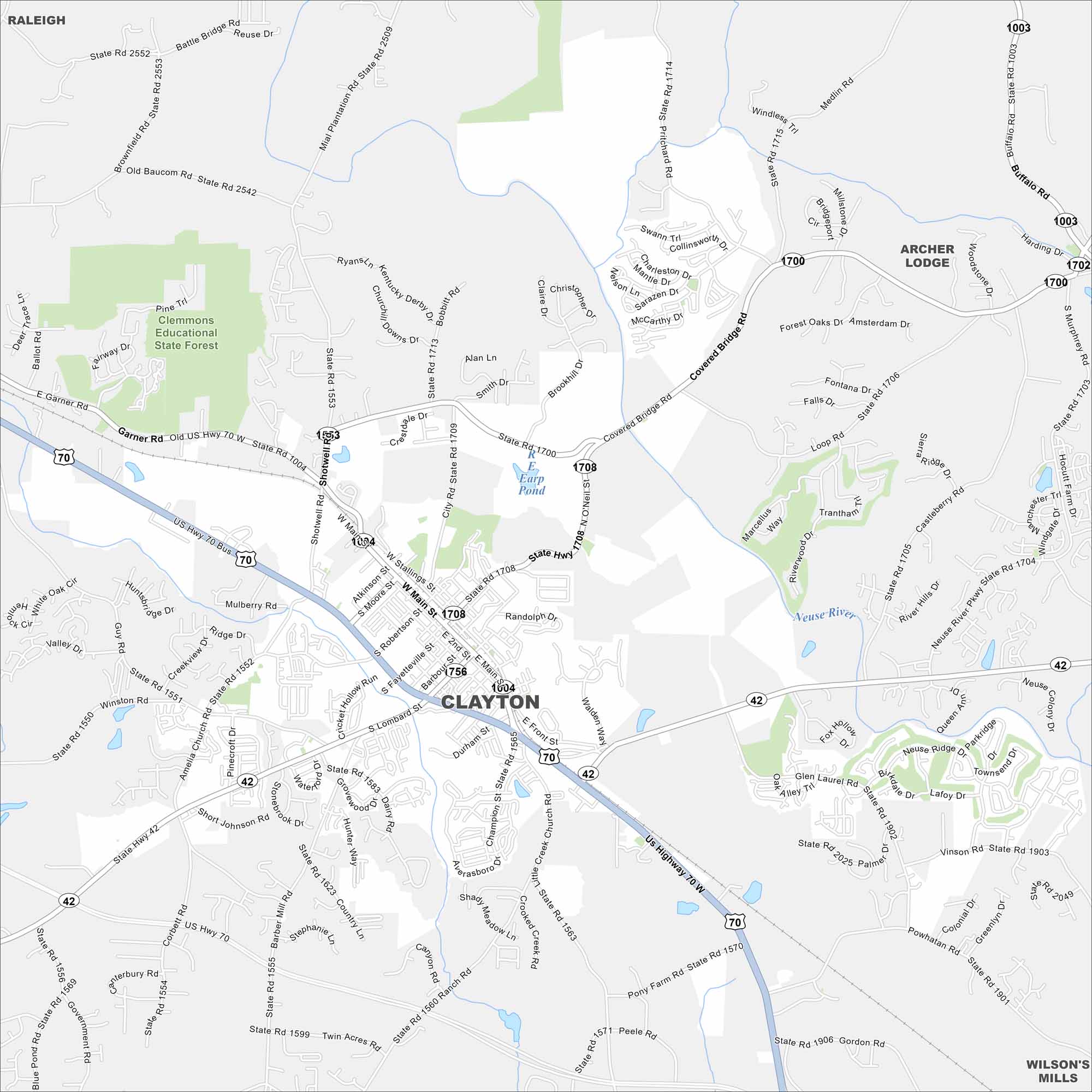
Our Clayton map displays Main Street leading through its small downtown. The town has grown quickly as part of the Research Triangle region. It’s just southeast of Raleigh.
Map Information
On the Map
Interstates/Highways: US Hwy 70, US Hwy 70 Bus, State Rte 42 Major Roads: Shotwell Rd, Main St, O’Neil St, Winston Rd, Amelia Church Rd, Guy Rd, Barber Mill Rd, Boling St, Lombard St, Front St, Durham St, Fayetteville St, Robertson St, Stallings St, Moore St, Atkinson St, Powhatan Rd, Covered Bridge Rd, Buffalo Rd, Smith Dr Lakes and Reservoirs: Earp Pond Major Rivers: Neuse River Parks and Preserves: Clemmons Educational State Forest Nearby Communities: Raleigh, Archer Lodge, Wilson’s MillsNorth Carolina State Maps
Get to know the mountains and coastlines of North Carolina.


City Maps of North Carolina
Journey through North Carolina with our city maps


