Map of Chandler, Arizona
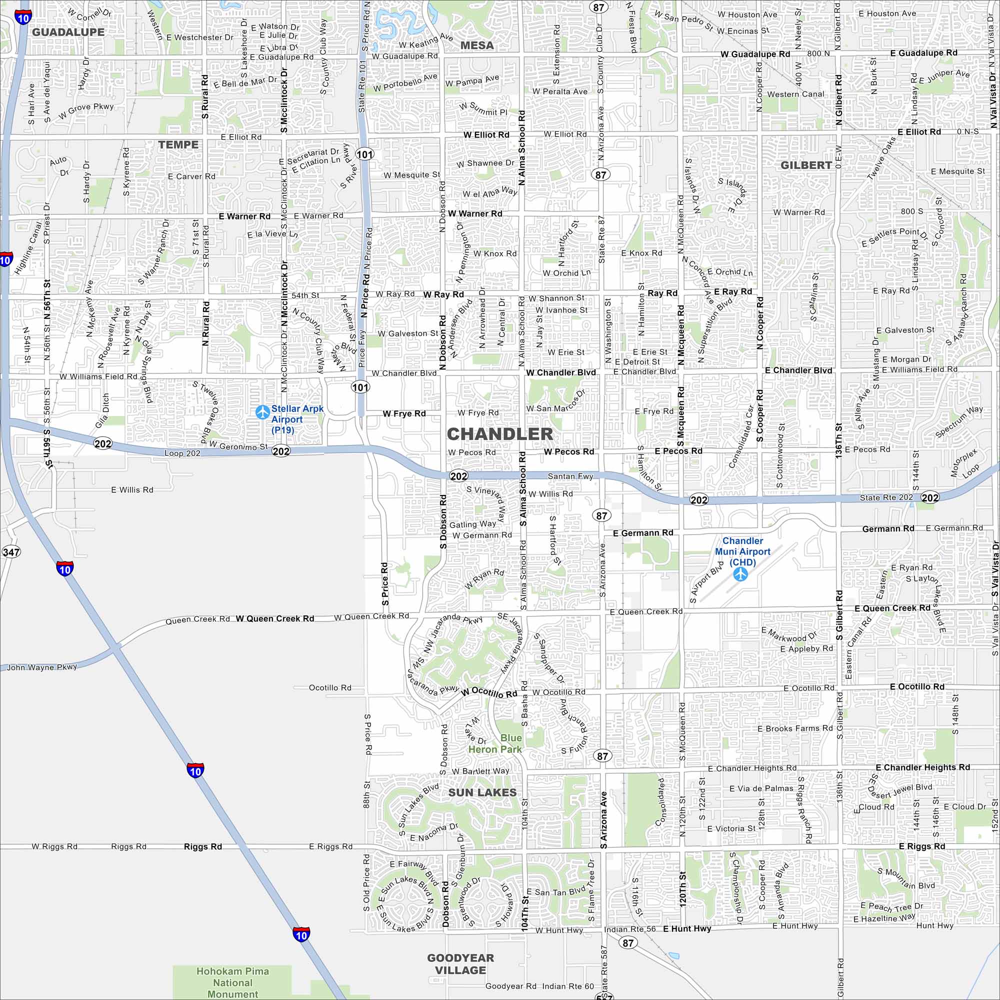
Discover Chandler with our map. This is where parks and lakes line its neighborhoods. The city is a key hub in the East Valley near Phoenix. Growth has been rapid, but it still balances open spaces with new development.
Arizona State Maps
Check out our Arizona state maps we’ve put together


Map Information
On the Map
Interstates/Highways: I-10, State Rte 101 (Price Fwy), State Rte 202 (Santan Fwy), State Rte 87 (Arizona Ave) Major Roads: Chandler Blvd, Ray Rd, Warner Rd, Elliot Rd, Williams Field Rd, Pecos Rd, Germann Rd, Queen Creek Rd, Ocotillo Rd, Chandler Heights Rd, Riggs Rd, Kyrene Rd, Rural Rd, McClintock Dr, Dobson Rd, Alma School Rd, McQueen Rd, Cooper Rd, Gilbert Rd, Arizona Ave Airports: Chandler Muni Airport (CHD), Stellar Arpk Airport (P19) Parks/Preserves/Forests: Blue Heron Park, Hohokam Pima National Monument Nearby Communities: Mesa, Gilbert, Tempe, Guadalupe, Sun Lakes, Goodyear VillageArizona City Maps
Here’s our full batch of Arizona city maps


