Maine Counties and Cities Map
Maine’s 16 counties have vast forests and a jagged Atlantic coastline. Augusta is the capital, while Portland is the most populous.
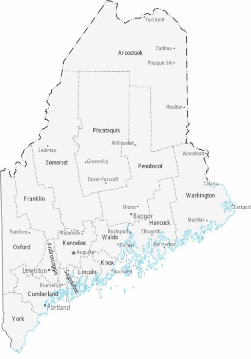
Maine’s 16 counties have vast forests and a jagged Atlantic coastline. Augusta is the capital, while Portland is the most populous.
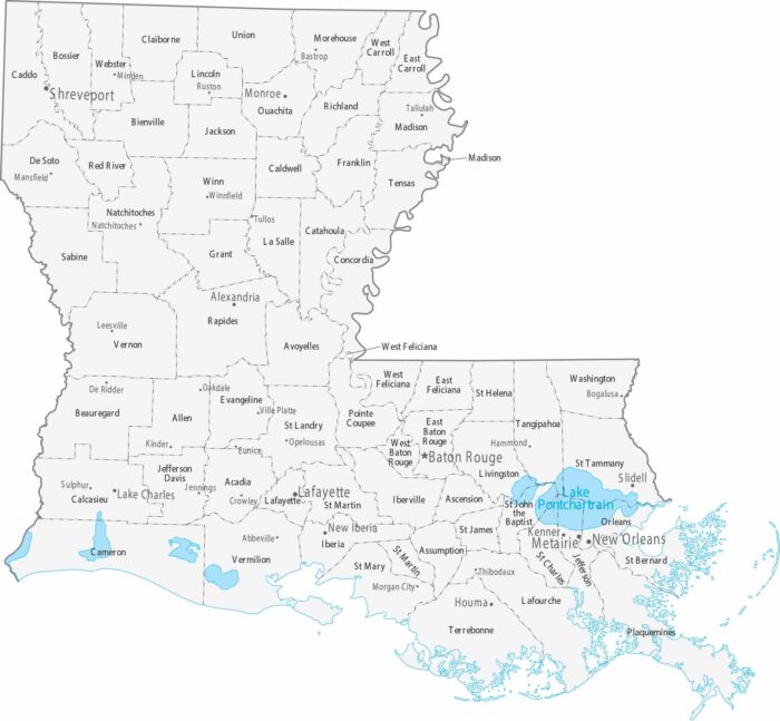
Parishes replace counties in Louisiana. Our county and cities map shows its 64 parishes and major population centers.
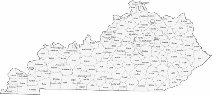
Kentucky is split into 120 small counties. Our map displays its counties and cities. County boundaries become more irregular in the mountains.
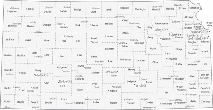
Counties in Kansas form a clean grid statewide. Topeka holds down the capital in the northeast with Kansas City not too far away.
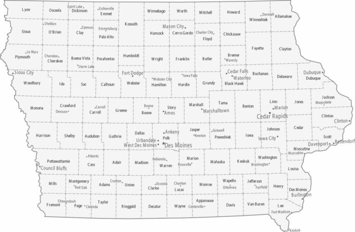
Iowa’s map is an orderly grid of 99 counties. Des Moines is the capital and central business hub near the center of the state.
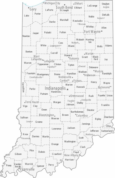
Our map of Indiana has Indianapolis sitting almost perfectly in the center. Fort Wayne anchors the northeast and Evansville the southwest.
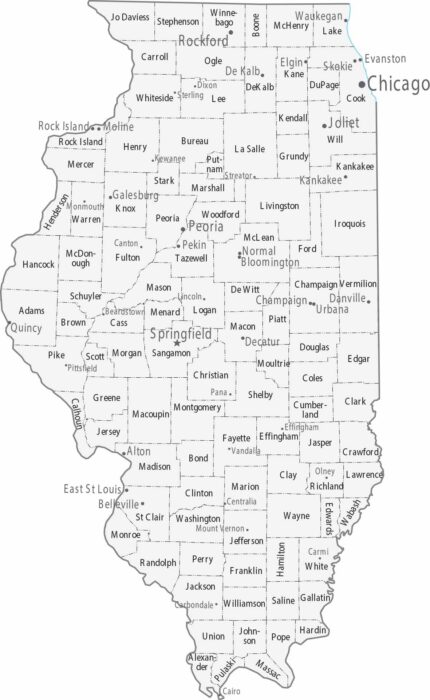
Chicago absolutely dominates the northeast corner of Illinois, while the rest of Illinois is mostly smaller cities across flat farmland.
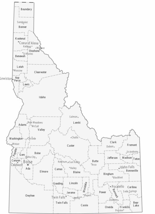
Our Idaho map shows its 44 counties. Boise is the capital and largest city in the southwest. Coeur d’Alene is the main hub in the north.
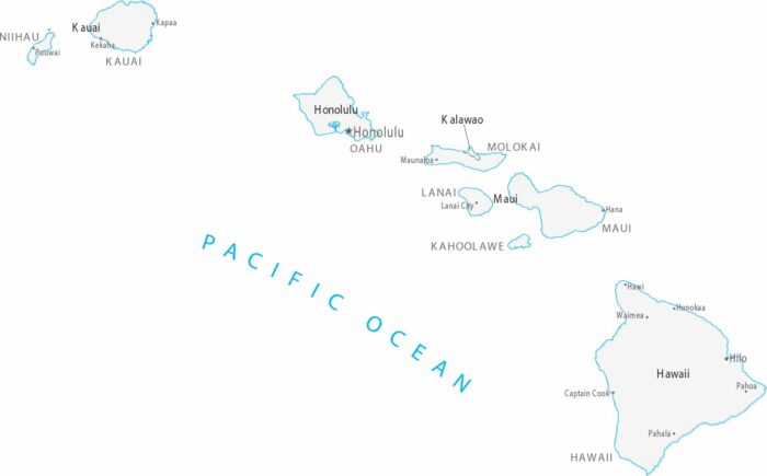
In Hawaii, counties align with island boundaries rather than land divisions. Cities cluster along coastlines, especially on Oahu
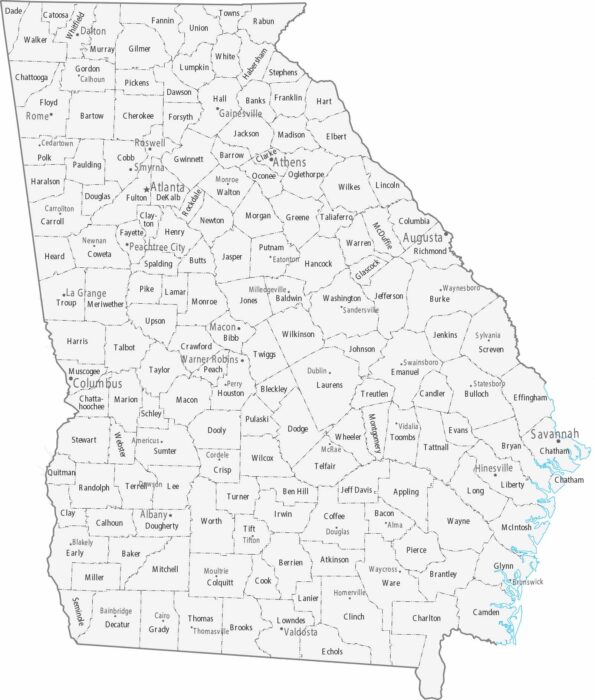
Our map displays Georgia’s 159 counties, many with small county seats. Metro Atlanta dominates Fulton and surrounding counties.
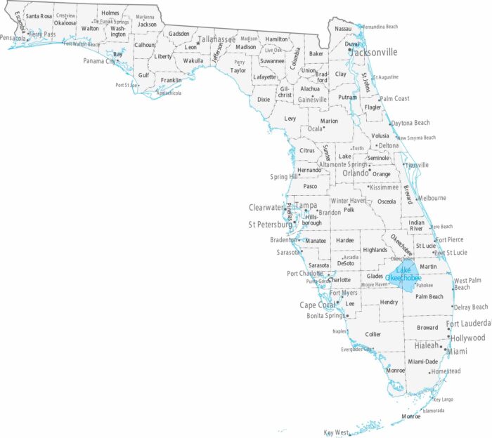
Our map shows Florida’s cities concentrate on the coasts. Miami, Fort Lauderdale, and West Palm Beach are all in the southeast.
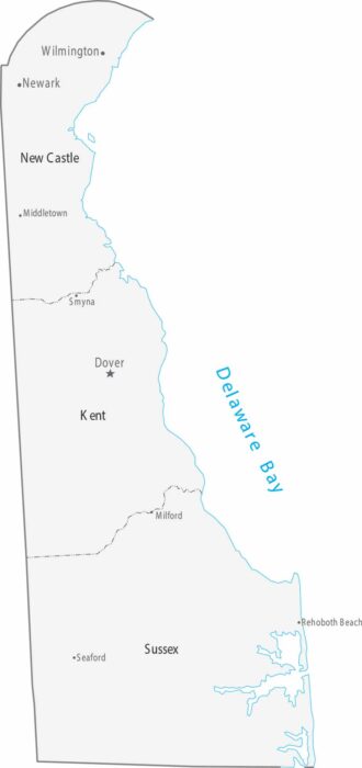
Only three counties divide the state from north to south. As shown on our map, cities thin out as the map moves south.
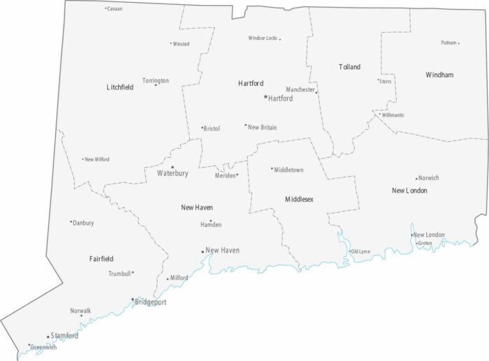
Connecticut’s small size means cities are packed close together, especially along the coast and the Connecticut River valley.
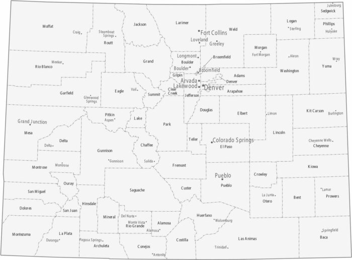
Colorado counties have irregular shapes in the mountains. Cities line up along the Front Range in counties like Denver, Boulder, and El Paso.
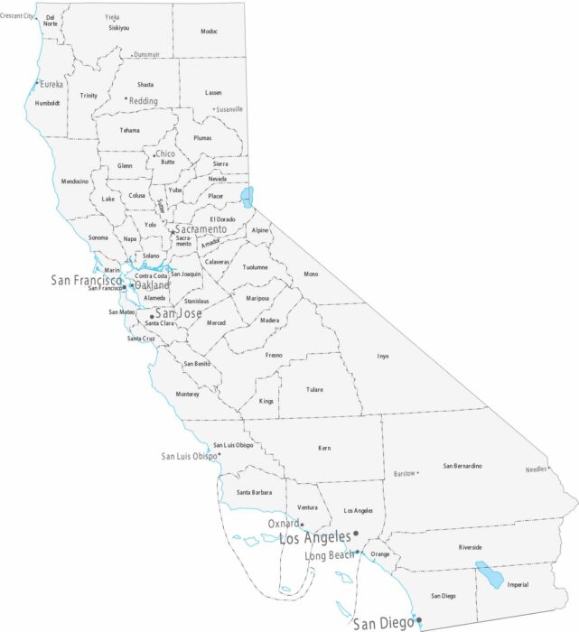
California is organized into 58 counties as shown on our map. California’s cities line up along the coast and in the Central Valley.