New Hampshire Zip Code Map
New Hampshire zip codes are compact and tightly arranged. Our map shows short distances between postal areas.
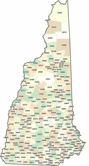
New Hampshire zip codes are compact and tightly arranged. Our map shows short distances between postal areas.
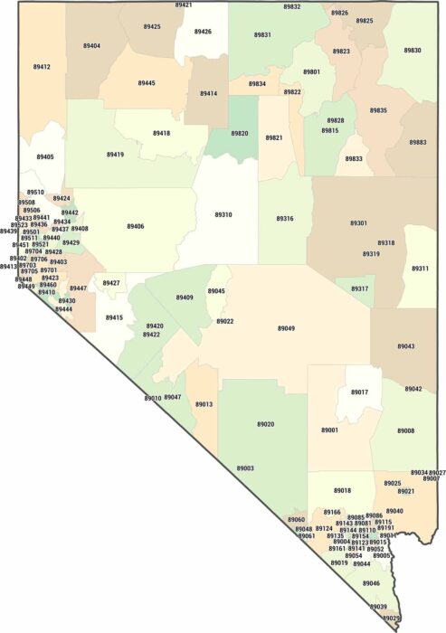
Nevada is mostly desert, and our Nevada zip code map proves it. Zip codes in Nevada concentrate heavily in Las Vegas and Reno.
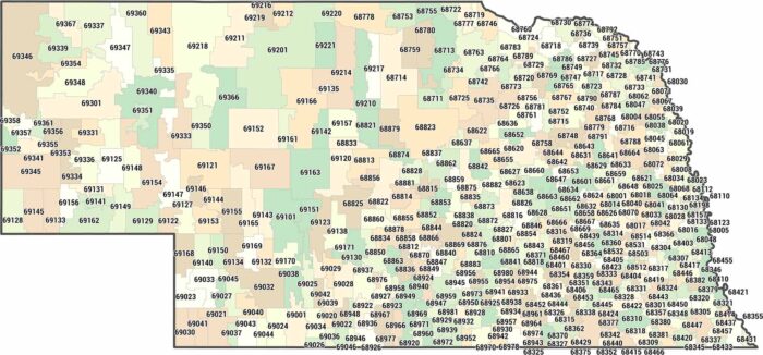
Our Nebraska zip code map shows boundaries cluster densely around Omaha and Lincoln. Then, they spread out thin across the western Sandhills.
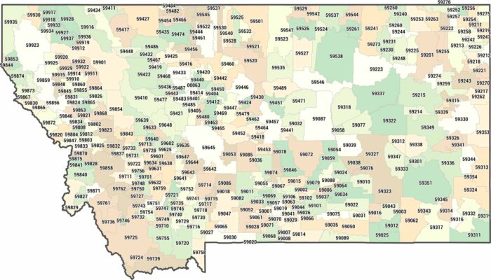
Montana zip codes are enormous. Our Montana zip code map shows postal areas that stretch for miles in every direction.
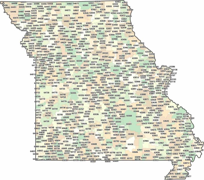
Missouri claims zip codes from 630XX to 658XX. We’ve mapped each one from edge to edge. Nothing feels extreme. Some follow urban growth.
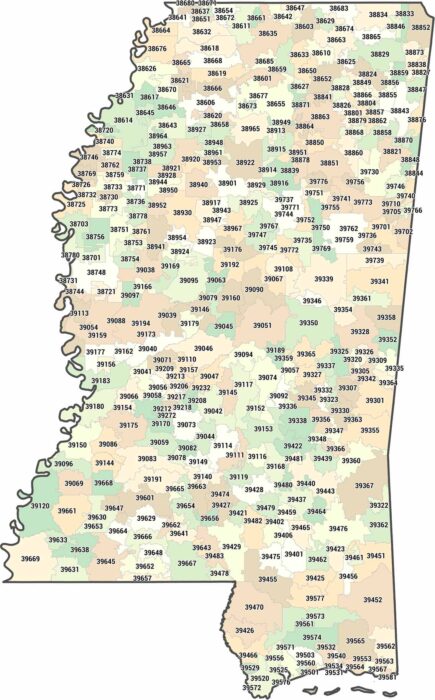
What happens to zip codes in a mostly rural state? Our Mississippi zip code map highlights how much ground a single postal area can cover.
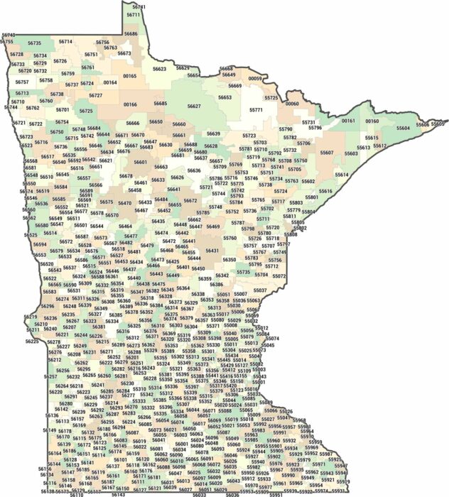
Minnesota zip codes cover lakes, forests, and farmland. But it’s really a heck of a lot of lakes. We’ve mapped every zone from Iowa to Canada.
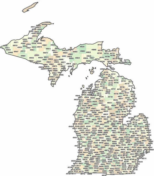
Michigan zip codes span two peninsulas and a lot of water. From 480XX-499XX, our map shows how postal areas are split by lakes, not just land.
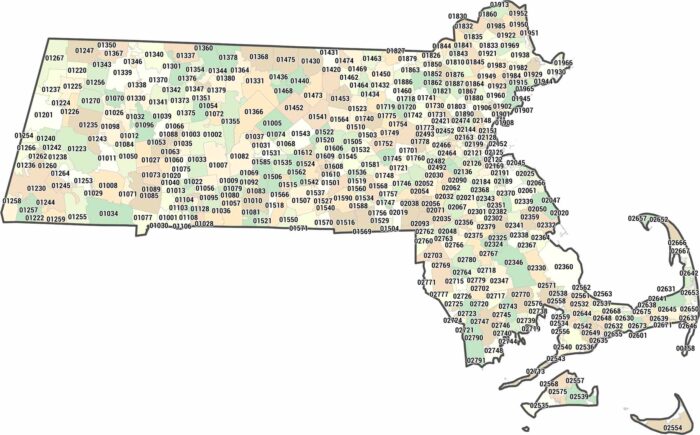
Massachusetts zip codes are packed tight, especially near the coast. Our Massachusetts zip code map shows postal areas shrink around Boston.
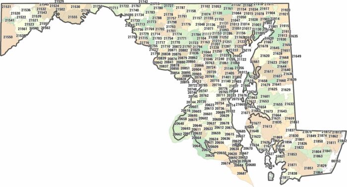
Find any Maryland address on this map covering the 20XXX to 21XXX range. Our zip code map of Maryland shows its boundaries.
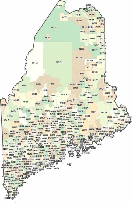
Maine owns 039 to 049, covering rocky coastline and deep forest. Our map of Maine highlights how sparse zip codes are in the north.
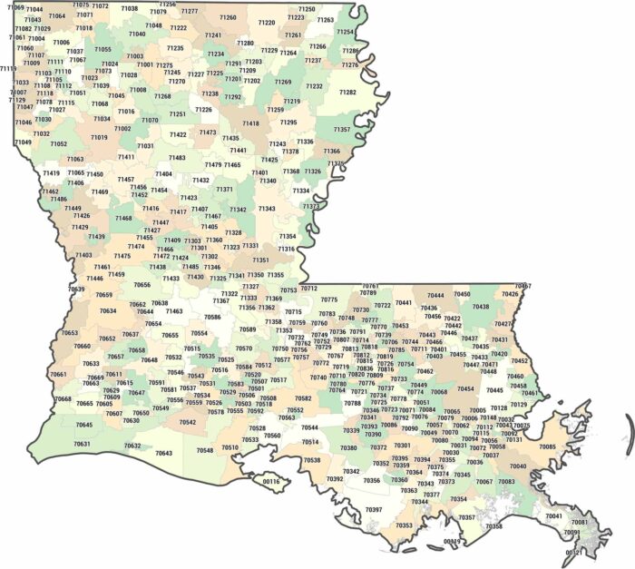
Our map of Louisiana lays out zip codes along the Mississippi and the Gulf. Louisiana lives in the 700-714 range.
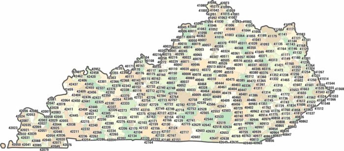
With over 750 zip codes, Kentucky stretches through 400 to 427. This Kentucky zip code map shows how zip codes follow the hills and valleys.
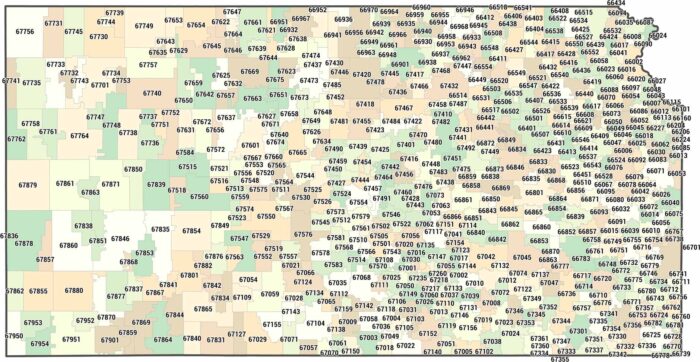
See how zip codes stretch across Kansas. Our Kansas zip code map shows large postal areas shaped by open land and small towns.
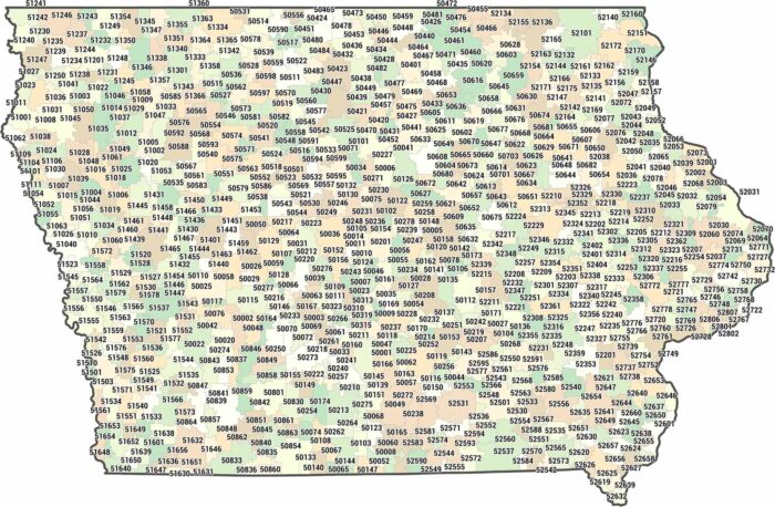
Iowa zip codes cover a lot of ground, spanning 500XX to 528XX. Our Iowa zip code map shows wide postal areas between towns.