Utah Biomes Map
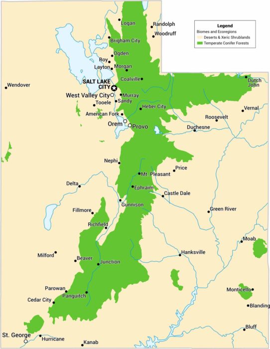
Our biomes map of Utah highlights its deserts and forests. Elevation matters here. The geography explains the sharp biome boundaries.
Our biomes map of Utah highlights its deserts and forests. Elevation matters here. The geography explains the sharp biome boundaries.
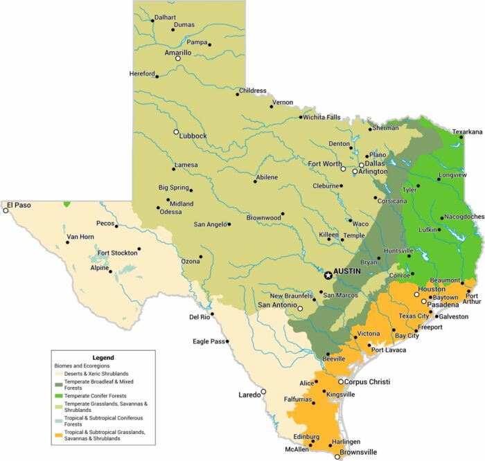
Texas is big, and the biomes prove it. We’ve mapped deserts, plains, and forests across the state. The west-to-east shift is especially clear.
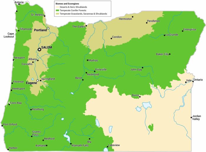
Our Oregon biomes map shows wet coastal forests, dry interior basins, and forests. It’s one state that has very different environments.
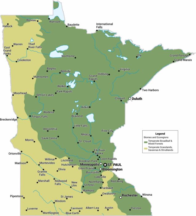
Our map of Minnesota focuses on forests, savannas, and shrublands. The state sits right where major biomes meet and overlap.
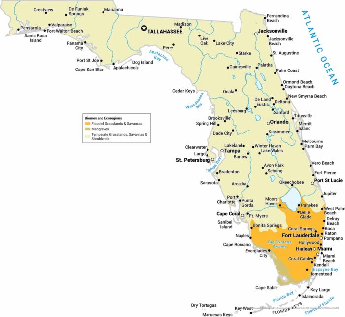
We’ve mapped grasslands, savannas, and mangroves across the peninsula. Water shapes almost everything you see on this map.
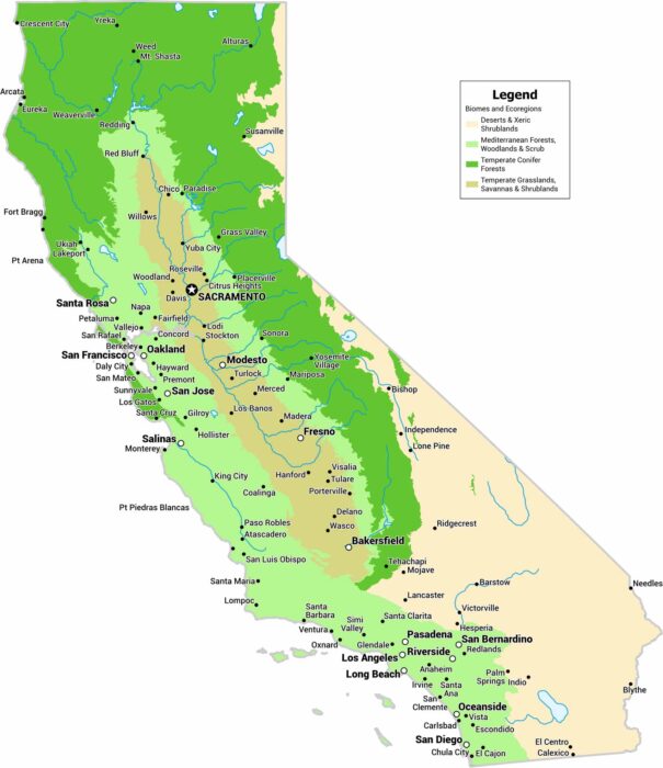
When it comes to biomes in California, it’s a state of contrasts. Our map highlights coastal zones, valleys, deserts, and mountain biomes.
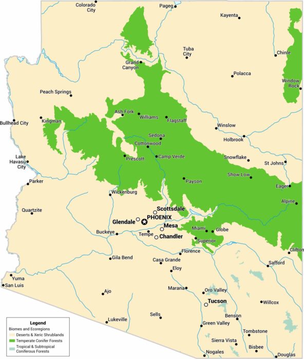
Our Arizona biomes map shows more than desert. It tracks biomes from tropical coniferous forests to temperate conifer forests.
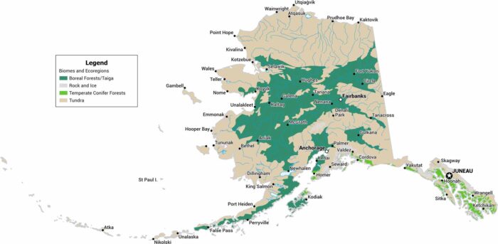
See how Alaska spreads from Arctic tundra down to boreal forest. We’ve mapped the state’s major biomes across its vast terrain.
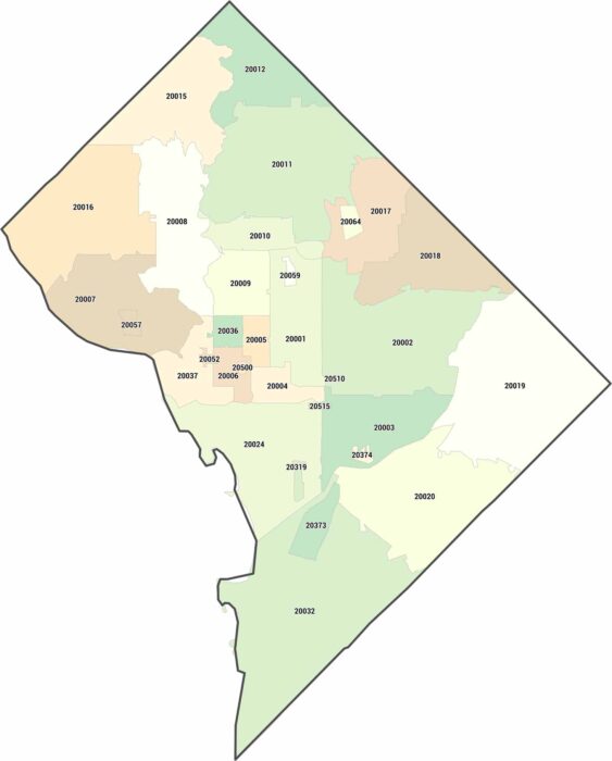
Our zip code map of DC packs 32 zip codes into just 68 square miles. The White House has its own zip code (20500).
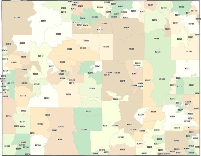
Wyoming has 98 zip codes total. That’s it. Our zip code map of Wyoming shows how the least populous state needs the least postal areas.
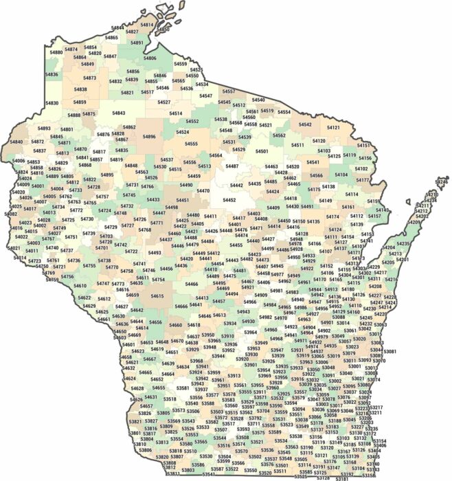
Green Bay, Madison, Milwaukee. Our zip code map shows how it clusters at cities and northern counties spread out much larger.
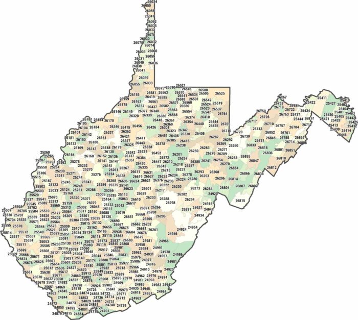
Our West Virginia zip code map highlights postal areas shaped by hills and valleys. Nothing spreads evenly here. Size varies constantly.
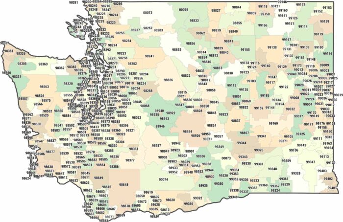
Two halves, one state. Our Washington zip code map shows how zip codes cluster west of the Cascades and expand sharply to the east.
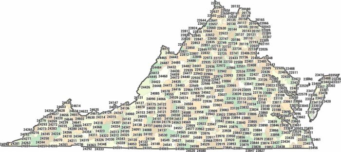
Our map of Virginia isn’t about roads or counties. We’ve mapped every zip code across the 201XX to 246XX range.
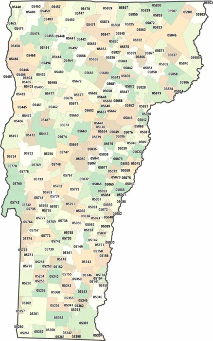
Vermont zip codes cover quiet, low-density regions. Our map highlights wide spacing between towns. Simplicity defines the layout here.